Las Milpas Hike
In Ojito Region
Map File Source: DeLorme
 Hike Key: H10166
Last Updated: 03/04/2021 12:00am
Last Updated By: Marilyn Fixer
Hike Class: C (Challenging)
Hike Distance: 8 mi
Minimum Elevation: 5846 ft
Elevation Change: 135 ft
Total Uphill: 385 ft
Total Downhill: 385 ft
Avg. Grade: 2 %
Route Type: InOut
On Trail: Yes
Paved or Gravel Roads: No
GPS Advised: Yes
Drive Distance Round Trip: 110 mi
Drive Time One-Way: 1:00
Hiking Seasons: Spring, Fall, and Winter
New Mexico Game Unit: 9
Hike Status: Published
Highlights
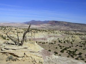
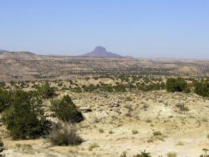
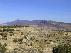
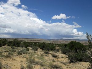
A mesa hike past sandstone formations, badlands and several ruins. Dramatic views of the eastern part of Ojito.
CautionsNone.
Trailhead Directions
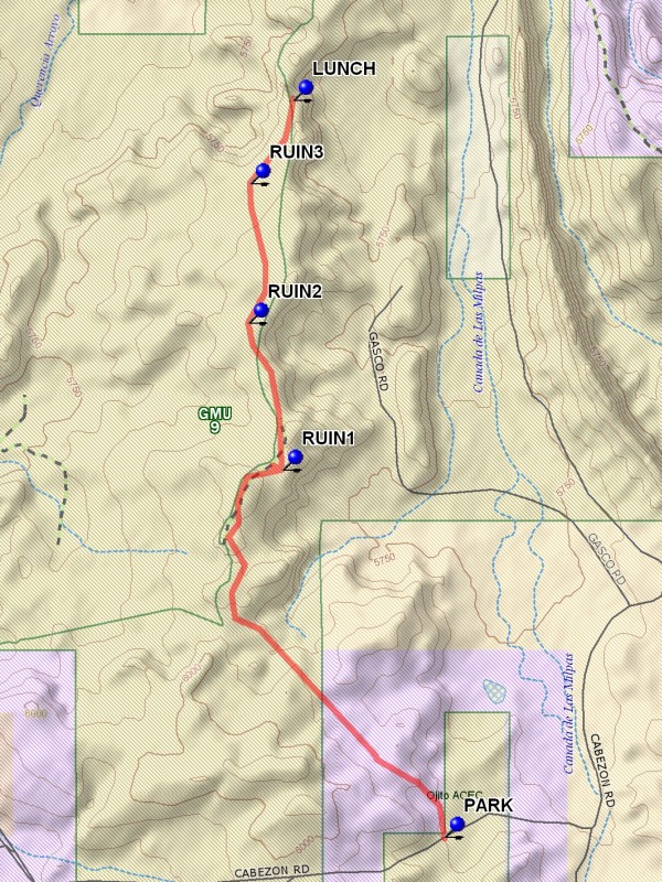
I-25 north to exit 242. West on US 550 to milepost 21. Turn left at sign for Cabezon Rd. Go through the gate (ignore Zia Pueblo, No Trespassing sign). The road forks immediately. Take the left fork (Cabezon Rd.) and not the right one (White Mesa). Cabezon Rd. goes thru Zia land, then at the cattle crossing enters Public Land (Ojito WSA). The road is slick and dangerous when wet. Drive about 6 miles and PARK (0.0 mi) where a road heads off to the right. If you’re feeling adventurous and have checked out the side road beforehand, drive up it a ways (you can lengthen the hike accordingly).
Actual Hike
Hike that road in a roughly northern direction. At the first three forks, go right. You will cross signs indicating a pipeline. See if you can find the three pre-Columbian ruins that appear on topo maps (RUIN1 (2.1 mi), RUIN2 (2.8 mi), and RUIN3 (3.4 mi)). Ruins 3 is off the road to the west. For the lunch spot, return to the road and locate a high rocky outcrop.
Comments
This hike is in between White Mesa and Dinosaur Dig. On a clear day it offers 360 degree views of White Mesa, the Tierra Amarilla Anticline, Cabezon, Bernalillito Mesa, the Sandias and an amazing palette of rock colors. The name “Las Milpas” was chosen because we look down into “Canada de Las Milpas” or “Valley of the Cornfields” (maize) just to the east and is the only unique place name one can search for in map databases. From the lunch site are great views of the Sierra Nacimiento to the north, the western ridge of the White Mesa hike, the canyon below to the east used by the Gas Company. You can see Mesa Bernalillito to the west. Dick Brown scouted this out for us. At the beginning of the hike there are some attractive cliffs in creamy white off to the left (west).
WaypointsPARK: N 35 28.972, W 106 51.508
RUIN1: N 35 30.265, W 106 52.210
RUIN2: N 35 30.781, W 106 52.357
RUIN3: N 35 31.274, W 106 52.349
LUNCH: N 35 31.567, W 106 52.163
Hike GPS File Name: LasMilpasWayTrack_JBMW.gpx
Hike GPS File: Click link to download hike waytrack file
Text Author: Roger Holloway
Map Author: Marilyn Warrant
Waypoints Author: Marilyn Warrant
Track Author: John Boyd
Maintainer: Not Assigned
Editor: Howard Carr