Hay-Oat Canyons Loop from FR144 Extended Hike
In Jemez Mountains Region
Map File Source: NG Topo
 Hike Key: H10387
Last Updated: 12/15/2020 12:00am
Last Updated By: Marilyn Warrant
Hike Class: C (Challenging)
Hike Distance: 6.3 mi
Minimum Elevation: 8093 ft
Elevation Change: 712 ft
Total Uphill: 730 ft
Total Downhill: 730 ft
Avg. Grade: 7 %
Route Type: Loop
On Trail: No
Paved or Gravel Roads: No
GPS Advised: Yes
Drive Distance Round Trip: 150 mi
Drive Time One-Way: 1:45
Hiking Seasons: Spring, Summer, and Fall
New Mexico Game Unit: 6A
Hike Status: Inactive
Highlights
Nice hike down bucolic valley surrounded by pines and perhaps a few cattle. Descend to the Cebolla valley below and return by way of Oat Canyon.
CautionsNone.
Trailhead Directions
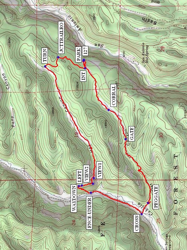
North on I-25 to exit 242 (Bernalillo), west on US 550 to San Ysidro. North on SR 4 to La Cueva. Take SR 126 west of La Cueva about four miles to Forest Road FR 144. It is about a mile past sign, “Hot Dry Rock Site” (geothermal site) on the left. Take a right, and drive north on the rocky FR 144 about six miles and PARK (0.0 mi) at junction of FR 380 (SR 127) off to the left.
Actual Hike
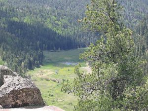
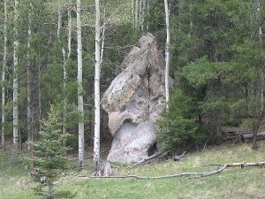
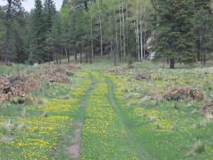
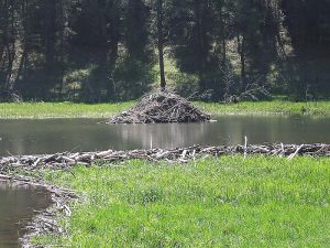
This hike is designed to have the best part first, in case you have to high-tail it out of there during a thunderstorm. Take FR 380 a short distance, then take a right at the intersection (INT (0.1 mi)) on a trail. After a short climb, a left at a junction with an old road (JCTTRAILRO (0.5 mi)), and a TURN (0.8 mi) to the left, it’s all downhill (southwest) through Hay Canyon to the Cebolla (Onion) River. On the way, you’ll go through green meadows where timber has been cut and see massive rock formations typical of the Jemez. Either view VIEW1 (2.4 mi) or VIEW2 (2.5 mi) is a great place to take a break, explore the caves in the rocks, and look down on the river below (if you choose to make the hike clockwise, this is a good lunch spot). From VIEW2, proceed north north-west along the trail, keeping to the LEFT (2.6 mi) at any junctions. Not far is the WAYDOWN (2.6 mi), which is a steep narrow animal trail going southwest down to a fence that you can cross at FNCE-UNDER (2.9 mi). Take a left, and walk along the river to your lunch spot, perhaps near the beaver pond. CROSS (3.6 mi) the river either here or look for a better place downstream near the trees if the water is high. Enter Oat Canyon through the PEGGATE (3.8 mi), then it’s a steady uphill climb past the GATE (5.1 mi) and CORRAL (5.5 mi) back to the van.
Comments
We saw a tiny calypso orchid in the shade, a profusion of dandelions in the meadows, and ducks and fish in the river. There’s a short, very steep section to get down to the river from Hay Canyon. If you have them, bring your hiking sticks and remember side-stepping. This is a good alternative to the Oat-Hay Canyons hike, which requires the gate at the Seven Springs Fish Hatchery to be open. You can check with the hatchery at 1-575-829-3740 to inquire. In previous years, the gate has remained closed until Memorial Day.
Made inactive since there is a safer way down from Hay.
Waypoints126: N 35 52.033, W 106 38.290
FR144B: N 35 53.492, W 106 40.078
127: N 35 56.900, W 106 38.690
PARK: N 35 56.903, W 106 38.701
INT: N 35 56.887, W 106 38.796
JCTTRAILRO: N 35 57.158, W 106 38.659
TURN: N 35 57.290, W 106 38.768
VIEW1: N 35 56.801, W 106 40.150
VIEW2: N 35 56.809, W 106 40.218
LEFT: N 35 56.921, W 106 40.241
WAYDOWN: N 35 56.951, W 106 40.245
FNCE-UNDER: N 35 56.830, W 106 40.331
CROSS: N 35 56.318, W 106 40.592
PEGGATE: N 35 56.253, W 106 40.457
GATE: N 35 56.481, W 106 39.668
CORRAL: N 35 56.650, W 106 39.308
Hike GPS File Name: Hay-OatCanyonsLoopExtendedWayTrack_KSMW.gpx
Hike GPS File: Click link to download hike waytrack file
Text Author: Marilyn Warrant
Map Author: Marilyn Warrant
Waypoints Author: Marilyn Warrant
Track Author: Marilyn Warrant
Maintainer: Marilyn Warrant
Editor: Howard Carr