Golden Open Space – North Hike
In Golden Region
Map File Source: NG Topo
 Hike Key: H10203
Last Updated: 03/07/2024 5:35pm
Last Updated By: Marilyn Fixer
Hike Class: C (Challenging)
Hike Distance: 7.1 mi
Minimum Elevation: 6020 ft
Elevation Change: 370 ft
Total Uphill: 700 ft
Total Downhill: 700 ft
Avg. Grade: 5 %
Route Type: CCW Loop
On Trail: No
Paved or Gravel Roads: No
GPS Advised: Yes
Drive Distance Round Trip: 70 mi
Drive Time One-Way: 1:15
Hiking Seasons: Spring, Fall, and Winter
New Mexico Game Unit: 8
Hike Status: In Process
Access Description: Golden Open Space Access
Highlights
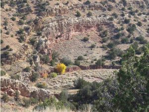
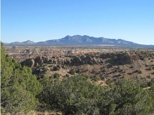
Wide-angle views of the Ortiz and Sandia Mountains. Hike in parts of three different arroyos in the Golden Open Space, two with colorful red, yellow, and white walls.
CautionsMost uphill on return. Bring hiking poles for the steep sections. The new bike trail is steep and narrow, with a dropoff on one side.
Trailhead Directions
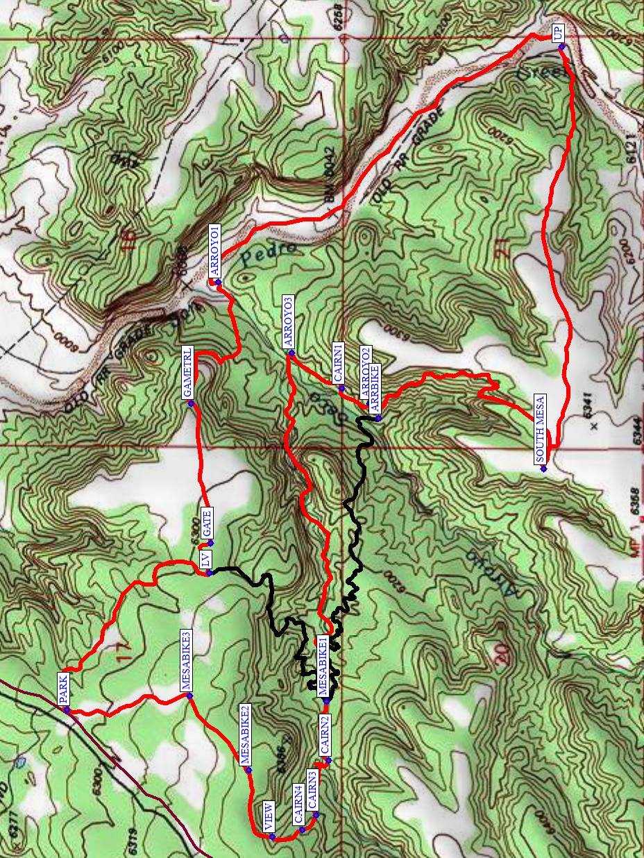
From Albuquerque, take I-40 to North 14. In Cedar Crest just after the school on the left, turn left onto LA MADERA Road (the road to East Mountain High School). Stay on the windy but paved road until it turns to dirt at a cattleguard in 7.5 miles. It is about 2 miles from this point to [PARK] (0.0 mi).
Actual Hike
From PARK, hike to your left southeast on the bike trail to LV (0.65 mi). Go east for a short distance, then through a GATE (0.75 mi). Continue east until the GAMETRL (1.1 mi) is reached. Follow the trail, which is faint at times, to the southeast, descending to the bottom at ARROYO1 (1.6 mi). Hike up this big arroyo to UP (2.75 mi), then head west to get up on the mesa. Have lunch up on top at SOUTH MESA (3.9 mi). After lunch, go down the new (steep) portion of the bike trail to Arroyo Seco at ARROYO2 (4.6 mi). Continue going northeast up this arroyo until you reach the intersection with ARROYO3 (4.9 mi). This is the most colorful arroyo in the system. Follow this arroyo west, going uphill. When you reach MESABIKE1 (5.9 mi), there is are two options (1) to continue in the arroyo or (2) leave it to follow the bike trail (black track) up onto the mesa, head northeast to LV, then return to PARK the way you came. This is a more gradual climb. If you stay in the arroyo (option 1), follow a series of cairns starting with CAIRN2 (6.0 mi) up to a VIEW (6.3 mi). Take a sharp right here (due east) and meet up with the Mesa bike trail again at MESABIKE2 (6.5 mi). Follow that trail northeast to MESABIKE3 (6.8 mi) then north back to parking.
Comments
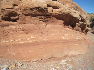
This hike is on the Golden Open Space, administered by the City of Albuquerque. There are steep portions to get down into the arroyo area then back up to the mesa. There are many interesting arroyos, including the deep one with red rocks from the Abo formation that is also featured in the Golden Open Space – North West hike. Many of the red rocks have round spots or streaks of white caused by bacterial reduction of iron. There are also some beautiful green rocks in the bottoms of the arroyos. On the way back, we’ll have some wide-angle views of the Ortiz and Sandia Mountains.
If we’re having a wet year, you may not be able to get very far up Arroyo3 unless you’re willing to get wet in one of the deep pools. If you want to avoid the water, turn left after you reach ARROYO2, find the continuation of the bike trail in a few feet at ARRBIKE, and take that to MESABIKE1.
WaypointsLA MADERA: N35 10.421, W106 20.225
PARK: N35 16.289, W106 19.695
LV: N35 15.989, W106 19.341
GATE: N35 15.985, W106 19.265
GAMETRL: N35 16.027, W106 18.906
ARROYO1: N35 15.970, W106 18.592
UP: N35 15.244, W106 17.986
SOUTH MESA: N35 15.282, W106 19.074
ARROYO2: N35 15.650, W106 18.906
ARRBIKE: N35 15.630, W106 18.944
CAIRN1: N35 15.708, W106 18.866
ARROYO3: N35 15.815, W106 18.776
MESABIKE1: N35 15.740 W106 19.673
CAIRN2: N35 15.737 W106 19.824
CAIRN3: N35 15.763 W106 19.965
CAIRN4: N35 15.792 W106 20.004
VIEW: N35 15.855 W106 20.021
MESABIKE2: N35 15.905 W106 19.850
MESABIKE3: N35 16.030 W106 19.659
Hike GPS File Name: GoldenOpenSpaceNorthRev3.gpx
Hike GPS File: Click link to download hike waytrack file
Additional File 1 Link Click link to download an additional file.
Text Author: Marilyn Warrant
Map Author: Marilyn Warrant
Waypoints Author: Marilyn Warrant
Track Author: Marilyn Warrant
Maintainer: Marilyn Warrant
Editor: Howard Carr