Armijo Canyon Loop Hike
In Sandia Mountain East Region
Map File Source: DeLorme
 Hike Key: H10094
Last Updated: 12/27/2023 2:07pm
Last Updated By: Marilyn Warrant
Hike Class: C (Challenging)
Hike Distance: 5.3 mi
Minimum Elevation: 7080 ft
Elevation Change: 780 ft
Total Uphill: 975 ft
Total Downhill: 975 ft
Avg. Grade: 8 %
Route Type: CW Loop
On Trail: Yes
Paved or Gravel Roads: Yes
GPS Advised: Yes
Drive Distance Round Trip: 50 mi
Drive Time One-Way: 0:45
Hiking Seasons: Spring, Summer, and Fall
New Mexico Game Unit: 8
Hike Status: Published
Highlights
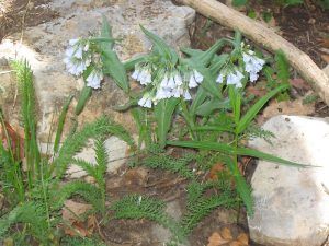
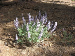
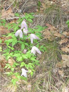
Alligator junipers, wildflowers, and a stream.
CautionsSome parts of the trail are brushy and rocky.
Trailhead Directions
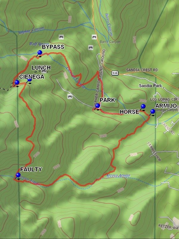
From Albuquerque take I-40 east to Tijeras exit 175. North on SR 14. Left on Sandia Crest Scenic Byway (SR 536). Watch for signs. Cienega Canyon and Sulfur Canyon will be on your left, just after milepost 1. Almost immediately there is a fork to the left (south to Cienega Trailhead). Take that road to the T intersection and go right uphill for about 200 feet and PARK (0.0 mi) in the parking area on the left.
Actual Hike
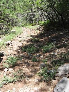
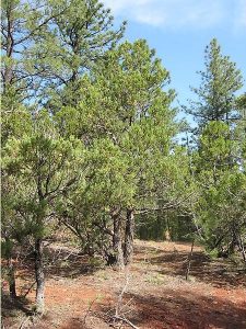
Hike back down the road to the east for about 0.4 miles to where it turns left. Two trails take off to the right. One is at a narrow angle to the other and is marked Cienega Horse Bypass, HORSE (0.4 mi). Take the other which is an old gravel road to the right. It is marked “Faulty” which means it heads for Faulty Trail. At the end of the road you can see “Private Property” signs ahead. The trail into Armijo Canyon veers off to the right into ARMIJO (0.6 mi). Trees are marked with migratory bird signs “Permanent Monitoring Station.” Follow the meandering trail up through heavily wooded areas with many stream crossings and small waterfalls (not always), to the intersection of Faulty Trail 195. You may find that you are already on Faulty Tr. Without realizing it. Just before getting there, there is a signpost with a fork. Either one goes to Faulty, but take the left one to the FAULTY (2.4 mi). Follow Faulty Trail north toward Cienega Canyon. You can have your LUNCH (3.5 mi) at the overlook there. At the bottom of the canyon is a crossroads with CIENEGA (3.6 mi). The trail goes up and down the canyon whereas Faulty continues up the other side. You can go on back down to the picnic grounds from here or continue on to take the Cienega Horse BYPASS (4.0 mi) which goes off to the right (east), also ending back at the picnic grounds by following that trail to the road and going south on the road, or the trail paralleling its west side to parking.
Comments
Watch for the nice alligator junipers on the way back on the Horse Bypass Trail
WaypointsPARK: N35 09.899, W106 22.607
HORSE: N35 09.894, W106 22.170
ARMIJO: N35 09.854, W106 22.077
FAULTY: N35 09.355, W106 23.369
LUNCH: N35 10.108, W106 23.261
CIENEGA: N35 10.082, W106 23.381
BYPASS: N35 10.316, W106 23.163
Hike GPS File Name: ArmijoCanyonLoopWayTrack_DBDB.gpx
Hike GPS File: Click link to download hike waytrack file
Text Author: Dick Brown
Map Author: Marilyn Warrant
Waypoints Author: Dick Brown
Track Author: Dick Brown
Maintainer: Ken Smith
Editor: Marilyn Warrant