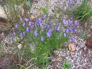
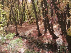
0TEST Hike
In Manzano Mountains West Region
Map File Source: Other
Last Updated: 01/30/2021 12:00am
Last Updated By: Marilyn Fixer
Hike Class: B (Moderate)
Hike Distance: 4.5 mi
Minimum Elevation: 5280 ft
Elevation Change: 100 ft
Total Uphill: 1000 ft
Total Downhill: 200 ft
Avg. Grade: 2 %
Route Type: InOut
On Trail: No
Paved or Gravel Roads: No
GPS Advised: No
Drive Distance Round Trip: 2 mi
Drive Time One-Way: 0:30
Hiking Seasons: Spring, Summer, and Fall
New Mexico Game Unit: 6B
Hike Status: Inactive
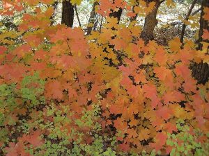
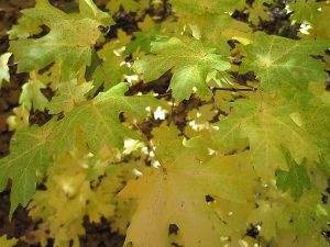
Attractions: Fall Color, Forest, Meadows, Rock Formations, and Views
Highlights
OMG, what views! What BS!
Trailhead DirectionsThis is a test hike so there are no Trailhead Directions. More testing.
Actual HikeAs stated above, this is a test hike so there are no Actual Hike directions. Too bad!
CommentsReally, you know this is a test so there are no Comments.
Map Filename: 0TESTImage_DB.jpgHike GPS File Name: PadreAlonzoTrailTrack_Garmin1.gpx
Text Author: Nan Burke
Map Author: Cindy McConnell
Waypoints Author:
Track Author: Bill Gloyd
Maintainer: Not Assigned
Editor: Howard Carr
10K – Osha Loop – Survey Hike
In Sandia Mountain East Region
Map File Source: DeLorme
 Hike Key: H10140
Last Updated: 03/20/2023 2:48pm
Last Updated By: Marilyn Fixer
Hike Class: D (Difficult)
Hike Distance: 8.4 mi
Minimum Elevation: 9232 ft
Elevation Change: 1183 ft
Total Uphill: 1586 ft
Total Downhill: 1586 ft
Avg. Grade: 8 %
Route Type: CCW Loop
On Trail: Yes
Paved or Gravel Roads: Yes
GPS Advised: No
Hiker Limit (NF/BLM/NP): 15 (Sandia Wilderness)
Drive Distance Round Trip: 60 mi
Drive Time One-Way: 1:00
Hiking Seasons: Spring, Summer, and Fall
New Mexico Game Unit: 8
Hike Status: Published
Highlights
A hike in the woods with good views to the west.
CautionsSome bushwhacking at the north end. Trekking poles recommended.
Trailhead DirectionsI-40 to Tijeras exit 175, north on SR 14 to Crest Road 536 to 10K Trailhead (Trail 200) which is past milepost 10 and PARK (0.0 mi). A three dollar fee or Golden Age Pass is required.
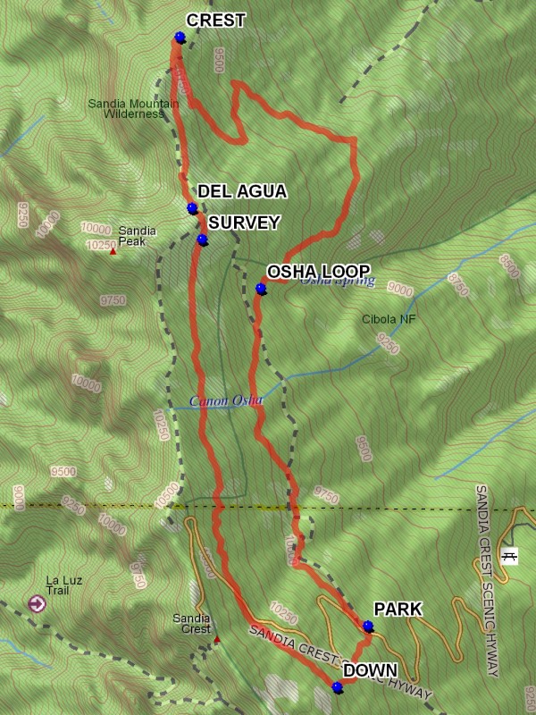
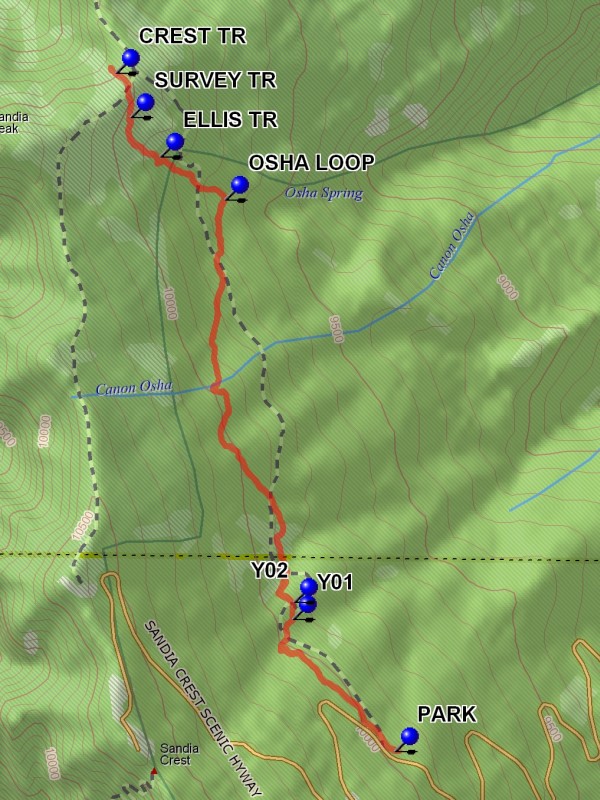
Actual HikeThe 10K trail starts at west end of parking area, follows the road for a bit then heads north. It is well marked with blue diamond blazes and yellow bird signs. Go around the OSHA LOOP (1.9 mi) until you reach the CREST (4.5 mi) trail and find a good place for lunch. Continue south passing the DEL AGUA (5.4 mi) overlook, and return using the SURVEY (5.5 mi) trail. You’ll have to bushwhack DOWN (8.0 mi) and cross the road to the parking area for another half mile.
CommentsTrail is so named because it generally follows the 10,000′ contour line.
WaypointsPARK: N35 12.587, W106 26.123
OSHA LOOP: N35 13.952, W106 26.654
CREST: N35 14.970, W106 27.056
DEL AGUA: N35 14.276, W106 26.996
SURVEY: N35 14.150, W106 26.945
DOWN: N35 12.339, W106 26.277
Hike GPS File Name: 10K-OshaLoop-SurveyWayTrack_JBJB.gpx
Hike GPS File: Click link to download hike waytrack file
Text Author: Roger Holloway
Map Author: Marilyn Warrant
Waypoints Author: John Boyd
Track Author: John Boyd
Maintainer: Ken Smith
Editor: Marilyn Warrant
10K – Survey Loop Hike
In Sandia Mountain East Region
Map File Source: DeLorme
 Hike Key: H10141
Last Updated: 03/20/2023 2:07pm
Last Updated By: Marilyn Fixer
Hike Class: C (Challenging)
Hike Distance: 5.7 mi
Minimum Elevation: 9645 ft
Elevation Change: 775 ft
Total Uphill: 1020 ft
Total Downhill: 1020 ft
Avg. Grade: 9 %
Route Type: CCW Loop
On Trail: Yes
Paved or Gravel Roads: Yes
GPS Advised: No
Hiker Limit (NF/BLM/NP): 15 (Sandia Wilderness)
Drive Distance Round Trip: 60 mi
Drive Time One-Way: 1:00
Hiking Seasons: Spring, Summer, and Fall
New Mexico Game Unit: 8
Hike Status: Published
Attractions: Fall Color, Forest, and Meadows
Highlights
A good late spring, summer or fall hike
CautionsNone.
Trailhead DirectionsFrom Albuquerque take I-40 east to Tijeras exit. North on NM 14, west on Crest Road SR-536. PARK (0.0 mi) at the 10K trailhead turnoff on the right just past mile marker 10. A three dollar fee or Golden Age Pass is required.
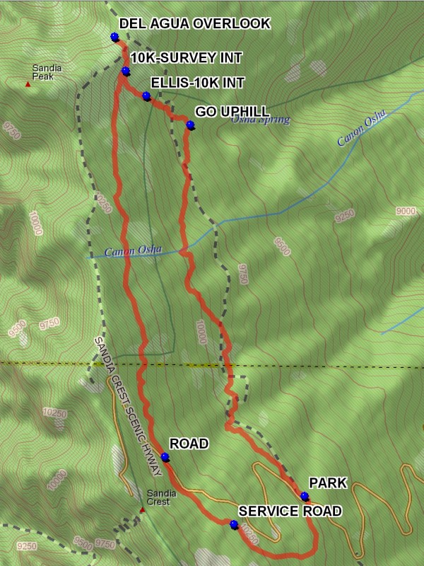
Actual HikeGo to the north end of the parking lot where the 10K trail starts. The trail goes northward with ups and downs, losing altitude for 2.1 miles. GO UPHILL (2.0 mi) at this point where there is a trail going down hill. This trail goes to Osha Spring, an arduous down and back up side trip. After another 0.3 miles the ELLIS-10K INT (2.3 mi) is reached. Continue uphill for 0.1 miles to the 10K-SURVEY INT (2.5 mi). This intersection is important for the return trip. Remember it. Continue uphill to the ridge where the 10K trail meets the Crest Trail. Continue to the DEL AGUA OVERLOOK (2.7 mi) ahead for a great view to the west and north. In the fall there will be a colorful large stand of aspen on the northwest facing slope to the left. This stand is easily visible from the valley below in the Fall. This is a good spot for lunch.
Return to the 10K-SURVEY INT (2.5 mi) and turn right onto the Survey Trail. This is a pleasant soft surfaced shaded trail which gains elevation for the next 2 miles at which point the paved ROAD (4.7 mi) is reached. Cross the road and take the trail downward for about 0.5 miles to where the SERVICE ROAD (5.1 mi) is reached. Go left on the service road to the Ellis Trailhead parking lot. Go to the southeast corner of the lot and find a two track leading downhill. This track will meet with the trail which is the end part of the 10K South – Crest hike. Follow this trail which will continue downward, then north to the 10K parking lot.
WaypointsPARK: N35 12.585, W106 26.139
GO UPHILL: N35 13.952, W106 26.654
ELLIS-10K INT: N35 14.057, W106 26.852
10K-SURVEY INT: N35 14.150, W106 26.945
DEL AGUA OVERLOOK: N35 14.276, W106 26.996
ROAD: N35 12.729, W106 26.768
SERVICE ROAD: N35 12.481, W106 26.457
Hike GPS File Name: 10K-SurveyLoopWayTrack_DBDB.gpx
Hike GPS File: Click link to download hike waytrack file
Text Author: Dick Brown
Map Author: Marilyn Warrant
Waypoints Author: Dick Brown
Track Author: Dick Brown
Maintainer: Not Assigned
Editor: Marilyn Warrant
10K North Hike
In Sandia Mountain East Region
Map File Source: DeLorme
 Hike Key: H10104
Last Updated: 03/20/2023 2:08pm
Last Updated By: Marilyn Fixer
Hike Class: C (Challenging)
Hike Distance: 5.2 mi
Minimum Elevation: 9650 ft
Elevation Change: 380 ft
Total Uphill: 1135 ft
Total Downhill: 1135 ft
Avg. Grade: 10 %
Route Type: InOut
On Trail: Yes
Paved or Gravel Roads: Yes
GPS Advised: No
Hiker Limit (NF/BLM/NP): 15 (Sandia Wilderness)
Drive Distance Round Trip: 60 mi
Drive Time One-Way: 1:00
Hiking Seasons: Spring, Summer, and Fall
New Mexico Game Unit: 8
Hike Status: Published
Attractions: Forest
Highlights
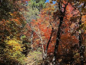
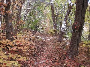
Forest hike with views to the west. Beautiful fall color from the aspens.
CautionsLots of steady but gradual uphill on the return from lunch.
Trailhead DirectionsFrom Albuquerque take 1-40 east to Tijeras exit 175, then go north on SR 14 to SR 536. Go east up the mountain for 10.1 miles to the parking on the right at the 10K trailhead. A three dollar fee or Golden Age Pass is required to PARK (0.0 mi) here.
Actual HikeThe trail starts at the far end of the 10K parking area. The trail goes northward from that point, and is generally shaded by trees. At Y01 (0.6 mi) go left. A short distance beyond this point at Y02 (0.6 mi) go left again. The trail generally follows the contour line, going up and down but losing elevation. At the OSHA LOOP (2.0 mi) Trail terminus, stay left up hill. The trail crosses the ELLIS TR (2.3 mi). This broad swath was originally intended to be a road. The trail crosses the SURVEY TR (2.5 mi) and continues to the top of the mountain where it crosses the CREST TR (2.7 mi). From this point it is a short distance to the Del Agua overlook. Enjoy the view. Return to parking the way you came
CommentsTrail is so named because it generally follows the 10,000 foot contour line. At the far end of the hike there is a view to the west overlooking Del Agua Canyon. Cool in the summer. During the fall foliage season a large stand of yellow aspens covers the northwest facing slope.
WaypointsPARK: N 35 12.585, W 106 26.139
Y01: N 35 12.911, W 106 26.448
Y02: N 35 12.954, W 106 26.446
OSHA LOOP: N 35 13.952, W 106 26.654
ELLIS TR: N 35 14.057, W 106 26.852
SURVEY TR: N 35 14.156, W 106 26.942
CREST TR: N 35 14.265, W 106 26.986
Hike GPS File Name: 10KNorthWayTrack_DBDB
Hike GPS File: Click link to download hike waytrack file
Text Author: Dick Brown
Map Author: Dick Brown
Waypoints Author: Dick Brown
Track Author: Dick Brown
Maintainer: Ken Smith
Editor: Marilyn Warrant
10K North to Barite Mine Hike
In Sandia Mountain East Region
Map File Source: Garmin BaseCamp
 Hike Key: H10139
Last Updated: 03/20/2023 2:08pm
Last Updated By: Marilyn Fixer
Hike Class: C (Challenging)
Hike Distance: 6.7 mi
Minimum Elevation: 8750 ft
Elevation Change: 1030 ft
Total Uphill: 1765 ft
Total Downhill: 1765 ft
Avg. Grade: 9 %
Route Type: InOut
On Trail: Yes
Paved or Gravel Roads: Yes
GPS Advised: Yes
Hiker Limit (NF/BLM/NP): 15 (Sandia Wilderness)
Drive Distance Round Trip: 60 mi
Drive Time One-Way: 1:00
Hiking Seasons: Spring, Summer, and Fall
New Mexico Game Unit: 8
Hike Status: Published
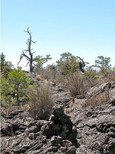
Attractions: Forest and Rock Formations
Highlights
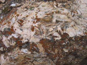
The barite mine site contains many interesting rocks not generally found in the Sandias. A fun place to look around after lunch.
CautionsLots of steady but gradual uphill on the return from lunch.
Trailhead DirectionsFrom Albuquerque take 1-40 east to Tijeras exit 175, then go north on SR 14 to SR 536. Go east up the mountain for 10.1 miles to PARK 13 (0.0 mi) on the right at the 10K parking lot. A three dollar fee or Golden Age Pass is required to park here.
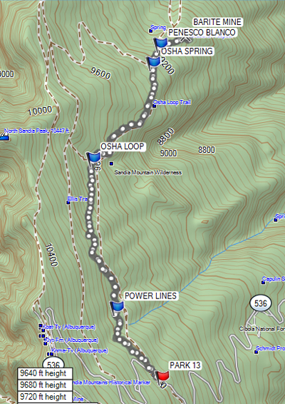
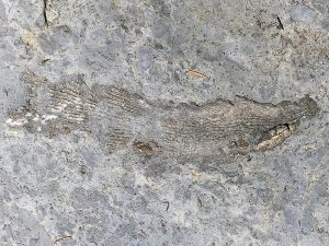
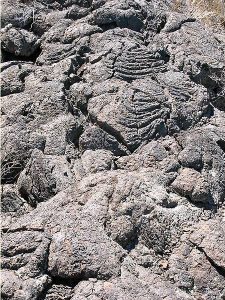
Actual HikeNote: This hike was formerly called the 10K North to Calcite Mine. The trail starts at the far end of the 10K parking area. The trail goes northward from that point, and is generally shaded by trees. The trail generally follows the contour line, going up and down but losing elevation. The trail goes under POWERLINES (0.7 mi), switches to a section of the OSHA LOOP (1.9 mi) trail, then continues on the OSHA SPRING (2.9 mi) trail to the intersection of the PENASCO BLANCO (3.0), stay straight on the Osha Spring trail to an interesting, abandoned BARITE MINE (3.2 mi). Barite is barium sulfate, a white, crystalline mineral. This mine is the Landsend (Lone Star) barite claim and was excavated by bulldozers which opened many wide pits 8-12 feet deep. In 1968 the Forest Service asked that the claim be declared and void. It was subsequently so declared in 1977. Have lunch at the mine and return the way you came.
CommentsTrail is so named because it generally follows the 10,000 foot contour line.
WaypointsPARK: N35 12.587, W106 26.123
POWERLINES: N35 13.021, W106 26.472
OSHA LOOP: N35 13.952, W106 26.654
OSHA SPRING: N35 14.548, W106 26.188
PENASCO BLANCO: N35 14.666 W106 26.131
BARITE MINE: N35 14.730, W106 25.472
Hike GPS File Name: 10KNorthToBariteMineWaytrack_HCHC.gpx
Hike GPS File: Click link to download hike waytrack file
Text Author: Howard Carr
Map Author: Howard Carr
Waypoints Author: Howard Carr
Track Author: Howard Carr
Maintainer: Howard Carr
Editor: Marilyn Warrant
10K South – Crest Hike
In Sandia Mountain East Region
Map File Source: NG Topo
 Hike Key: H10070
Last Updated: 12/15/2020 12:00am
Last Updated By: Marilyn Warrant
Hike Class: C (Challenging)
Hike Distance: 5.2 mi
Minimum Elevation: 9400 ft
Elevation Change: 900 ft
Total Uphill: 950 ft
Total Downhill: 950 ft
Avg. Grade: 11 %
Route Type: CW Loop
On Trail: Yes
Paved or Gravel Roads: Yes
GPS Advised: Yes
Drive Distance Round Trip: 60 mi
Drive Time One-Way: 1:00
Hiking Seasons:
New Mexico Game Unit: 8
Hike Status: Published
Attractions: Fall Color, Forest, Meadows, and Views
Highlights
A high cool hike over a variety of terrain; nice views both east and west.
CautionsThere is a long uphill stretch in the middle of the hike-a good workout hike.
Trailhead DirectionsFrom Albuquerque take I-40 east to Tijeras exit. North on NM 14, west on Crest Road SR-536. Park at the 10K Trailhead turnoff on the right just past mile marker 10.
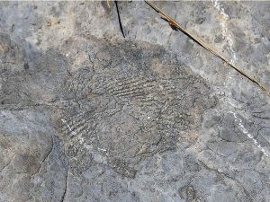
Actual HikeWalk across road, notice the sign for 10K Trail which points to left. If you look straight away from the road, that is where you will return from. Following 10K Trail you will eventually come into a clearing that is a ski run stretching up and down the mountain. You will cross several of these; three of them have chair lifts. You will descend a long slope and then up until you come to the intersection of 10K Trail with Crest Trail and Tree Spring Trail (10K TREE (2.3 mi)). Continue for about 300 feet to the intersection with the CREST TRAIL (2.3 mi). Go north on the Crest Trail. There is a option (see the track shown in black on the map) to take a trail closer to the cliff edge starting at OPTION-2. Go east uphill to a VIEW, then north to FISH ROCK where you can see some excellent fossils. Rejoin the Crest trail at OPTION-1. Otherwise, continue on a series of switch backs to the ridge and on to the TRAM (3.9 mi). There are good views on the deck in front of the restaurant, and a good place for lunch. Go north on the service road behind the ski lifts and leave the road at sign ROCKYPOINT (4.2 mi). Leave the service road at this point, following the trail down until it goes up, then leave it at the 10K CUTOFF (4.7 mi) which is a cut slanting down. Eventually you will see the highway off to your left. You’ll come to a large area of downed trees. Cross that and go north along the clearing until the highway is reached.
CommentsGreat views down the ski slopes to the San Pedro mountains to the east. Follow the blue diamonds for cross country skiers to help keep you on the 10K trail.The Sandia Ranger District has set a 25-hiker limit for this area.
WaypointsPARK: N35 12.571, W106 26.121
10K TREE: N35 11.236, W106 25.256
CREST TRAIL: N35 11.203, W106 25.280
OPTION-2: N35 11.380, W106 25.305
VIEW: N35 11.321, W106 25.385
FISH ROCK: N35 11.386, W106 25.435
OPTION-1: N35 11.444, W106 25.745
TRAM: N35 11.770, W106 26.066
ROCKYPOINT: N35 11.958, W106 26.083
10K CUTOFF: N35 12.320, W106 26.288
Hike GPS File Name: 10KSouth-CrestWayTrackOptions_DBMW.gpx
Hike GPS File: Click link to download hike waytrack file
Text Author: Dick Brown
Map Author: Marilyn Warrant
Waypoints Author: Dick Brown
Track Author: Dick Brown
Maintainer: Ken Smith
Editor: Howard Carr
3 Places – ABQ Open Spaces Hike
In Albuquerque Region
Map File Source:
Last Updated: 03/19/2021 12:00am
Last Updated By: Marilyn Fixer
Hike Class: B (Moderate)
Hike Distance: 7.3 mi
Minimum Elevation: 5000 ft
Elevation Change: 450 ft
Total Uphill: 450 ft
Total Downhill: 450 ft
Avg. Grade: 5 %
Route Type: Multiple Hikes
On Trail: Yes
Paved or Gravel Roads: Yes
GPS Advised: No
Drive Distance Round Trip: 45 mi
Drive Time One-Way: 0:15
Hiking Seasons: Spring, Fall, and Winter
New Mexico Game Unit: 9
Hike Status: Waiting Editor
Highlights
Here is a chance to visit three open spaces on the west side of Albuquerque. The Volcanoes, Los Poblanos and the Open Space may provide opportunities to see wildlife including sandhill cranes in the winter.
CautionsNone.
Trailhead DirectionsPart 1: For the Volcanoes Open Space, take I-40 west to the Atrisco Vista Boulevard (formerly Paseo de Volcan) exit 149 and travel north 4.8 miles to the parking area.
Part 2: The Open Space Visitor Center is located on Coors between Montano and Paseo del Norte on the east side. The address is 6500 Coors and is just north of Sagebrush Church.
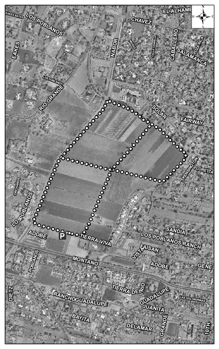
Part 3: The Los Poblanos Open Space parking area is at Montano & Rio Grande NW but access is easier from 4th St then west to the site.
Actual HikePart 1: The Volcanoes Trail is a 3.2 mile loop trail. See the Los Volcanos hike.
Part 2: This Open Space hike takes you through various portions of the Rio Grande Valley State Park. The hike is 2.2 miles including the River Loop Trail and the Canopy Loop Trail. There are opportunities to walk along the Rio Grande and to walk north along the drainage ditch. Also the center offers art, a great place for lunch and a viewing area for birds.
Part 3: There are three several options of different lengths for the Los Poblanos Open Space hike. We will be doing a 1.9 mile loop on wide natural farm roads or ditch banks.
CommentsThe hike is kept as a “B” hike since the additional distance has very little uphill.
Text Author: Cathy Intemann
Map Author:
Waypoints Author:
Track Author:
Maintainer: Cathy Intemann
Editor: Marilyn Warrant
4th of July Hike
In Manzano Mountains East Region
Map File Source: NG Topo
 Hike Key: H10038
Last Updated: 04/05/2021 12:00am
Last Updated By: Marilyn Fixer
Hike Class: C (Challenging)
Hike Distance: 5.7 mi
Minimum Elevation: 7539 ft
Elevation Change: 1250 ft
Total Uphill: 1260 ft
Total Downhill: 1260 ft
Avg. Grade: 9 %
Route Type: InOut
On Trail: Yes
Paved or Gravel Roads: No
GPS Advised: No
Drive Distance Round Trip: 110 mi
Drive Time One-Way: 1:30
Hiking Seasons: Spring, Summer, and Fall
New Mexico Game Unit: 14
Hike Status: Published
Attractions: Fall Color, Forest, and Views
Highlights
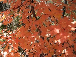
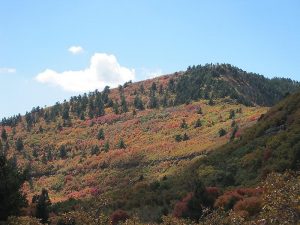
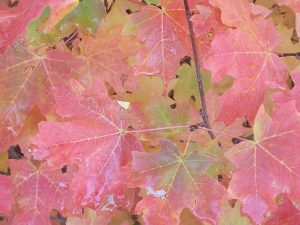
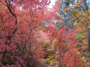
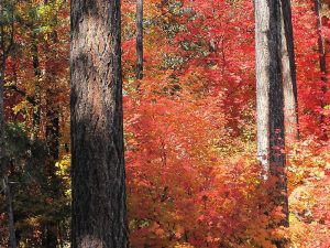
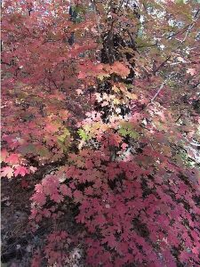
Great views of the Rincon Mountains, spectacular views of the nearly vertical northwest face of the Sandias (The Shield), Sandia Crest, Mt. Taylor, and the city. Colorful maple leaves in fall.
CautionsHiking poles recommended for the downhill return.
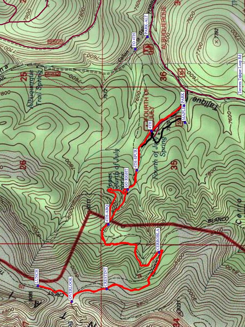
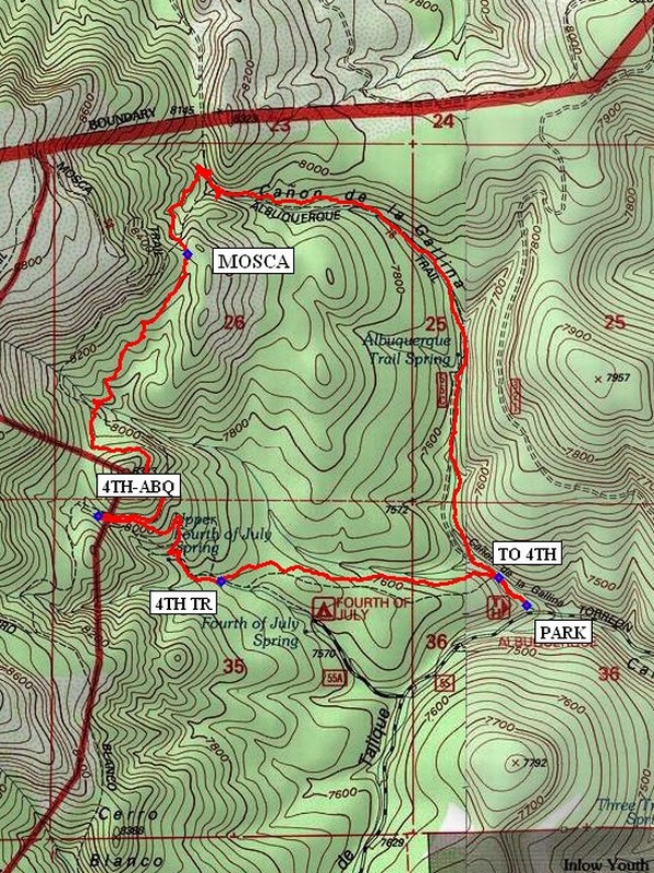
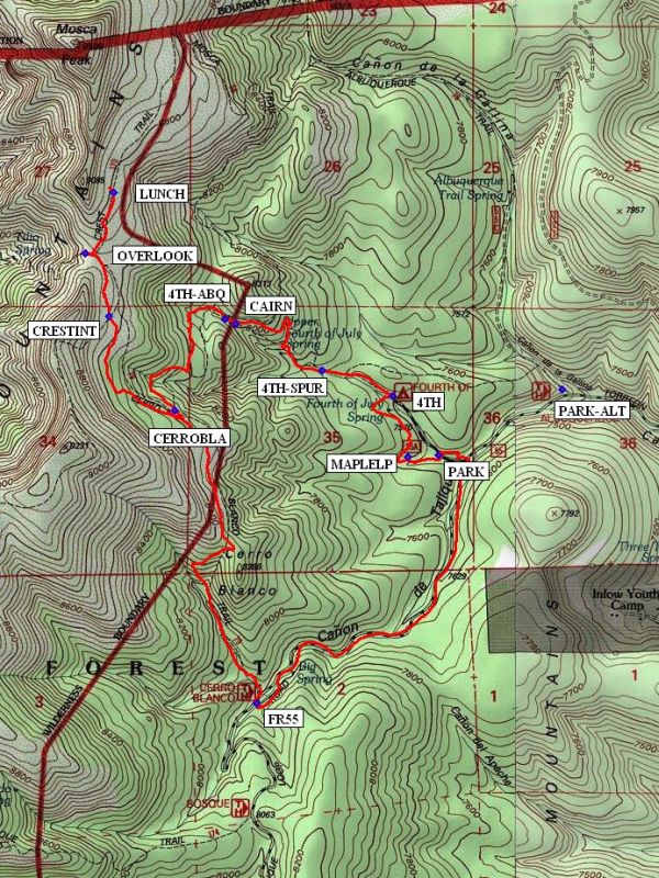
Trailhead DirectionsI-40 east to Tijeras exit. South on SR 337 30 miles to SR 55. SR 55 west to Tajique. Turn right in Tajique between the church and the water tower onto FR 55, yes, SR 55 to FR 55. Take FR 55 about 7 miles to 4th of July CG and [PARK] (0.0 mi). If the road looks bad beyond the Albuquerque Trail trailhead, park instead at PARK-ALT and take the 4th of July Spur Trail at TO 4TH over to the 4th of July.
Actual HikeStart out with the optional short MAPLELP (0.2 mi) Trail if the leaves are colorful this low. Otherwise, start hiking the 4th of July Trail (4TH (0.3 mi)). You’ll encounter intersections with the 4th of July Spur Trail (4TH-SPUR (0.6 mi)), a junction with a trail that goes by the spring (GO RIGHT (0.7 mi)), Albuquerque Trail (4TH-ABQ (1.2 mi)), the Cerro Blanco Trail 79 (CERROBLA (1.8 mi)) and the Manzano Crest Trail (CRESTINT (2.4 mi)). The OVERLOOK (2.7 mi) is a panoramic view. Continue north on the Manzano Crest Trail to a lovely grove of maples for LUNCH (2.9 mi), which is also out of the wind. Return the way you came but at 4TH-ABQ (4.7 mi), go straight to go by the spring. Then continue down the road to the van rather than taking the Maple Loop Trail.
CommentsThis is a beautiful hike any time of the year, but especially in the fall. The 4th of July Trail is well-known for its red, orange, and yellow leaves of the Rocky Mountain maples. Even if the timing isn’t right and the leaves are already on the ground, they are still gorgeous.
WaypointsPARK-ALT: N34 47.616, W106 22.358
TO 4TH: N34 47.684, W106 22.439
PARK: N34 47.414, W106 22.820
MAPLELP: N34 47.408, W106 22.934
4TH: N34 47.594, W106 22.991
4TH-SPUR: N34 47.675, W106 23.256
GO RIGHT: N34 47.727, W106 23.385
4TH-ABQ: N34 47.834, W106 23.619
CAIRN: N34 47.816, W106 23.580
CERROBLA: N34 47.552, W106 23.808
CRESTINT: N34 47.841, W106 24.052
OVERLOOK: N34 48.035, W106 24.139
LUNCH: N34 48.224, W106 24.032
Hike GPS File Name: 4thOfJulyWayTrackOptions_MW.gpx
Hike GPS File: Click link to download hike waytrack file
Text Author: Roger Holloway
Map Author: Marilyn Warrant
Waypoints Author: Marilyn Warrant
Track Author: Marilyn Warrant
Maintainer: Marilyn Warrant
Editor: Howard Carr
4th of July – Albuquerque Trail Loop Short Hike
In Manzano Mountains East Region
Map File Source: NG Topo
 Hike Key: H10039
Last Updated: 06/29/2021 12:00am
Last Updated By: Marilyn Fixer
Hike Class: C (Challenging)
Hike Distance: 5.5 mi
Minimum Elevation: 7438 ft
Elevation Change: 810 ft
Total Uphill: 985 ft
Total Downhill: 985 ft
Avg. Grade: 8 %
Route Type: CW Loop
On Trail: Yes
Paved or Gravel Roads: No
GPS Advised: Yes
Drive Distance Round Trip: 100 mi
Drive Time One-Way: 1:30
Hiking Seasons: Spring, Summer, and Fall
New Mexico Game Unit: 14
Hike Status: Published
Highlights
Wonderful hike in the fall with the red and yellow colors of maple leaves.
CautionsHiking poles recommended for the downhill return.
Trailhead DirectionsI-40 East to Tijeras exit, south on SR 337 to its end, right (west) on SR 55 to Tajique. Look for sign in Tajique for “4th of July Canyon.” Take FR 55 about 6.5 miles. At the 6.5 mile point the road will bend to the left. Just beyond the bend on the right side of the road there will be two large parking areas separated by an island with an outhouse. You have gone too far if you reach the 4th of July Canyon CGA.
Actual HikeThe trail starts at the north end of parking. Hike out to a sign that says 4th of July Canyon Tr. Spur (TO 4TH (0.1 mi)). Go left there and in a mile you will come to 4th of July Canyon Tr (4TH TR (1.0)). Follow it out to the intersection 4TH-ABQ (1.6 mi) where you turn right onto the Albuquerque Trail. Continue north on the Albuquerque Trail past the intersection with the MOSCA (3.0 mi) Trail. You’ll make a right turn on the Albuquerque Trail and head east and then south back to the vehicle at the Albuquerque Tr. Trailhead.
WaypointsPARK: N34 47.614, W106 22.357
TO 4TH: N34 47.684, W106 22.439
4TH TR: N34 47.675, W106 23.256
4TH-ABQ: N34 47.834, W106 23.619
MOSCA: N34 48.468, W106 23.354
Hike GPS File Name: 4thofJuly-AlbuquerqueTrailLoopShortWayTrack_MW(1).gpx
Hike GPS File: Click link to download hike waytrack file
Text Author: Roger Holloway
Map Author: Marilyn Warrant
Waypoints Author: Dick Brown
Track Author: Dick Brown
Maintainer: Marilyn Warrant
Editor: Howard Carr
4th Of July – Crest – Albuquerque Trail Loop Long Hike
In Manzano Mountains East Region
Map File Source: NG Topo
 Hike Key: H10284
Last Updated: 03/04/2021 12:00am
Last Updated By: Marilyn Fixer
Hike Class: D (Difficult)
Hike Distance: 8.3 mi
Minimum Elevation: 7471 ft
Elevation Change: 1391 ft
Total Uphill: 1684 ft
Total Downhill: 1684 ft
Avg. Grade: 11 %
Route Type: CW Loop
On Trail: Yes
Paved or Gravel Roads: No
GPS Advised: Yes
Drive Distance Round Trip: 100 mi
Drive Time One-Way: 1:30
Hiking Seasons: Spring, Summer, and Fall
New Mexico Game Unit: 14
Hike Status: Published
Highlights
Wonderful hike in the fall with the red and yellow colors of maple leaves.
CautionsHiking poles recommended for the downhill return.
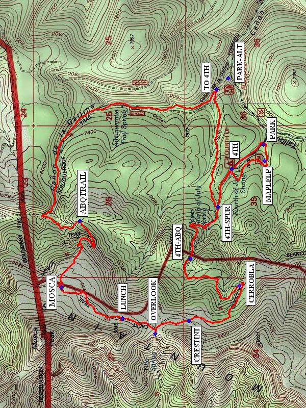
Trailhead DirectionsI-40 East to Tijeras exit, south on SR 337 to its end, right (west) on SR 55 to Tajique. Look for sign in Tajique for “4th of July Canyon.” Take FR 55 about 6.5 miles. At the 6.5 mile point the road will bend to the left. Go past the Albuquerque Trail trailhead to the 4th of July Campground. PARK (0.0 mi) near the beginning of the Maple Loop trail.
Actual HikeStart at the beginning of the MAPLELP (0.2 mi) Trail, then join the 4th of July Trail at 4TH TR. Continue uphill past the junction with the Albuquerque Trail 4TH-ABQ (1.4 mi) and the Cerro Blanco Trail CERROBLA (2.1 mi). You’ll reach the intersection with the Manzano Crest Trail CRESTINT (2.7 mi). Take a few minutes to check out the overlook of the Rio Grande Valley to the west. If the wind isn’t too strong, you could have lunch there. An even better spot for LUNCH (3.3 mi) is in a protected grove of maples north along the Manzano Crest Trail. Continue north on Manzano Crest Trail until it ends at the Mosca Trail (MOSCA (3.9 mi)), which you’ll follow until it connects with the Albuquerque Trail ABQTRAIL (4.7 mi). Take that to the 4TH CUTOFF where you’ll take a right back to 4TH TR to complete the loop. You then can retrace your steps through the Maple Loop Trail or just follow the road back to PARK.
CommentsWhat you see to the west from the overlook is a subdivision called Meadow Lake and the towns of Valencia and Los Lunas directly beyond. This is a great hike especially during the fall. If you choose to do the hike in the spring or summer, you could eliminate the Maple Loop Trail and start instead at the Albuquerque Trail trailhead at PARK-ALT.
WaypointsPARK-ALT: N34 47.616, W106 22.358
PARK: N34 47.414, W106 22.820
MAPLELP: N34 47.408, W106 22.934
4TH: N34 47.594, W106 22.991
4TH-SPUR: N34 47.675, W106 23.256
4TH-ABQ: N34 47.834, W106 23.619
CERROBLA: N34 47.552, W106 23.808
CRESTINT: N34 47.841, W106 24.052
OVERLOOK: N34 48.035, W106 24.139
LUNCH: N34 48.224, W106 24.032
MOSCA: N34 48.573, W106 23.815
ABQTRAIL: N34 48.468, W106 23.354
TO 4TH: N34 47.684, W106 22.439
Hike GPS File Name: AlbuquerqueTrailLoopLongWayTrack_MWMW.gpx
Hike GPS File: Click link to download hike waytrack file
Text Author: Roger Holloway
Map Author: Marilyn Warrant
Waypoints Author: Marilyn Warrant
Track Author: Marilyn Warrant
Maintainer: Marilyn Warrant
Editor: Howard Carr

4th of July – Crest – Cerro Blanco – FR55 Hike
In Manzano Mountains East Region
Map File Source: NG Topo
 Hike Key: H10399
Last Updated: 12/15/2020 12:00am
Last Updated By: Marilyn Warrant
Hike Class: D (Difficult)
Hike Distance: 7.6 mi
Minimum Elevation: 7539 ft
Elevation Change: 1258 ft
Total Uphill: 1509 ft
Total Downhill: 1509 ft
Avg. Grade: 9 %
Route Type: Loop
On Trail: Yes
Paved or Gravel Roads: No
GPS Advised: Yes
Drive Distance Round Trip: 110 mi
Drive Time One-Way: 1:30
Hiking Seasons: Spring, Summer, and Fall
New Mexico Game Unit: 14
Hike Status: Published
Highlights
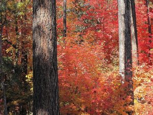
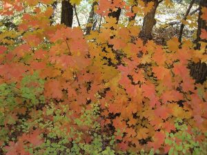
You can’t beat the crimson, pink, yellow and gold colors of foliage in early October.
CautionsCerro Blanco trail is quite steep in places; bring hiking poles.
Trailhead DirectionsI-40 east to Tijeras exit. South on SR 337 30 miles to SR 55. SR 55 west to Tajique. Turn right in Tajique between the church and the water tower onto FR 55, yes, SR 55 to FR 55. Take FR 55 about 7 miles to 4th of July CG and PARK (0.0 mi). If the road looks bad beyond the Albuquerque Trail trailhead, park instead at PARK-ALT and take the 4th of July Spur Trail at TO 4TH over to the 4th of July.
Actual HikeStart out with the short MAPLELP (0.2 mi) Trail. Then start hiking the 4th of July Trail (4TH (0.6 mi)). Notice the CAIRN on your way up. You’ll encounter intersections with the 4th of July Spur Trail (4TH-SPUR (0.8 mi)), Albuquerque Trail (4TH-ABQ (1.4 mi)), the Cerro Blanco Trail 79 (CERROBLA (2.1 mi) ) and the Manzano Crest Trail (CRESTINT (2.7 mi)). The OVERLOOK (3.0 mi) is a panoramic view. Continue north on the Manzano Crest Trail to a lovely grove of maples for LUNCH (3.3 mi), which is also out of the wind. On the way back, take the Cerro Blanco Trail at CERROBLA, and continue down that trail to the road (FR55 (6.0 mi)), then down the road to parking at the 4th of July CG.
CommentsThis is a beautiful hike any time of the year, but especially in the fall. The 4th of July Trail is well-known for its red, orange, and yellow leaves of the Rocky Mountain maples. Even if the timing isn’t right and the leaves are already on the ground, they are still gorgeous.
WaypointsPARK-ALT: N34 47.616, W106 22.358
PARK: N34 47.414, W106 22.820
MAPLELP: N34 47.408, W106 22.934
4TH: N34 47.594, W106 22.991
4TH-SPUR: N34 47.675, W106 23.256
4TH-ABQ: N34 47.834, W 106 23.619
CERROBLA: N34 47.552, W106 23.808
CRESTINT: N34 47.841, W106 24.052
OVERLOOK: N34 48.035, W106 24.139
LUNCH: N34 48.224, W106 24.032
FR55: N34 46.649, W106 23.499
Hike GPS File Name: 4thofJuly-Crest-CerroBlanco-FR55WayTrack_MWMW.gpx
Hike GPS File: Click link to download hike waytrack file
Text Author: Vivian Heyward
Map Author: Marilyn Warrant
Waypoints Author: Marilyn Warrant
Track Author: Marilyn Warrant
Maintainer: Vivian Heyward
Editor: Marilyn Warrant
ABQ Art, History, Architecture: Downtown-Old Town Hike
In Albuquerque Region
Map File Source: Other
 Hike Key: H10503
Last Updated: 03/10/2021 12:00am
Last Updated By: Marilyn Fixer
Hike Class: B (Moderate)
Hike Distance: 5.1 mi
Minimum Elevation: 4951 ft
Elevation Change: 10 ft
Total Uphill: 10 ft
Total Downhill: 10 ft
Avg. Grade: %
Route Type: CW Loop
On Trail: Yes
Paved or Gravel Roads: Yes
GPS Advised: No
Drive Distance Round Trip: 16 mi
Drive Time One-Way: 0:15
Hiking Seasons: Spring, Fall, and Winter
New Mexico Game Unit: 9
Hike Status: Published
Highlights
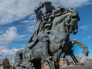
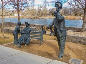
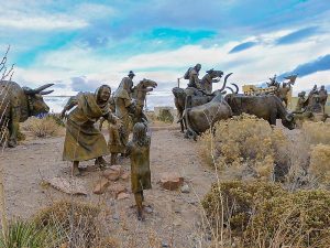
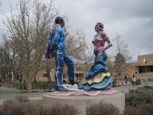
Stroll through downtown and Old Town Albuquerque to see public art, sculpture, architecture and historic features.
CautionsBring your smaller packs–at the Federal Courthouse we will be going through security, and a huge pack is inconvenient.
Trailhead DirectionsFrom I-40, exit on Rio Grande Boulevard and travel south to Mountain Road. Turn left/east and, just past the Albuquerque Museum of Art and History, turn right/south on 19th. Park on 19th Street near the museum.
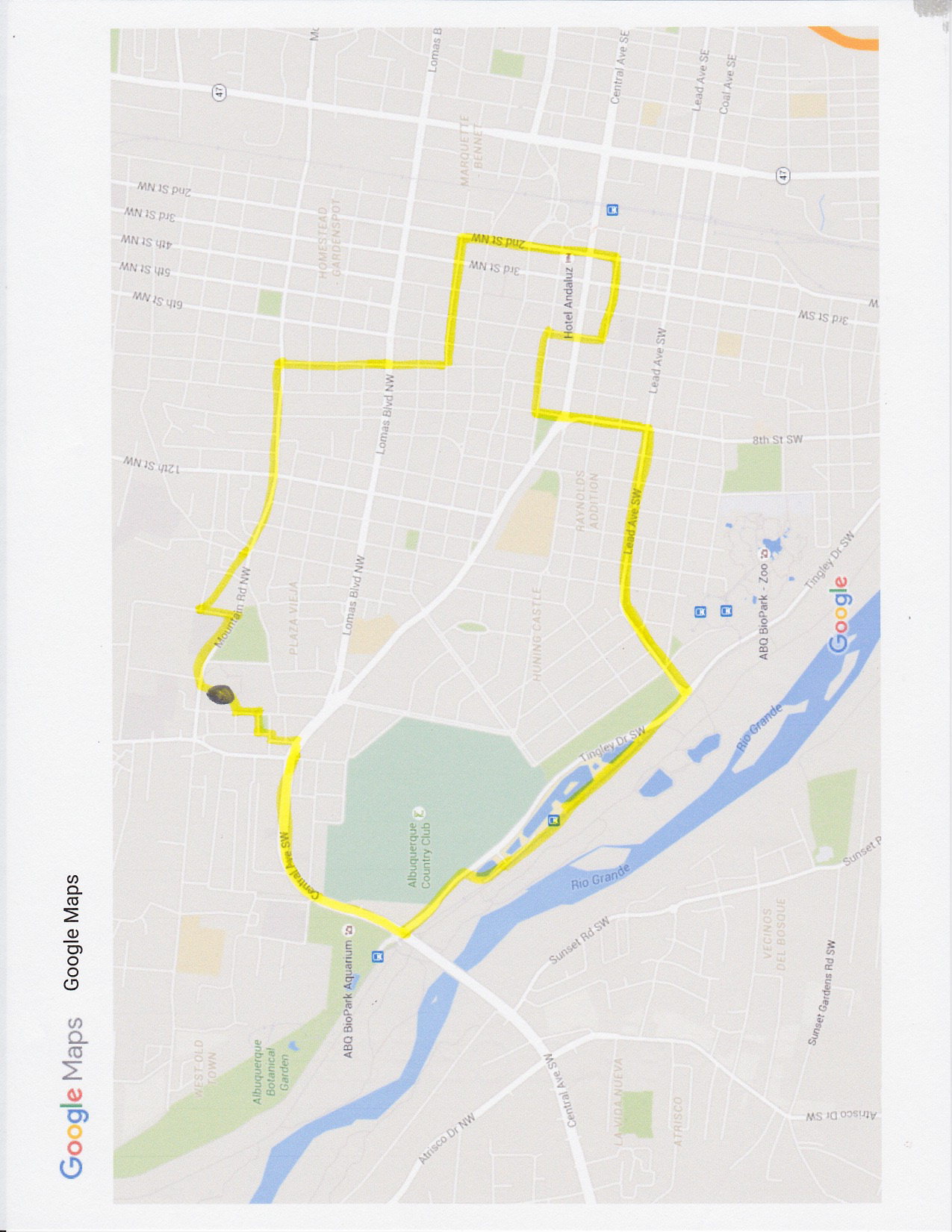
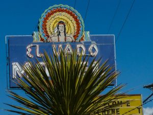
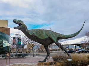
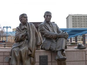
Actual HikeStart at the Albuquerque Museum sculpture garden, go north to Mountain Road and view sculptures near the Natural History Museum and Explora!. Continue along Mountain Road to 7TH and turn right/south to see the Harwood. At Roma, turn left/east, to Second, for an old mural on the laundry building. Go south on 3rd to COPPER, turn right/west on Copper and go to the Main Library at 5th. Go south on Second to the Convention Center tile murals, the historic Hotel Andaluz, and more wall murals. Turn west on Gold to see Amy Biehl, the Federal Courthouse, and the white ceramic bank. Turn north on Fifth to pass the Kimo, and view art at the parking garage and the Public Library at Fifth and Copper. Continue west on Copper to the corner of Robinson Park, and turn south on Eighth. Pass the Fire Station 3-dimensional mural. Turn right/west on Lead, which becomes Alcalde Place when it turns southwest. Cross Tingley Drive and turn right/northwest. Continue through Tingley Beach Aquatic Park to see several sculptures. Continue to Central and turn right/northeast. Notice the Beach Condominiums. Pass the El Vado and Turquoise Museum. Cross Rio Grande Blvd. and turn left/north on Romero. Walk through Old Town, viewing the Virgin of Guadalupe tree and the small chapel. Return to the back entrance of the Museum, viewing the rest of the sculpture garden and mosaic pathways.
CommentsThis hike explores the museum district, downtown, Tingley Beach and Old Town, focusing on art and historic buildings. Highlights are creations installed through the city’s 1% Public Art Program, started in 1978. Albuquerque was one of the first U.S. cities to have such a program. It sets aside 1% of voter-approved general obligation and revenue bonds for art in public spaces. An Urban Enhancement Trust Fund, created in 1983, funds capital and cultural projects. Today there are more than 650 works of public art city-wide.
Map Filename: art hike map_2.jpegAdditional File 1 Link Click link to download an additional file.
Text Author: Joan Weissman
Map Author: Joan Weissman
Waypoints Author:
Track Author:
Maintainer: Joan Weissman
Editor: Howard Carr
ABQ Art, History, Architecture: Nob Hill & UNM Hike
In Albuquerque Region
Map File Source: Garmin BaseCamp
 Hike Key: H10548
Last Updated: 12/15/2020 12:00am
Last Updated By: Marilyn Warrant
Hike Class: A (Easy)
Hike Distance: 3.9 mi
Minimum Elevation: 5157 ft
Elevation Change: 112 ft
Total Uphill: 140 ft
Total Downhill: 140 ft
Avg. Grade: %
Route Type: Loop
On Trail: Yes
Paved or Gravel Roads: Yes
GPS Advised: No
Drive Distance Round Trip: 10 mi
Drive Time One-Way: 0:15
Hiking Seasons: Spring and Fall
New Mexico Game Unit: 9
Hike Status: Published
Highlights
A walking tour of Nob Hill and the UNM campus highlighting history, architecture, landscaping, and Public Art installations.
CautionsMost of the walk will be on concrete surfaces. Wear comfortable shoes.
Trailhead DirectionsHike will begin at the free parking lot behind the Nob Hill shopping center (La Montanita Coop). It is on Silver, between Carlisle and Amherst.
Actual HikeThe hike will encompass two interesting areas of Southeast Albuquerque. Brief commentary will be presented at many waypoints, but we will walk briskly and far enough to qualify as exercise. In the Nob Hill section, we will compare residences of several characteristic architectural styles as well as historic churches and commercial areas. On the UNM campus, we will view some of the iconic original buildings, take note of many public sculptures, and rest at the Duck Pond. We will return to our starting point via Central Avenue (Route 66), to see how old and new have developed into the eclectic mix of today’s Nob Hill neighborhood.
CommentsThe hike is approximately 4 miles, and will take 2.5 – 3 hours. The last mile is straight along Central. If you get tired, you could opt to take the bus (Rapid Ride) for $.35 back to the starting point.
Hike data were determined using a Garmin GPSMap 60CSx and Garmin BaseCamp’s DEM for TOPO US 24K Southwest.
Map Filename: NobHill_Art&ArchitectureMap1_JWMW.jpgHike GPS File Name: NobHill_Art&ArchitectureWayTrack_MW.gpx
Hike GPS File: Click link to download hike waytrack file
Additional File 1 Link Click link to download an additional file.
Text Author: Joan Weissman
Map Author: Joan Weissman
Waypoints Author: Marilyn Warrant
Track Author: Marilyn Warrant
Maintainer: Joan Weissman
Editor: Howard Carr


Acoma – Zuni All Hike
In El Malpais Region
Map File Source: NG Topo
 Hike Key: H10259
Last Updated: 04/20/2021 12:00am
Last Updated By: Marilyn Fixer
Hike Class: D (Difficult)
Hike Distance: 7.7 mi
Minimum Elevation: 6842 ft
Elevation Change: 94 ft
Total Uphill: 105 ft
Total Downhill: 0 ft
Avg. Grade: 1 %
Route Type: Multiple Hikes
On Trail: No
Paved or Gravel Roads: Yes
GPS Advised: Yes
Drive Distance Round Trip: 180 mi
Drive Time One-Way: 2:00
Hiking Seasons: Spring, Fall, and Winter
New Mexico Game Unit: 13
Hike Status: Published
Access Description: El Malpais North Access
Highlights
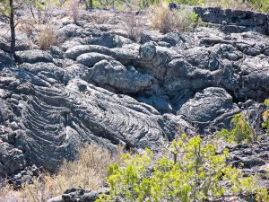
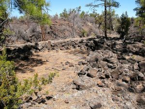
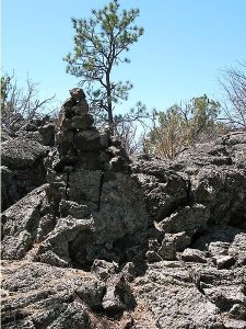
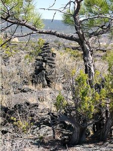
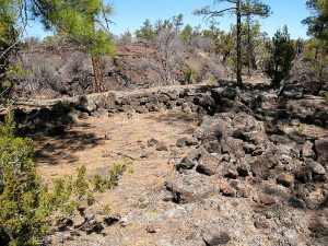
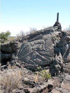
Part of an ancient route that connects the pueblos of Acoma and Zuni across the lava flow area of El Malpais National Monument.
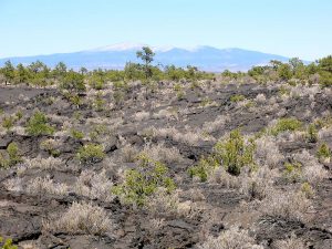
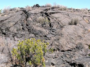
CautionsDifficult walking on lava rock; trekking poles and leather gloves extremely helpful.
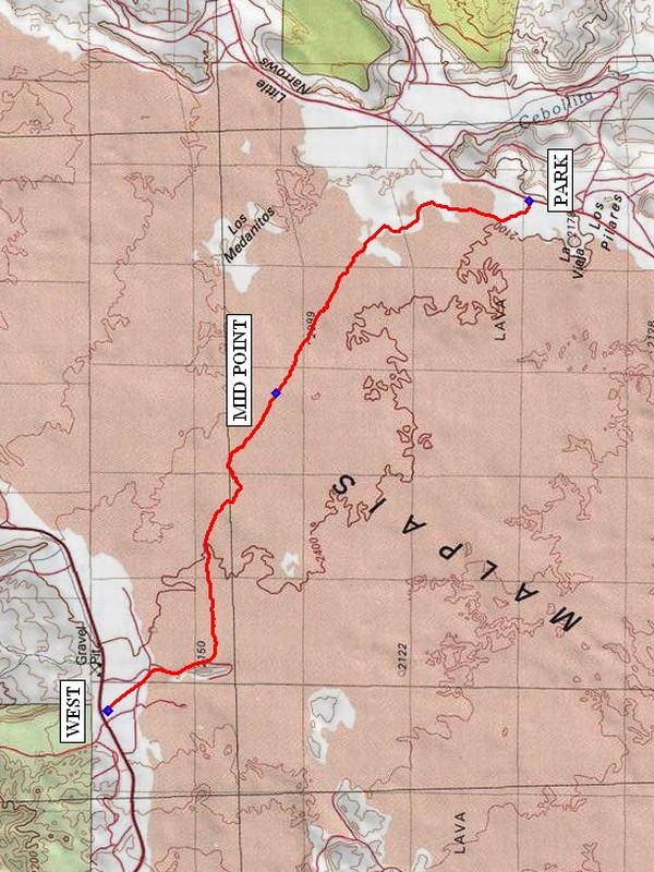
Trailhead DirectionsSee the individual hike descriptions for information: Acoma-Zuni All From East and Acoma-Zuni All From West.
Actual HikeThe trail is dangerous if you do not watch for the next stone pile, or cairn, before proceeding because there is really no trail and it would be easy to become hopelessly lost. See the individual hike descriptions for information: Acoma-Zuni All From East and Acoma-Zuni All From West.
CommentsNot a hike for people who are clumsy. Walking sticks are almost a must — to maintain at least two points of contact with the ground at all times. Leather gloves are another good idea. This description is appropriate for one center with two vans, where the two groups exchange van keys somewhere in the middle, then meet at a convenient location e.g., Grants or the intersection of I40 and SR 117, to exchange vans. The rating has been set to D because of the difficulty walking on lava rock. Travel time is to the west trailhead.
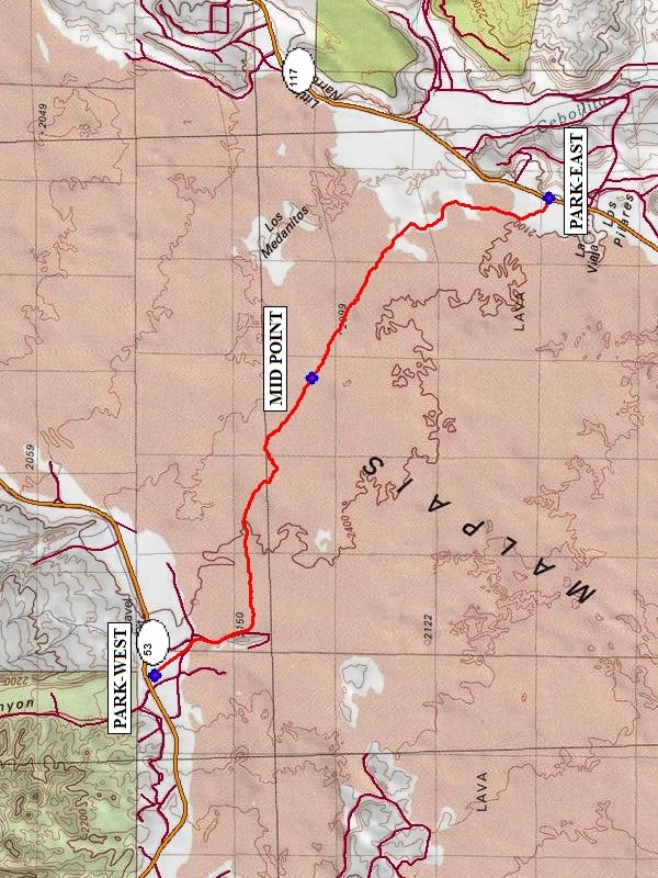
WaypointsPARK-EAST: N34 53.938, W107 51.546
PARK-WEST: N34 57.375, W107 56.579
MID POINT: N34 56.001, W107 53.446
Hike GPS File Name: Acoma-ZuniAllWayTrack_mod_JBJB.gpx
Hike GPS File: Click link to download hike waytrack file
Text Author: Roger Holloway
Map Author: Marilyn Warrant
Waypoints Author: John Boyd
Track Author: John Boyd
Maintainer: Dawn McIntyre
Editor: Marilyn Warrant


Acoma – Zuni All From East Hike
In El Malpais Region
Map File Source: NG Topo
 Hike Key: H10417
Last Updated: 12/15/2020 12:00am
Last Updated By: Marilyn Warrant
Hike Class: D (Difficult)
Hike Distance: 7.7 mi
Minimum Elevation: 6834 ft
Elevation Change: 94 ft
Total Uphill: 108 ft
Total Downhill: 46 ft
Avg. Grade: 1 %
Route Type: Oneway
On Trail: No
Paved or Gravel Roads: Yes
GPS Advised: Yes
Drive Distance Round Trip: 160 mi
Drive Time One-Way: 1:45
Hiking Seasons: Spring, Fall, and Winter
New Mexico Game Unit: 13
Hike Status: Published
Access Description: El Malpais North Access
Highlights
Part of an ancient route that connects the pueblos of Acoma and Zuni across the lava flow area of El Malpais National Monument.
CautionsDifficult walking on lava rock; trekking poles and leather gloves extremely helpful.
Trailhead DirectionsFrom Albuquerque take I-40 west to exit 89 at Grants. Go south on SR 117 about 19 miles, between mileposts 40 and 41, to PARK (0.0 mi) at the Acoma-Zuni East trailhead. There is also a Ranger Station Visitor Center with toilets near milepost 48.
Actual HikeThe trail is dangerous if you do not watch for the next stone pile, or cairn, before proceeding because there is really no trail and it would be easy to become hopelessly lost. At the west end of the hike, the trail crosses over a lava chasm that might very well be the most interesting part of the hike. You will pass areas of level soft, sandy ground then come upon areas of very rough lava.
CommentsNot a hike for people who are clumsy. Walking sticks are almost a must — to maintain at least two points of contact with the ground at all times. Leather gloves are another good idea. One way to hike the entire trail is to team up with another senior center, exchange van keys somewhere in the middle, then meet at a convenient location e.g., Grants or the intersection of I-40 and SR 117, to exchange vans. The rating has been set to D because of the difficulty walking on lava rock.
WaypointsPARK: N34 53.938, W107 51.546
WEST: N34 57.375, W107 56.579
MID POINT: N34 56.001, W107 53.446
Hike GPS File Name: Acoma-ZuniAllFromEastWayTrack_JB_mod.gpx
Hike GPS File: Click link to download hike waytrack file
Text Author: Roger Holloway
Map Author: Marilyn Warrant
Waypoints Author: John Boyd
Track Author: John Boyd
Maintainer: Dawn McIntyre
Editor: Marilyn Warrant


