Acoma – Zuni All From West Hike
In El Malpais Region
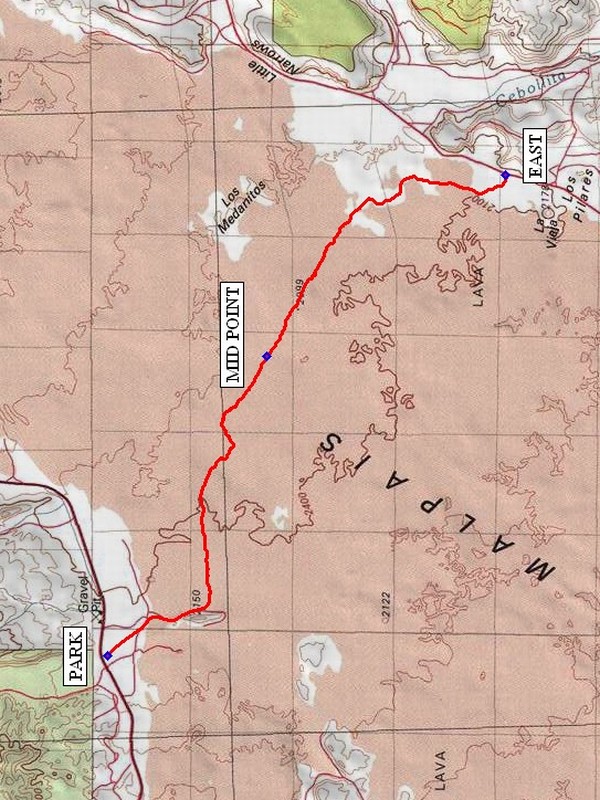
Map File Source: NG Topo
 Hike Key: H10418
Last Updated: 12/15/2020 12:00am
Last Updated By: Marilyn Warrant
Hike Class: D (Difficult)
Hike Distance: 7.7 mi
Minimum Elevation: 6834 ft
Elevation Change: 94 ft
Total Uphill: 46 ft
Total Downhill: 108 ft
Avg. Grade: 1 %
Route Type: Oneway
On Trail: No
Paved or Gravel Roads: Yes
GPS Advised: Yes
Drive Distance Round Trip: 180 mi
Drive Time One-Way: 2:00
Hiking Seasons: Spring, Fall, and Winter
New Mexico Game Unit: 13
Hike Status: Published
Access Description: El Malpais North Access
Highlights
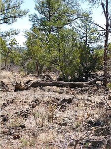
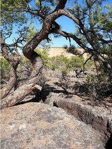
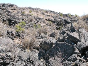
Part of an ancient route that connects the pueblos of Acoma and Zuni across the lava flow area of El Malpais National Monument. Views of Mt. Taylor, sandstone bluffs, and gnarly plants and trees that have found a way to grow in the inhospitable environment.
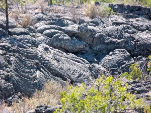
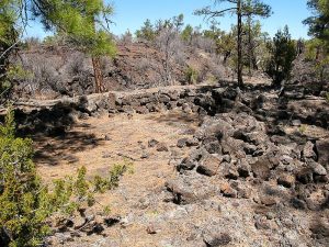
CautionsDifficult walking on lava rock; trekking poles, leather gloves, long pants, and sturdy boots extremely helpful.
Trailhead Directions
From Albuquerque take I-40 west to exit 81 at Grants. Go south on SR 53 about 15 miles, now going west, past a gravel operation on right and MP 70 to PARK (0.0 mi) at the Acoma-Zuni West trailhead on left. Note that first milepost on SR 53 at I-40 is MP 85.
Actual Hike
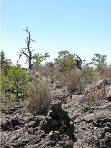
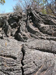
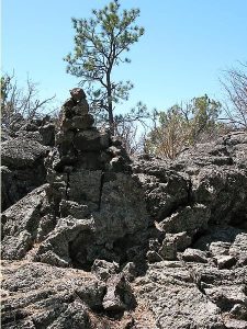
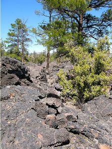
The trail is dangerous if you do not watch for the next stone pile, or cairn, before proceeding because there is really no trail and it would be easy to become hopelessly lost. At the west end of the hike, the trail crosses over a lava chasm that might very well be the most interesting part of the hike. You will pass areas of level soft, sandy ground then come upon areas of very rough lava.
Comments
Not a hike for people who are clumsy. Walking sticks are almost a must — to maintain at least two points of contact with the ground at all times. Leather gloves are another good idea. One way to hike the entire trail is to team up with another senior center, exchange van keys somewhere in the middle, then meet at a convenient location e.g., Grants or the intersection of I-40 and SR 117, to exchange vans. The rating has been set to D because of the difficulty walking on lava rock.
WaypointsPARK: N34 57.375, W107 56.579
MID POINT: N34 56.001, W107 53.446
EAST: N34 53.938, W107 51.546
Hike GPS File Name: Acoma-ZuniAllFromWestWayTrack_JB_mod.gpx
Hike GPS File: Click link to download hike waytrack file
Text Author: Roger Holloway
Map Author: Marilyn Warrant
Waypoints Author: John Boyd
Track Author: John Boyd
Maintainer: Dawn McIntyre
Editor: Marilyn Warrant