Tree Spring – Oso Corredor – Bill Springs Hike
In Sandia Mountain East Region
Map File Source: Garmin BaseCamp
 Hike Key: H10628
Last Updated: 12/15/2020 12:00am
Last Updated By: Marilyn Warrant
Hike Class: B (Moderate)
Hike Distance: 4 mi
Minimum Elevation: 7430 ft
Elevation Change: 1140 ft
Total Uphill: 265 ft
Total Downhill: 1231 ft
Avg. Grade: 5 %
Route Type: Oneway
On Trail: Yes
Paved or Gravel Roads: Yes
GPS Advised: No
Drive Distance Round Trip: 50 mi
Drive Time One-Way: 0:45
Hiking Seasons: Spring, Summer, and Fall
New Mexico Game Unit: 8
Hike Status: Published
Highlights
Wildflowers, Abert’s squirrels, Bill Spring
CautionsHiking poles are recommended for the steep descent of 1200 ft along Faulty Tr.
Trailhead Directions
I-25 east to Tijeras exit, north on NM 14, west on Crest Road to PARK (0.0 mi) at the Tree Spring trailhead. On the way, leave a shuttle vehicle at the west end of the Doc Long Picnic Grounds (BILL SPR TH). Put a Golden Age Passport on dashboard of each vehicle.
Actual Hike
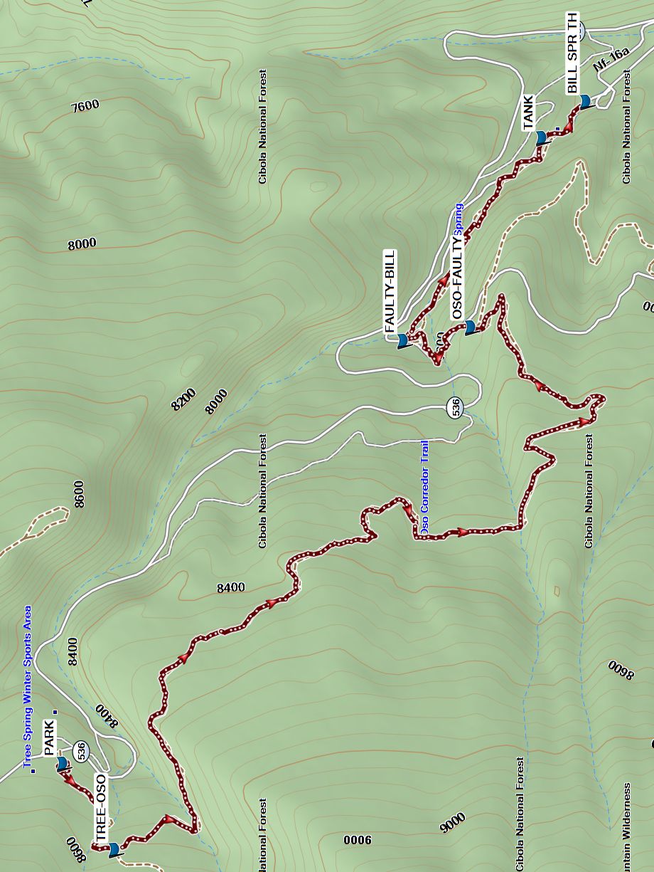
This trail starts near the outhouses just west of the parking (PARK) area. The trail is well-marked and easy to follow. This is a hike through a lush woodland of mixed conifer, oak, and aspen trees. There are just enough aspen to make it a worthwhile fall color hike. All along this well used trail there are many wildflowers in the spring and summer months. Hike uphill until you see the junction with 0so Corredor Tr 265 (TREE-OSO at 0.3 mi). The trail is undulating with a total ascent of less than 250 ft and ends at its juncture with Faulty Tr 195 (OSO-FAULTY)(3.0 mi). Head east on Faulty Tr which descends steeply until it meets with Bill Spring Tr (FAULTY-BILL) (3.3. mi). Follow this trail to TANK (3.9 mi) and the shuttle location at BILL SPR TH. Have lunch at the picnic tables at Doc Long’s.
Comments
Tree Spring trail is well used and weathered and has many tripping hazards such as exposed tree roots, pointy rocks and the like, so hikers should mind their footing while they enjoy the scenery. Tree Spring Trail #147 is outside of the Sandia Wilderness Area, so you may encounter bicycles. Oso Corredor means “Running Bear”. Except for short rocky Faulty Trail, the footing is very good and elevation gain is very gradual. There are Abert’s squirrels in the Doc Long Picnic Ground that are quite large and tame and are remarkable for their grey and white coloring.
WaypointsPARK: N35 11.610, W106 24.301
TREE-OSO: N35 11.515, W106 24.500 (0.3 mi)
OSO-FAULTY: N35 10.856, W106 23.296 (3.0 mi)
FAULTY-BILL: N35 10.980, W106 23.329 (3.3 mi)
TANK: N35 10.725, W106 22.861 (3.9 mi)
BILL SPR TH: N35 10.643, W106 22.778
Hike GPS File Name: TreeSpring-OsoCorredor-BillSpringsWayTrack_VH.gpx
Hike GPS File: Click link to download hike waytrack file
Text Author: Vivian Heyward
Map Author: Marilyn Warrant
Waypoints Author: Vivian Heyward
Track Author: Vivian Heyward
Maintainer: Vivian Heyward
Editor: Howard Carr