Tomas Baca Well Figure 8 Hike
In Socorro Region
Map File Source: NG Topo
 Hike Key: H10329
Last Updated: 12/15/2020 12:00am
Last Updated By: Marilyn Warrant
Hike Class: C (Challenging)
Hike Distance: 5.4 mi
Minimum Elevation: 5286 ft
Elevation Change: 377 ft
Total Uphill: 560 ft
Total Downhill: 560 ft
Avg. Grade: 5 %
Route Type: Figure8
On Trail: No
Paved or Gravel Roads: No
GPS Advised: Yes
Drive Distance Round Trip: 186 mi
Drive Time One-Way: 1:45
Hiking Seasons: Spring, Fall, and Winter
New Mexico Game Unit: 18
Hike Status: Published
Access Description: Quebradas Access
Highlights
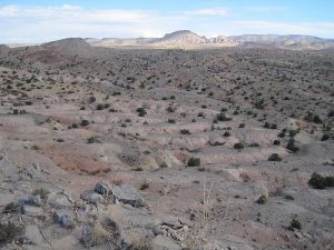
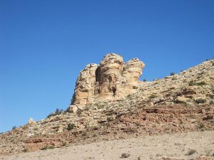
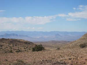
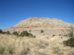
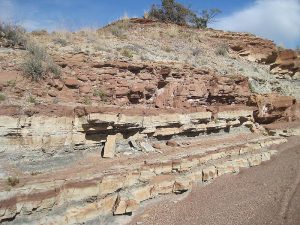
A walk around the “shoulder” of a small hill, 360 deg views, travel the “Roman highway” in stone, explore a rocky arroyo.
CautionsAll off trail, some walking on rocks. Exposure walking around the hill. Hiking poles advised. This can be a hot hike, so bring plenty of water.
Trailhead Directions
From Albuquerque take I-25 south to Exit 152-ESCONDIDA. Go east for 0.1 mile on SR-408. Turn left onto SR-408 and go 1 mile to Escondida (Hidden) Lake. Turn RIGHT and go 0.8 miles, crossing the Rio Grande to STARTDIRT. DO NOT follow the signs to the Quebradas and turn right. Instead, continue straight. There’s about 9 mi of dirt road (20 min or so) from there to the trailhead. You’ll be on the southern boundary of the Veranito Wilderness Study Area. Keep an eye out for potential wash outs on the downhill side of the road. Go generally northeast. When you come to a tattered sign “5”, that’s WSMR P Route 5. Veer right there. Find the big wash about half a mile before the Tomas Baca Well, identified by the windmill, cows, side road, and stone ruin and PARK (0.0 mi) either in the arroyo or off to the side. Return either the way you came, or take SR-408 to Lemitar and get on I-25 from there.
Actual Hike
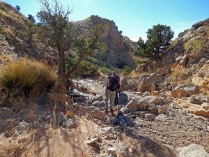
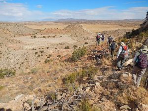
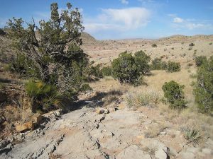
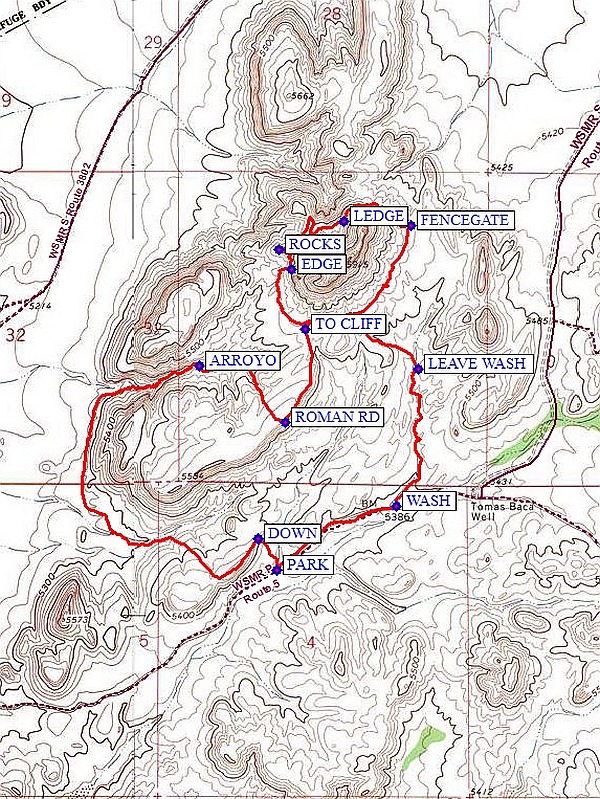
Walk up the road then north up WASH (0.5 mi) (stay to the left) to a cattle path on the left and LEAVE WASH (1.0 mi). From there, head in a northwesterly direction uphill toward the large mesa ahead. You will reach a heavily traveled cattle trail. Start going around the knob clockwise. There are some erosion features to work around, so go close to the knob EDGE (1.7 mi). Part way around is the ROCKS (1.8 mi) spot with a wonderful view of the mountains to the west and some rocks for protection from the wind. This is a good place for lunch. Continue going around the knob, following game trails. LEDGE (2.2 mi) is a good place to take a break and explore the cave you just passed. Take a look at the FENCEGATE (2.5 mi), the way you wish all wire fence gates would be constructed. You’ll eventually retrace a few of your steps once you get all the way around. At the southern end of the mesa turn south toward a valley followed by a rise. The south end of this rise is a cliff. Go up starting at TO CLIFF (3.1 mi) and walk along the edge for a good view to the south. You can get a glimpse of the van down below. Turn 90 degrees right at ROMAN RD (3.4 mi) and go downhill on a formation that looks just like a broken up Roman road might look, funneling into an arroyo that eventually joins the main arroyo at ARROYO (3.8 mi). Near this waypoint are some trees; by this time you may need the shade and a break. There are some large rocks you’ll need to climb around in the arroyo, but nothing too serious. You may also want to take a short break at the bottom of the arroyo. Then walk around the bottom of the cliffs, sometimes on cattle trails. Start up an arroyo coming from the east. Follow the right side of this arroyo uphill looking for an easy way to get up the hill to the right to the way DOWN (5.3 mi).
Comments
The uneven footing for some of this hike has resulted in an increase in rating to C. If the weather has been wet, don’t attempt to go around the north end of the knob or down the big arroyo (you probably won’t want to go on the road to get here, either). Allow about one extra hour for this hike, especially if the weather is hot.
WaypointsAccess:
152-ESCONDIDA: N34 06.204, W106 54.049
RIGHT: N34 07.207, W106 53.544
STARTDIRT: N34 07.307 W106 52.736
WSMR-5: N34 09.435, W106 48.201
Hike:
PARK: N34 10.131, W106 44.555
WASH: N34 10.309, W106 44.156 (0.5 mi)
LEAVE WASH: N34 10.694, W106 44.081 (1.0 mi)
EDGE: N34 10.973, W106 44.506 (1.7 mi)
ROCKS: N34 11.029, W106 44.551 (1.8 mi)
LEDGE: N34 11.108, W106 44.332 (2.2 mi)
FENCEGATE: N34 11.097, W106 44.106 (2.5 mi)
TO CLIFF: N34 10.805, W106 44.462 (3.1 mi)
ROMAN RD: N34 10.546, W106 44.528 (3.4 mi)
ARROYO: N34 10.704, W106 44.816 (3.8 mi)
DOWN: N34 10.219, W106 44.620 (5.3 mi)
Hike GPS File Name: TomasBacaFigure8Rev2WayTrack_MW.gpx
Hike GPS File: Click link to download hike waytrack file
Additional File 1 Link Click link to download an additional file.
Text Author: Marilyn Warrant
Map Author: Marilyn Warrant
Waypoints Author: Marilyn Warrant
Track Author: Marilyn Warrant
Maintainer: Marilyn Warrant
Editor: Howard Carr