San Ysidro Trials East Hike
In San Ysidro Region
Map File Source: DeLorme
 Hike Key: H10062
Last Updated: 12/15/2020 12:00am
Last Updated By: Marilyn Warrant
Hike Class: B (Moderate)
Hike Distance: 5.6 mi
Minimum Elevation: 5500 ft
Elevation Change: 450 ft
Total Uphill: 650 ft
Total Downhill: 650 ft
Avg. Grade: 4 %
Route Type: Lollypop
On Trail: No
Paved or Gravel Roads: Yes
GPS Advised: Yes
Drive Distance Round Trip: 70 mi
Drive Time One-Way: 1:15
Hiking Seasons: Spring and Fall
New Mexico Game Unit: 6A
Hike Status: Published
Highlights
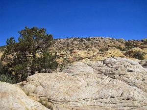
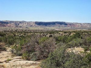
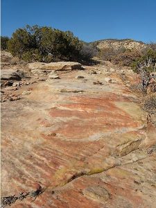
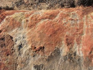
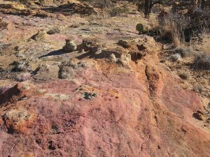
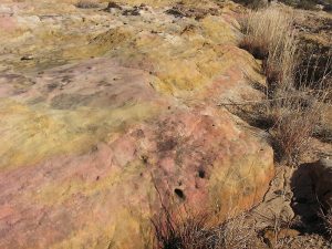
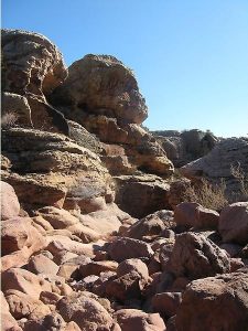
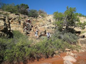
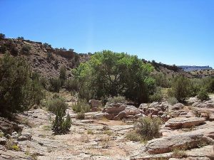
Hike on expanses of rock surface with rock formations, and through canyons and arroyos. You may encounter lots of wildflowers after late summer rains.
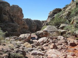
CautionsSome walking on rock surfaces. Must cross 40 foot deep and steep sided arroyo. Hiking poles recommended.
Trailhead Directions
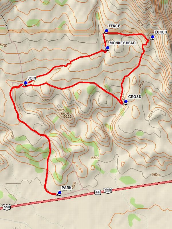
From Albuquerque go North on I-25 to Bernalillo. Go west on US 550 from Bernalillo to milepost 25 which is about 1.5 miles beyond San Ysidro. There is a small parking area beyond the west end of paved pull off area on the right in a fenced parking area marked “San Ysidro Trials”. Pull in there and PARK (0.0 mi).
Actual Hike
There is a fence pass-through at the west end of the parking area. Go through the pass-through and hike the road which curves to the north and up the hill. The road drops down into an open area before the first arroyo. This is where the motorcycle rallies start. Cross the arroyo and go straight at the JOIN (1.2 mi) point. The trail follows a relatively straight path until a canyon is reached at the MONKEY HEAD (2.0 mi) formation, which has been used to identify the canyon crossing point. Unfortunately weathering has made this figure difficult to spot. Find a way into the canyon and up the other side. Beyond this point there is no trail to follow. Turn north and go along the east side of the canyon to the FENCE (2.2 mi). Jemez Pueblo land is beyond the fence. Turn to the east and more or less follow the fence, eventually reaching the top of the north/south running ridge which is a good place for LUNCH (2.7 mi). Then depart, going south west. There are numerous ways to cover this very interesting terrain, which is also known as “fun rocks”. A small canyon is reached at the easiest CROSS (3.4 mi) point. There are other crossings to the north of this point. After crossing this canyon go west, but stay north of the hill which is west of the canyon. Head west to the JOIN point. Retrace the route back to the parking area.
Comments
This is BLM land. A motorcycle club has an agreement with the BLM to use the area for trials. A series of courses have been laid out in the area. The area is seldom used by the cyclists, who have access to the area on the gated road during events.
WaypointsPARK: N35 33.284, W106 48.411
JOIN: N35 34.109, W106 48.722
MONKEY HEAD: N35 34.375, W106 47.966
FENCE: N35 34.504, W106 47.974
LUNCH: N35 34.456, W106 47.547
CROSS: N35 33.971, W106 47.796
Hike GPS File Name: SanYsidroTrialsEastWayTrack_HCHC.gpx
Hike GPS File: Click link to download hike waytrack file
Text Author: Dick Brown
Map Author: Dick Brown
Waypoints Author: Dick Brown
Track Author: Howard Carr
Maintainer: Howard Carr
Editor: Marilyn Warrant