Sabino Canyon Open Space Hike
In Cedro Peak Region
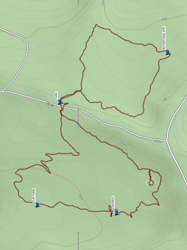
Map File Source: Garmin BaseCamp
 Hike Key: H10716
Last Updated: 04/19/2024 8:29pm
Last Updated By: Dawn McIntyre
Hike Class: A (Easy)
Hike Distance: 2.4 mi
Minimum Elevation: 7100 ft
Elevation Change: 137 ft
Total Uphill: 410 ft
Total Downhill: 410 ft
Avg. Grade: 0 %
Route Type: Loop
On Trail: Yes
Paved or Gravel Roads: Yes
GPS Advised: No
Drive Distance Round Trip: 40 mi
Drive Time One-Way: 0:45
Hiking Seasons: Spring, Summer, Fall, and Winter
New Mexico Game Unit:
Hike Status: Published
Attractions: Meadows and Wildflowers
Highlights
Wildflowers in season.
CautionsNone.
Trailhead Directions
From the I-25/I-40 intersection, drive 14.8 mi west to Tijeras, then south for 5 mi on NM 337 to Juan Tomas Rd. Take a left, and drive 0.6 mi to FR 252. Take another left here then it’s a short 0.2 mi to PARK.
Actual Hike
Hike on one side of the road, have lunch near the parking area, then hike on the other side.
Comments
If you’re interested in wildflowers, check the low area next to the road.
WaypointsWATERTANK SPR: N35 02.182, W106 20.482
EDWARDS: N35 02.287, W106 20.890
PARK: N35 02.403, W106 20.608
FUR FARM: N35 02.449, W106 20.871
Hike GPS File Name: SabinoCnynOSWayTrack_MW.gpx
Hike GPS File: Click link to download hike waytrack file
Text Author: Jody Latimer
Map Author: Marilyn Warrant
Waypoints Author: Marilyn Warrant
Track Author: Marilyn Warrant
Maintainer: Marilyn Warrant
Editor: Dawn McIntyre