Red Canyon Hike
In Manzano Mountains East Region
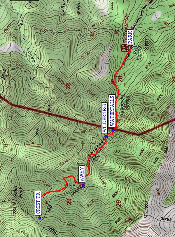
Map File Source: NG Topo
 Hike Key: H10290
Last Updated: 12/05/2023 9:54pm
Last Updated By: Marilyn Fixer
Hike Class: D (Difficult)
Hike Distance: 4.9 mi
Minimum Elevation: 7930 ft
Elevation Change: 1680 ft
Total Uphill: 1699 ft
Total Downhill: 1699 ft
Avg. Grade: 14 %
Route Type: InOut
On Trail: Yes
Paved or Gravel Roads: Yes
GPS Advised: No
Drive Distance Round Trip: 120 mi
Drive Time One-Way: 1:30
Hiking Seasons: Spring, Summer, and Fall
New Mexico Game Unit: 14
Hike Status: Published
Highlights
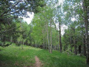
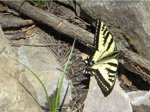
Beautiful green canyon in the Manzanos. Wildflowers, stream, and rock formations.
CautionsHiking poles recommended.
Trailhead Directions
From Albuquerque, take I-40 east to exit 175 for south NM 337. Take 337 south. From the stoplight, head 28.7 miles south on NM 337 through Chilili until the road ends at a T intersection with NM 55. Turn right (west) and continue another 12 miles passing through Tajique and Torreon to the town of Manzano. Watch for a sign which says: Manzano State Park; Red Canyon Campground; NM 131. After going 2.4 miles on NM 131, you are at the entrance to Manzano Mountains state park. Turn right; you are now on a one-lane paved road. 0.5 mi down the road you get to the forest boundary and the road turns to gravel. A few small side roads branch off, but remain on the main road for 1.8 miles, where you will see a sign for the Red Canyon campground. PARK (0.0 mi) at the horse camp at the Red Canyon campground.
Actual Hike
Take Red Canyon Trail #89. Hike up the trail following the stream to the WATERFALLS (1.0 mi) (that is, unless it’s been a dry year). The (WILDERNESS (1.1 mi)) boundary comes shortly thereafter. At AWAY (1.7 mi), the trail leaves the stream to go up to meet the Manzano CREST TR (2.4 mi). Have lunch there, and return.
Comments
The Spruce Spring hike also leaves from this campground.
WaypointsPARK: N 34 37.332, W 106 24.889
WATERFALLS: N 34 37.468, W 106 25.651
WILDERNESS: N 34 37.526, W 106 25.711
AWAY: N 34 37.702, W 106 26.161
CREST TR: N 34 38.035, W 106 26.460
Hike GPS File Name: RedCanyonWayTrack_MWMW.gpx
Hike GPS File: Click link to download hike waytrack file
Text Author: Marilyn Warrant
Map Author: Marilyn Warrant
Waypoints Author: Marilyn Warrant
Track Author: Marilyn Warrant
Maintainer: Randy Simons
Editor: Howard Carr