Michael Emery Trail Plus Hike
In Sandia Mountain West Region
Map File Source: Garmin BaseCamp
 Hike Key: H10718
Last Updated: 12/20/2023 2:43pm
Last Updated By: Marilyn Warrant
Hike Class: B (Moderate)
Hike Distance: 3.9 mi
Minimum Elevation: 6220 ft
Elevation Change: 410 ft
Total Uphill: 660 ft
Total Downhill: 660 ft
Avg. Grade: 2 %
Route Type: CCW Loop
Protected: No
On Trail: Yes
Paved or Gravel Roads: Yes
GPS Advised: Yes
Drive Distance Round Trip: 30 mi
Drive Time One-Way: 0:30
Hiking Seasons: Spring, Summer, Fall, and Winter
New Mexico Game Unit:
Hike Status: In Process
Attractions: Arroyos, Forest, Meadows, and Views
Highlights
An easy walk in the foothills with a short excursion into the Sandia Wilderness Area.
CautionsWatch for bicycles!
Trailhead Directions
Take Spain going east to the end and turn right onto High Desert NE. It’s a short distance to a parking area on the left.
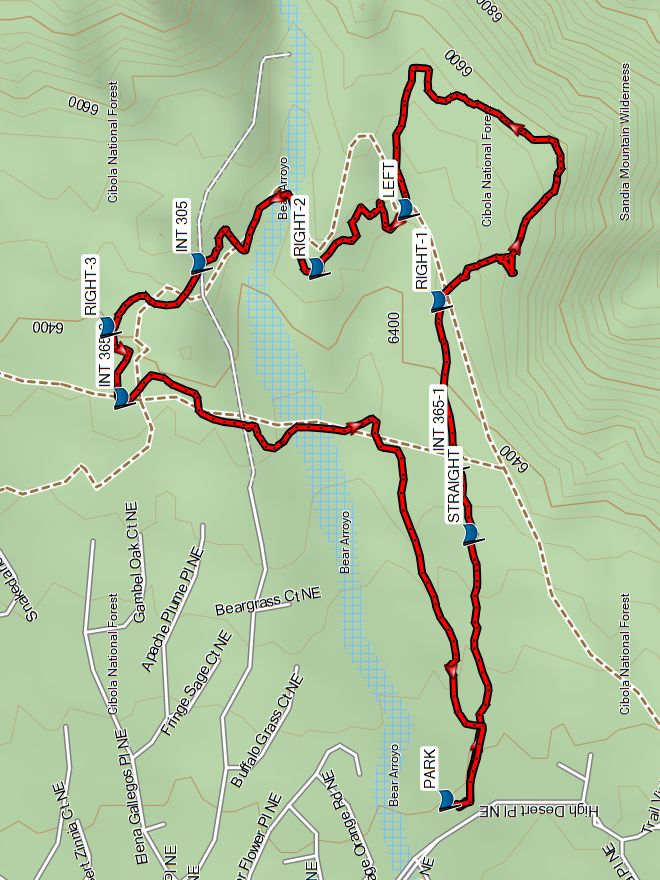
Actual Hike
From PARK, take the Michael Emery trail. At the first intersection, take a right then go straight, passing the first INT 365-1. Next, take a RIGHT-1 following a primitive trail into the wilderness. Curve around to your left. At the next intersection, go LEFT, followed by RIGHT-2, continuing to INT 305. Go RIGHT-3 to INT 365-2. After that, it’s a couple of straight sections back to PARK.
Map Filename: MichaelEmeryPlusMap_MW.jpg
Hike GPS File Name: MichaelEmeryPlusWayTrack.gpx
Hike GPS File: Click link to download hike waytrack file
Text Author: Marilyn Warrant
Map Author: Marilyn Warrant
Waypoints Author: Marilyn Warrant
Track Author: Marilyn Warrant
Maintainer: Marilyn Warrant
Editor: Dawn McIntyre