Jemez FR 376 Aspen Area Hike
In Jemez Mountains Region
Map File Source: DeLorme
 Hike Key: H10125
Last Updated: 09/05/2023 3:20pm
Last Updated By: Marilyn Warrant
Hike Class: B (Moderate)
Hike Distance: 4.2 mi
Minimum Elevation: 8175 ft
Elevation Change: 330 ft
Total Uphill: 403 ft
Total Downhill: 403 ft
Avg. Grade: 5 %
Route Type: InOut
On Trail: No
Paved or Gravel Roads: Yes
GPS Advised: Yes
Drive Distance Round Trip: 140 mi
Drive Time One-Way: 1:45
Hiking Seasons:
New Mexico Game Unit: 6A
Hike Status: Published
Highlights
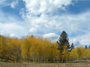
Easy stroll in a valley lined with aspens. Some sandstone rock formations.
CautionsNone.
Trailhead Directions
From Albuquerque take I-25 North to Bernalillo, US 550 west to San Ysidro, SR 4 north to La Cueva, left (west) on SR 126. Go west 3.8 miles to FR 376 which crosses SR 126. Turn left and go south 1.8 miles. Find any road to the left in the area and go a few hundred feet and PARK (0.0 mi).
Actual Hike
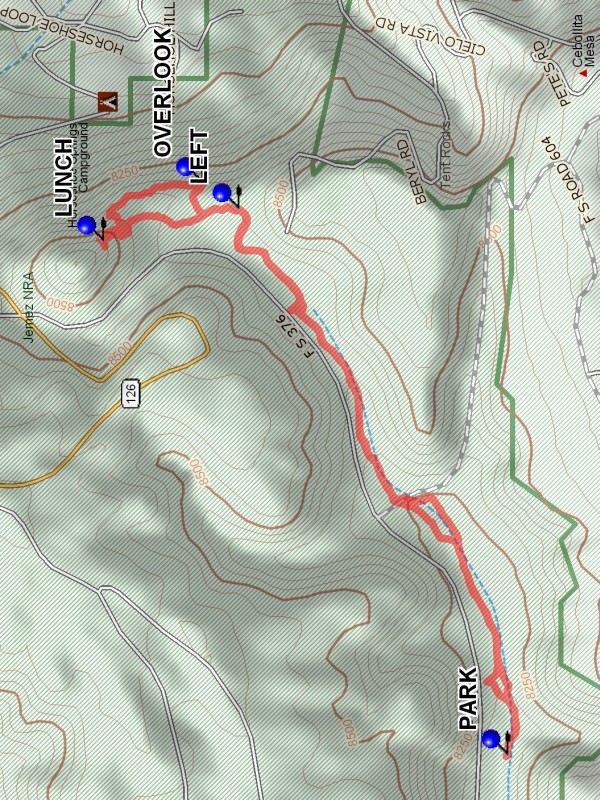
The hike proceeds in a north east direction up the valley. There is a maze of roads in the area, just stay in the valley. At 1.6 miles there is a branch to the LEFT (1.6 mi). Going straight leads to oblivion. In about .1 mile bearing to the left are a number of OVERLOOKs (1.7 mi). Then go north along the edge until blocked by a small peak. Bear left up the hill to a nice area for LUNCH (2.1 mi). Then return more or less the way you came to PARK.
Comments
This gentle sloping valley has many aspen groves, a good place to go for fall foliage.
WaypointsPARK: N35 51.932, W106 40.975
LEFT: N35 52.450, W106 39.674
OVERLOOK: N35 52.520, W106 39.612
LUNCH: N35 52.711, W106 39.751
Jemez Falls Bathrooms: N35 46.313, W106 41.444
Hike GPS File Name: JemezFR376AspenAreaWayTrack_DBDB.gpx
Hike GPS File: Click link to download hike waytrack file
Text Author: Dick Brown
Map Author: Marilyn Warrant
Waypoints Author: Dick Brown
Track Author: Dick Brown
Maintainer: Cindy McConnell
Editor: Marilyn Warrant
