Hamilton Mesa Hike
In Pecos Region
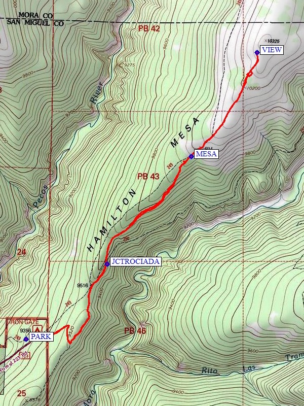
Map File Source: NG Topo
 Hike Key: H10131
Last Updated: 12/05/2023 9:27pm
Last Updated By: Marilyn Fixer
Hike Class: C (Challenging)
Hike Distance: 5.7 mi
Minimum Elevation: 9480 ft
Elevation Change: 825 ft
Total Uphill: 1070 ft
Total Downhill: 1070 ft
Avg. Grade: 7 %
Route Type: InOut
On Trail: Yes
Paved or Gravel Roads: No
GPS Advised: No
Hiker Limit (NF/BLM/NP): 15 (Pecos Wilderness)
Drive Distance Round Trip: 210 mi
Drive Time One-Way: 2:30
Hiking Seasons: Spring, Summer, and Fall
New Mexico Game Unit: 45
Hike Status: Published
Highlights
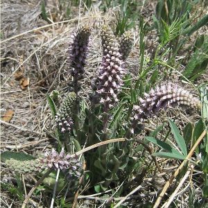
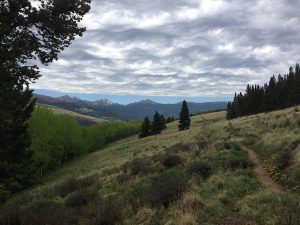
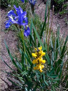
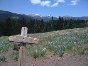
Beautiful views of the surrounding mountains, mesa with wildflowers, hike in woods.
CautionsRocky, poorly maintained dirt access road.
Trailhead Directions
Take I-25 north past Santa Fe to the Glorieta exit and follow SR50 east to the town of Pecos. Turn right and go one quarter mile to the Ranger Station for a restroom break if necessary or turn left and follow SR63 north toward Cowles. Go 4.6 miles past the Terrero General Store and turn right on FR233. The Iron Gate campground is 4.5 miles past the turnoff on a rough dirt road. There are signs directing you to Iron Gate at the major road intersections. Take care if the road is muddy. When you reach Iron Gate, PARK (0.0 mi).
Actual Hike
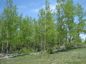
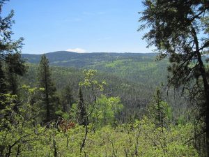
TR249 starts on the north side of the campground and wanders east uphill through aspen, pine and spruce forests to the ridge overlooking the Mora River Valley. Don’t take any other turnoff trails as TR249 continues north past the junction with the Rociada trail (JCTROCIADA (1.0 mi)) through a few low valleys along the ridgeline with great views to the east. The trail goes by a log fence then breaks out on Hamilton MESA (2.0 mi), which is a grassy meadow about 10 mi. long reaching toward the Santa Barbara Divide to the north. Continue on the trail up the hill toward the top of Hamilton Mesa (don’t take the trail sloping downhill to the left) until you find a great VIEW (2.8 mi) overlooking the entire Pecos Wilderness. Then return via the same route to Iron Gate.
Comments
The Pecos Wilderness is shaped like a U with the bottom of the U on the north end forming the Santa Barbara Divide, all of the big peaks form one leg of the U on the west and the Bordo del Medio forms the other leg of the U on the east side. Hamilton Mesa gives a great view of the entire U shape of the Pecos Wilderness. Round Mountain is in the near foreground to the west and in the distance is Santa Fe Baldy to the southwest, the Pecos Baldies to the west, the Truchas Peaks to the northwest and Chimayosos and Santa Barbara Peaks to the North. This is an excellent place to view the Pecos Wilderness in early June before the snow melts on the tall peaks and also in late September when the yellow aspens are in full color.
The hike track was recorded by a Garmin GPSMap 60CSx, and the hike data were determined from that track using the N.G. TOPO New Mexico software’s Digital Elevation Model.
WaypointsPARK: N35 50.394, W105 37.259
JCTROCIADA: N35 50.847, W105 36.712
MESA: N35 51.467, W105 36.117
VIEW: N35 52.070, W105 35.647
Hike GPS File Name: HamiltonMesaWayTrack500_MW.gpx
Hike GPS File: Click link to download hike waytrack file
Text Author: Rodger Carlson
Map Author: Marilyn Warrant
Waypoints Author: Marilyn Warrant
Track Author: Marilyn Warrant
Maintainer: Randy Simons
Editor: Howard Carr