Corrales Bosque North Hike
In Corrales Region
Map File Source: NG Topo
 Hike Key: H10068
Last Updated: 12/15/2020 12:00am
Last Updated By: Marilyn Warrant
Hike Class: A (Easy)
Hike Distance: 6.6 mi
Minimum Elevation: 5005 ft
Elevation Change: 16 ft
Total Uphill: 16 ft
Total Downhill: 16 ft
Avg. Grade: %
Route Type: CW Loop
On Trail: Yes
Paved or Gravel Roads: Yes
GPS Advised: No
Drive Distance Round Trip: 20 mi
Drive Time One-Way: 0:30
Hiking Seasons: Spring, Fall, and Winter
New Mexico Game Unit: 9
Hike Status: Published
Highlights
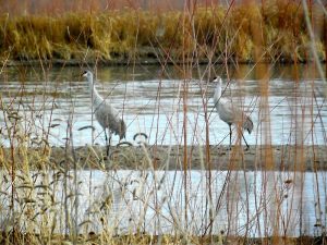
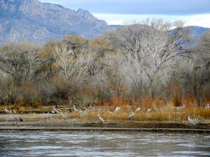
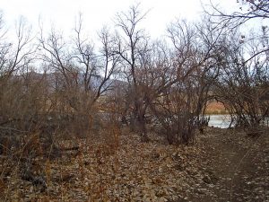
In the fall there is Cottonwood color, and in winter Sandhill Cranes along the Rio Grande.
CautionsNone.
Trailhead Directions
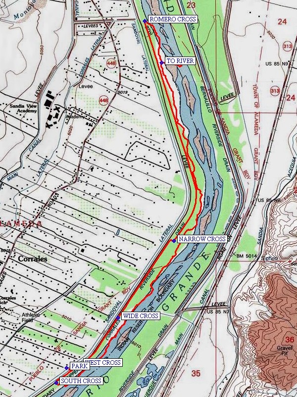
In Albuquerque go to the west side and take Coors north to just south of Cottonwood Mall. At the light take Coors to the right and go to the intersection with Alameda. From the intersection continue north for 2.5 miles to East Ella on the right. This road is easy to miss. It is a short distance after the Wells Fargo Bank on the left. Take East Ella east to the end and PARK (0.0 mi).
Actual Hike
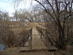
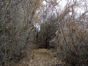
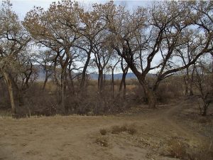
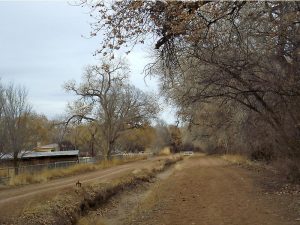
Take the pass-through eastward to the ditch bank. There are three north-south ditch banks. Any can be used to reach the north end of the hike at the Romero St (unmarked) crossing. Go north on the bank to where there is a WEST CROSS (0.1 mi) to the middle ditch bank. Go north on the middle bank to where there is a WIDE CROSS (0.5 mi) to the west bank. At this point an old orchard where sand hill cranes like to feed in the winter lies just to the north. There is the option of going to the orchard and return to the crossing or continuing another 0.5 mile to a NARROW CROSS (1.2 mi) to cross to the east. This crossing is a 3 foot wide steel grate with no guard rails. Proceed northward to the ROMERO CROSS (2.8 mi), the north end of the hike. This point is the starting point for the Corrales To Rivers Edge hike. At this point go east into the Bosque and take the south bound trail. After about 0.1 mile a side trail goes east, leading to the Rio Grande. Take this trail for a nice spot for lunch along the river. In winter there will probably be many sand hill cranes along the river. Return to the main trail and go south to the SOUTH CROSS (6.2 mi) which is 2.8 miles from the north end of the hike. The trail stays in the Bosque, occasionally coming close to the west ditch bank. If uncertain of the 2.8 mile point, leave the Bosque at one of these points and go along the ditch bank to the SOUTH CROSS (6.2 mi). Go west to the middle bank and turn north, going to the WEST CROSS then parking. Cross and go back south to the start of the hike.
Comments
In the Fall this is a good foliage hike. In the winter Sandhill Cranes can be seen at the river and in an orchard to the west of the hike route. A quiet approach is advised, as the birds are spooked easily. There are no good landmarks for exiting the Bosque. Without the aid of a GPS or prior knowledge of the hike, it is probably easier to do the hike in a counter-clockwise direction. This hike’s rating is reduced to its being a flat hike over smooth terrain.
WaypointsPARK: N35 13.311, W106 36.304
WEST CROSS: N35 13.331, W106 36.210
WIDE CROSS: N35 13.606, W106 35.933
NARROW CROSS: N35 14.061, W106 35.529
ROMERO CROSS: N35 15.360, W106 35.741
TO RIVER: N35 15.114, W106 35.618
SOUTH CROSS: N35 13.221, W106 36.380
Hike GPS File Name: CorralesBosqueNorthWayTrack_DBDB.gpx
Hike GPS File: Click link to download hike waytrack file
Text Author: Dick Brown
Map Author: Marilyn Warrant
Waypoints Author: Dick Brown
Track Author: Dick Brown
Maintainer: Dawn McIntyre
Editor: Marilyn Warrant