Bandelier – Lower Frijoles Canyon Hike
In Los Alamos Region
Map File Source: Roger Holloway
 Hike Key: H10146
Last Updated: 12/15/2020 12:00am
Last Updated By: Marilyn Warrant
Hike Class: C (Challenging)
Hike Distance: 4.5 mi
Minimum Elevation: 5378 ft
Elevation Change: 700 ft
Total Uphill: 750 ft
Total Downhill: 750 ft
Avg. Grade: 9 %
Route Type: InOut
On Trail:
Paved or Gravel Roads:
GPS Advised:
Drive Distance Round Trip: 200 mi
Drive Time One-Way: 2:15
Hiking Seasons: Spring, Summer, and Fall
New Mexico Game Unit: 6C
Hike Status: Inactive
Highlights
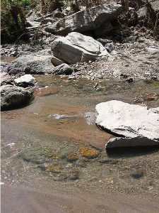
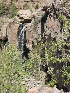
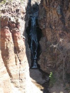
Cascading waterfalls and creek to soak your feet at lunch spot. Hike down to Rio Grande.
CautionsA few short steep sections; hiking poles good idea; rattlesnakes seen along trail.
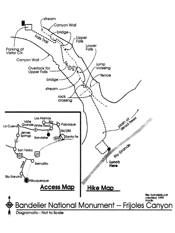
Trailhead Directions
I-25 north to exit 276B, Bypass Santa Fe to the west by taking NM 599 and then left on US 84/285 and north to Pajoaque. West on SR 502. Watch for signs to SR 4 (may be marked Truck Route). South on SR 4 past White Rock and follow signs to Bandelier National Monument – a left turn after milepost 56. On the way back continue on SR 4 through Valle Grande, La Cueva, Jemez Springs and San Ysidro and follow US 550 into Bernalillo. The round trip is 200 miles; 100 miles on each leg.
Actual Hike
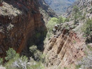
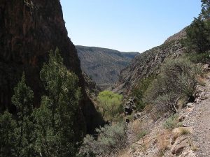
The hike starts off climbing up the canyon wall as the stream rapidly falls down. When you head down to the stream, you will cross it several times. There is a wooden footbridge, but many of the crossings are by jumping across or by stepping on rocks at midstream. At the bottom of the canyon the ground levels out into a plain reaching out to the Rio Grande. You maybe surprised at all of the dead trees there. It is because, on rare occasions, Cochiti Lake (built not too many years ago) floods and the overflow covers this plain. The trees can not survive the flooding.
Comments
Note: as of 2/16 you could only go down to the overlook at the upper falls. The rest of the trail down to the Rio Grande is closed.
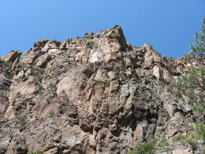
Bring your Golden Age passport. Someone should pick up a Trail Guide ($1.00) at Visitors Center to identify numbered posts on the trail. Frijoles (beans) Canyon is surprisingly narrow and deep. It consists mostly of compacted and consolidated volcanic ash called tuff which is relatively easy to erode. Some of the canyon walls are marked by large open pockets like Swiss cheese. Others are extremely hard basalt with curious swirls. As Frijoles Creek flowed down the canyon it eroded the soft tuff, making the canyon deeper. At a couple of points it runs into dense basalt that is much harder to erode and two large waterfalls have been created there. Driving back thru the Jemez is gorgeous. It passes the astounding Valle Grande which is the world’s largest caldera (collapsed crater) of the volcano that erupted and ejected the molten rock and ash that is now Frijoles Canyon.
WaypointsPARK: N35 46.728, W106 16.241
Map Filename: Bandelier-LowerFrijolesCanyonImage_RH.jpgHike GPS File Name: Bandelier-LowerFrijolesCanyonWayTrack_JBJB.gpx
Hike GPS File: Click link to download hike waytrack file
Text Author: Roger Holloway
Map Author: Roger Holloway
Waypoints Author: John Boyd
Track Author: John Boyd
Maintainer: Vivian Heyward
Editor: Marilyn Warrant