Aldridge Petroglyphs Loop Hike
In El Malpais Region
Map File Source: Garmin BaseCamp
 Hike Key: H10427
Last Updated: 03/08/2021 12:00am
Last Updated By: Marilyn Fixer
Hike Class: C (Challenging)
Hike Distance: 5 mi
Minimum Elevation: 7325 ft
Elevation Change: 212 ft
Total Uphill: 664 ft
Total Downhill: 664 ft
Avg. Grade: 7 %
Route Type: CW Loop
On Trail: No
Paved or Gravel Roads: No
GPS Advised: Yes
Drive Distance Round Trip: 210 mi
Drive Time One-Way: 2:00
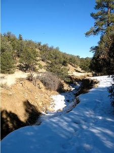
Hiking Seasons: Spring, Fall, and Winter
New Mexico Game Unit: 13
Hike Status: Published
Highlights
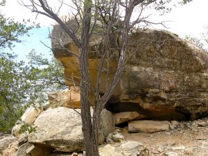
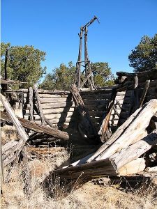
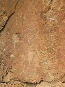
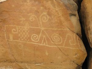
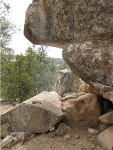
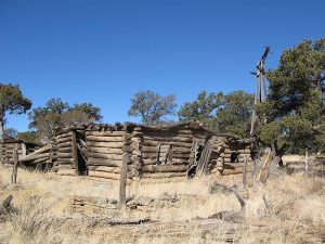
Outstanding petroglyph panels, ranch ruin, pueblo ruin. Follow an elk trail along an arroyo.
CautionsBring hiking poles for stability in the steep sections.
Trailhead Directions
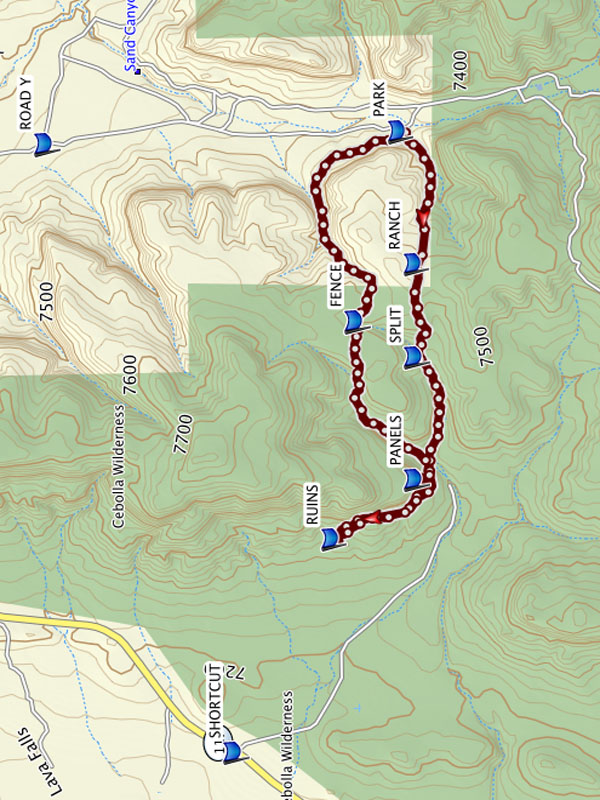
From Albuquerque take I-40 west for about 70 miles to Exit 89 a few miles before Grants. Go south on SR 117 for 26 miles to a DIRT ROAD on your left. Take the dirt road 3 miles to ROAD Y. Stay to the right for about 1.5 miles and PARK (0.0 mi).
Be especially careful driving on the dirt road from waypoint ROAD Y if rain or snow is forecast or there has been recent precipitation. Be aware, it’s possible to have a frozen road in the morning that can thaw during your hike. There is no cell phone reception until you are near the Narrows hike trailhead on the main highway. You can use an alternate hike to avoid the dirt roads completely — Aldridge Petroglyph Alternate. The trailhead is about 4.5 miles further down SR 117 to a wide spot in the road. The alternate trailhead starts at the waypoint titled SHORTCUT. On most maps, the first 1.5 miles of this alternate route looks like a a road, but it’s very overgrown with no visible trail, and it requires a different GPX track.
El Malpais BLM Ranger station, located on SR 117 9 miles from I-40, has interesting displays but is closed until further notice. However, the El Malpais National Monument Visitor Center is still open in Grants at exit 85 off I40.
Actual Hike
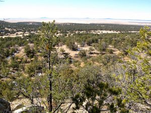
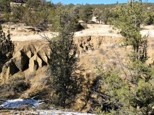
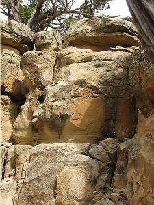
Hike west along an arroyo and across a meadow. After 0.7 miles, there will be RANCH (0.7 mi) ruins to explore. Continue through trees, brush and watch carefully at SPLIT (1.2 mi), continue over a fence, and through a deep arroyo to the point where the petroglyph PANELS (1.8 mi) are located. There are two sets of panels, the second set is to the left about 100 yards. Climb downhill and continue to the pueblo RUINS (2.4 mi), also a good lunch spot. For the return trip, hike back the way you came but stay below the ridge as you pass the petroglyph PANELS (2.9 mi). About 0.2 miles past the panels, cross the deep arroyo and turn left (northeast) and follow the south side of the arroyo along game trails. There are times when you must walk in the streambed or cross to the opposite side. Use your judgment about the best path. It will change seasonally. The track will veer east through the woods and over a ridge. FENCE (3.8 mi) is the best location to climb over. Continue northeast over the ridge and the track will come to a deep arroyo. Stay on the upper portion of the south ridge for the most part. Erosion has made this tricky in places. Track will follow the contours of the ridge back to PARK (5.0 mi).
Comments
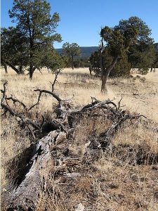
The trail for this entire hike meanders along arroyos and game trails. Sometimes it works to follow the game trails but watch your GPS carefully because game trails go in all directions. Some arroyos are steep, narrow and rocky. You have to use your judgment whether to hike down an arroyo, or pass on a ridge on either side. Sometimes the options have about the same difficulty and will change seasonally.
The hike is located in the El Malpais NCA, Cebolla Canyon. There is some shade but not recommended on hot days.
WaypointsDIRT ROAD: N34 46.794, W107 56.349
ROAD Y: N34 44.208, W107 55.690
SHORTCUT: N34 43.531, W107 58.509
PARK: N34 42.943, W107 55.629
RANCH: N34 42.888, W107 56.245
SPLIT: N34 42.885, W107 56.677
PANELS: N34 42.884, W107 57.245
RUINS: N34 43.182, W107 57.521
FENCE: N34 43.097, W107 56.510
Hike GPS File Name: AldridgePetroglyphsLoop_DM.GPX
Hike GPS File: Click link to download hike waytrack file
Text Author: Dawn McIntyre
Map Author: Dawn McIntyre
Waypoints Author: Dawn McIntyre
Track Author: Dawn McIntyre
Maintainer: Dawn McIntyre
Editor: Marilyn Warrant