Ghost Ranch – Multiple Hikes Hike
In Ghost Ranch Region
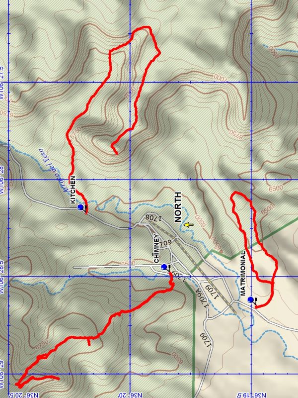
Map File Source: DeLorme
 Hike Key: H10474
Last Updated: 03/13/2021 12:00am
Last Updated By: Marilyn Fixer
Hike Class: C (Challenging)
Hike Distance: 5.1 mi
Minimum Elevation: 6410 ft
Elevation Change: 733 ft
Total Uphill: 980 ft
Total Downhill: 980 ft
Avg. Grade: 12 %
Route Type: Multiple Hikes
On Trail: No
Paved or Gravel Roads: Yes
GPS Advised: Yes
Drive Distance Round Trip: 240 mi
Drive Time One-Way: 2:15
Hiking Seasons: Spring and Fall
New Mexico Game Unit: 51
Hike Status: Published
Highlights
Multi-hike. See individual hike descriptions.
CautionsMulti-hike. See individual hike descriptions.
Trailhead Directions
From Albuquerque, take I-25 to Santa Fe, then US 84/285 to Espanola. Continue north on US 84/285 north, staying on US 84 when US 285 splits off about 5 mi from town. Continue about 35 miles through Abiquiu to the gravel road marked for the Ghost Ranch Presbyterian Center. Turn right and drive 1 mi to a road fork; follow the signs left to the office and ask for permission to hike.
Actual Hike
This multiple hike allows the hiker to do either of the following;
(A) Ghost Ranch – Kitchen Mesa
OR
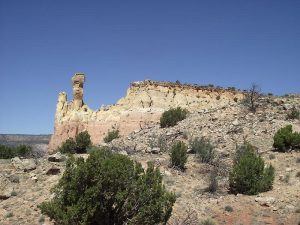
(B) Ghost Ranch – Chimney Rock
AND
Ghost Ranch – Matrimonial Mesa
Comments
As of March 2021, Ghost Ranch is temporarily closed to hiking due to Covid-19.
WaypointsCHIMNEY-TH: N36 19.837, W106 28.480
KITCHEN MESA TH: N36 20.182, W106 28.174
MATRIMONIAL-TH: N36 19.481, W106 28.650
Hike GPS File Name: GhostRanch-MultipleHikesWaypoints_DB.gpx
Hike GPS File: Click link to download hike waytrack file
Text Author: Dick Brown
Map Author: Dick Brown
Waypoints Author: Dick Brown
Track Author:
Maintainer: Not Assigned
Editor: Howard Carr