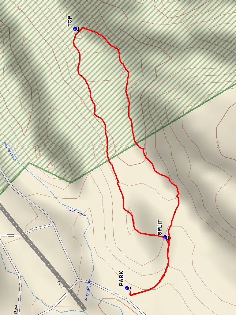
Ghost Ranch – Matrimonial Mesa Hike
In Ghost Ranch Region
Map File Source: DeLorme
 Hike Key: H10640
Last Updated: 06/29/2021 12:00am
Last Updated By: Marilyn Fixer
Hike Class: B (Moderate)
Hike Distance: 1.4 mi
Minimum Elevation: 6410 ft
Elevation Change: 169 ft
Total Uphill: 169 ft
Total Downhill: 169 ft
Avg. Grade: 6 %
Route Type: CCW Loop
On Trail:
Paved or Gravel Roads:
GPS Advised:
Drive Distance Round Trip: 240 mi
Drive Time One-Way: 2:15
Hiking Seasons: Spring and Fall
New Mexico Game Unit: 51
Hike Status: In Process
Highlights
Hike over open terrain along two ridges.
CautionsNone.
Trailhead Directions
From Albuquerque, take I-25 to Santa Fe, then US 84/285 to Espanola. Continue north on US 84/285 north, staying on US 84 when US 285 splits off about 5 mi from town. Continue about 35 miles through Abiquiu to the gravel road marked for the Ghost Ranch Presbyterian Center. Turn right and drive 1 mi to a road fork; follow the signs left to the office and ask for permission to hike.
Comments
There is now a $10 user fee to hike on Ghost Ranch. Day visitors are asked to reserve in advance.
Map Filename: GhostRanch-MatrimonialMesaMap_MW.jpgHike GPS File Name: GhostRanch-MatrimonialMesaWayTrack_DBMW.gpx
Text Author: Dick Brown
Map Author: Marilyn Warrant
Waypoints Author: Dick Brown
Track Author: Dick Brown
Maintainer: Not Assigned
Editor: