Picacho Peak Trail Hike
In Santa Fe Region
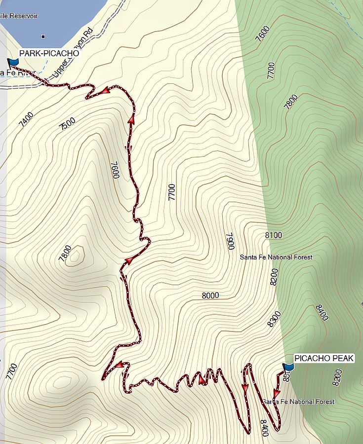
Map File Source: Garmin BaseCamp
 Hike Key: H10748
Last Updated: 06/04/2025 7:16pm
Last Updated By: Marilyn Warrant
Hike Class: C (Challenging)
Hike Distance: 3.7 mi
Minimum Elevation: 7320 ft
Elevation Change: 1250 ft
Total Uphill: 1455 ft
Total Downhill: 1455 ft
Avg. Grade: 13 %
Route Type: InOut
On Trail: Yes
Paved or Gravel Roads: Yes
GPS Advised: No
Drive Distance Round Trip: 65 mi
Drive Time One-Way: 1:15
Hiking Seasons: Summer and Fall
New Mexico Game Unit:
Hike Status: In Process
Attractions: Views
Highlights
This hike features a nice and steady uphill that winds up a series of switchbacks to reach Picacho Peak. While there are great views the entire way, the grand view is from the peak with astonishing 360-degree views.
CautionsThis is a steep hike.
Trailhead Directions
From Albuquerque, take I-25 to Santa Fe. Take exit 284 to Old Pecos Trail and go north, then turn right on E Zia Rd. Turn left on Old Santa Fe Trail. Turn right onto Camino Del Monte Sol, then right again on Camino De Cruz Blanca. Continue straight onto Camino Cabra then right onto Upper Canyon Rd. Turn left on Cerro Gordo Rd, then take a quick right to the Dale Ball Trailhead.
Actual Hike
Follow the well-marked trail up to Picacho Peak at 8500 ft.
Waypoints
PARK-PICACHO: N35 41.191, W105 53.708
PICACHO PEAK: N35 40.722, W105 53.182
Hike GPS File Name: PicachoPkTrlWayTrack_AT
Hike GPS File: Click link to download hike waytrack file
Text Author: Fred Garcia
Map Author: Marilyn Warrant
Waypoints Author: Marilyn Warrant
Track Author: All Trails
Maintainer: Not Assigned
Editor: Marilyn Warrant