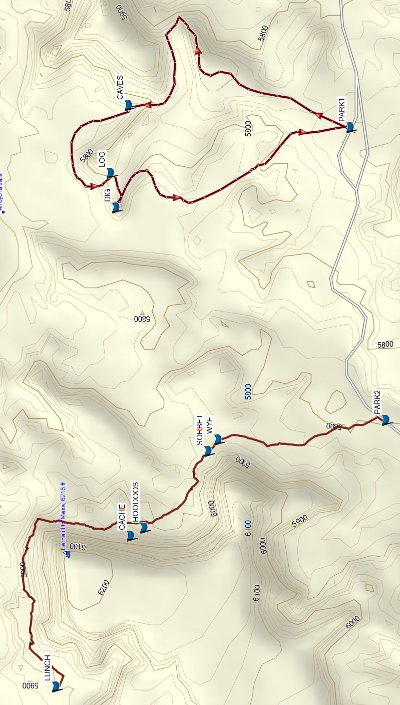
Dinosaur Dig – Bernalillito Hoodoos In-Out Hike
In Ojito Region
Map File Source: Garmin BaseCamp
 Hike Key: H10739
Last Updated: 09/09/2024 4:30pm
Last Updated By: Marilyn Fixer
Hike Class: B (Moderate)
Hike Distance: 6.5 mi
Minimum Elevation: 5706 ft
Elevation Change: 206 ft
Total Uphill: 587 ft
Total Downhill: 587 ft
Avg. Grade: %
Route Type: InOut
On Trail: No
Paved or Gravel Roads: No
GPS Advised: No
Drive Distance Round Trip: 100 mi
Drive Time One-Way: 1:15
Hiking Seasons: Spring, Fall, and Winter
New Mexico Game Unit:
Hike Status: In Process
Access Description: Ojito Wilderness Area Access
Attractions: Arroyos, Badlands, Rock Formations, and Views
Highlights
Outstanding badlands scenery.
CautionsNone.
Trailhead Directions
This is a multi hike. First go to the Dinosaur Dig TH. Take I-25 north to exit 242. West on US 550 to milepost 21. Turn left at sign for Cabezon Rd. Go through the gate (ignore Zia Pueblo, No Trespassing sign). Check odometer, the destination is 10.5 miles from here. The road forks immediately. Take the left fork (Cabezon Rd.) and not the right one (White Mesa). Cabezon Rd. goes thru Zia land, then at the cattle crossing enters Public Land. The road is slick and dangerous when wet. Drive about 10.5 miles to a “Parking Area” sign. PARK (0.0 mi) on left there, cross road and enter at the iron gate.
For the second hike, continue west about one mile to the Bernalillito Hoodoos TH.
Actual Hike
This is a multi hike. Consult each hike’s description for the details (Dinosaur Dig and Bernalillito Hoodoos In-Out).
Comments
Watch out for freeze and thaw for the access road if you go in the winter.
WaypointsSee the individual hikes.
Map Filename: DinoDig-BernHInOutMap2_MW.jpgHike GPS File Name: DDig-BernHD.gpx
Hike GPS File: Click link to download hike waytrack file
Text Author: Marilyn Warrant
Map Author: Marilyn Warrant
Waypoints Author: Dick Brown
Track Author: Marilyn Warrant
Maintainer: Not Assigned
Editor: