Continental Divide Trail FR193 North Hike
In Mount Taylor Region
Map File Source: NG Topo
 Hike Key: H10659
Last Updated: 03/23/2021 12:00am
Last Updated By: Marilyn Fixer
Hike Class: C (Challenging)
Hike Distance: 6.5 mi
Minimum Elevation: 9270 ft
Elevation Change: 430 ft
Total Uphill: 1165 ft
Total Downhill: 1165 ft
Avg. Grade: 8 %
Route Type: InOut
On Trail: Yes
Paved or Gravel Roads: Yes
GPS Advised: No
Drive Distance Round Trip: 197 mi
Drive Time One-Way: 1:45
Hiking Seasons: Spring, Summer, and Fall
New Mexico Game Unit: 9
Hike Status: Published
Highlights
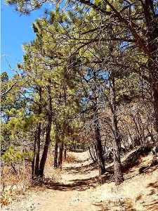
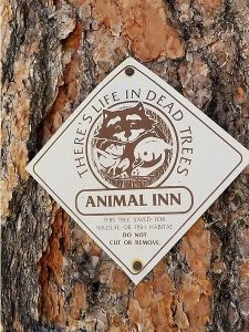
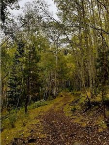
Great vistas from the trail. Magnificent ponderosa pines and aspen groves. Views of Mount Taylor and interesting “Animal Inn” signs on trees.
CautionsTrekking poles good to use but not necessary for those who do not use them. Small aspen branches down on trail but easy to step over or around. Last 0.1 mile to FR453 is a little messy.
Trailhead Directions
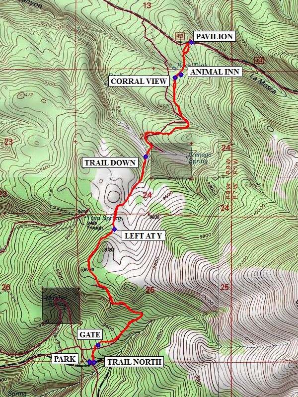
From Albuquerque take I-40 west for about 75 miles to the first Grants exit, I-40B exit 85. Go through town to SR547 (First St) and turn right. Continue northeast on SR547 which becomes Lobo Canyon Road for about 13 miles. At top of hill, turn right on FR193 and proceed approximately 3.7 miles. A large unmarked turn out for parking is on the left. If you pass 2 large cairns about 10′ off the road on each side, you have passed the parking area. From PARK staying on same side, walk up the road about 100′ east to the trailhead at the large cairn. The hike is north at this point.
Actual Hike
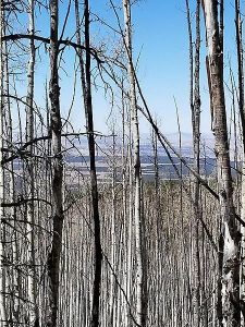
The CDT is a well-marked trail. There are game trails and ATV trails in this area. The hike starts at TRAIL NORTH about 100 feet east of the parking area and will be in a forest of aspens and pine trees including magnificent ponderosa pines. Continue the hike through the GATE (0.2 mi). The uphill part of the trail has beautiful vistas thru the trees. Soon the trail cuts through huge aspen groves where there could be small aspen branches across the trail that are easy to step over or around. Always look for cairns and CDT tree markers (both blue triangle or occasional red markers). Markers could be 200′ up the trail.
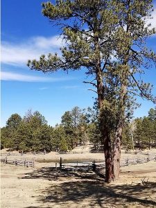
As you continue hiking, follow the trail and cairns at LEFT AT Y (1.5 mi). Soon in the open area, views of Mt. Taylor can be seen. Continue the hike past TRAIL DOWN (2.1 mi) to the view of the corral and pond. This is also an area for campers. At the CORRAL VIEW (3.0 mi), notice the tree markers are now painted blue circles. Follow the trail on the ridge. Be sure to look for tree with the ANIMAL INN (3.1 mi) sign. Hike up for a close look at the sign. Continue the hike on the trail until getting to a cleared area of many ATV tracks. Here there are no cairns or CDT signs but an occasional red metal marker on trees. The trail is more in the middle of this area (a little messy). Follow the GPS track. From here, hike north about .1 mile to the road and cairn for FR453. Uphill from the trailhead is PAVILION (3.3 mi). If you are not on-trail on the last part of this hike and come to the dirt road (FR453), look for the pavilion next to the road. This is a good place for lunch before returning the same way you hiked in. There is a portapotty across the road. From the pavilion, hike down the dirt road about 100 feet to FR453 for the trail back.
Comments
Beautiful hike late spring, summer and especially in the fall as the aspens are golden.
There are many old trails and ATV trails in this area, so be sure to follow CDT signs and cairns. As noted the last 0.1 mile is a little messy with ATV tracks & no official CDT markers (some red markers). Follow GPS track to FR453 and large cairn. The CDT actually continues across FR453 (another beautiful area) but that can be another hike.
WaypointsPARK: N35 13.918, W107 38.463
TRAIL NORTH: N35 13.914, W107 38.431
GATE: N35 14.018, W107 38.404
LEFT AT Y: N35 14.701, W107 38.285
TRAIL DOWN: N35 15.129, W107 38.062
CORRAL VIEW: N35 15.593, W107 37.849
ANIMAL INN: N35 15.613, W107 37.805
PAVILION: N35 15.803, W107 37.733
Hike GPS File Name: CDTFR193NorthWayTrack_DM.GPX
Hike GPS File: Click link to download hike waytrack file
Text Author: Debbie Manoogian
Map Author: Marilyn Warrant
Waypoints Author: Debbie Manoogian
Track Author: Debbie Manoogian
Maintainer: Carl Gervais
Editor: Howard Carr