Ghost Ranch – Kitchen Mesa Hike
In Ghost Ranch Region
Map File Source: DeLorme
 Hike Key: H10641
Last Updated: 06/29/2021 12:00am
Last Updated By: Marilyn Fixer
Hike Class: C (Challenging)
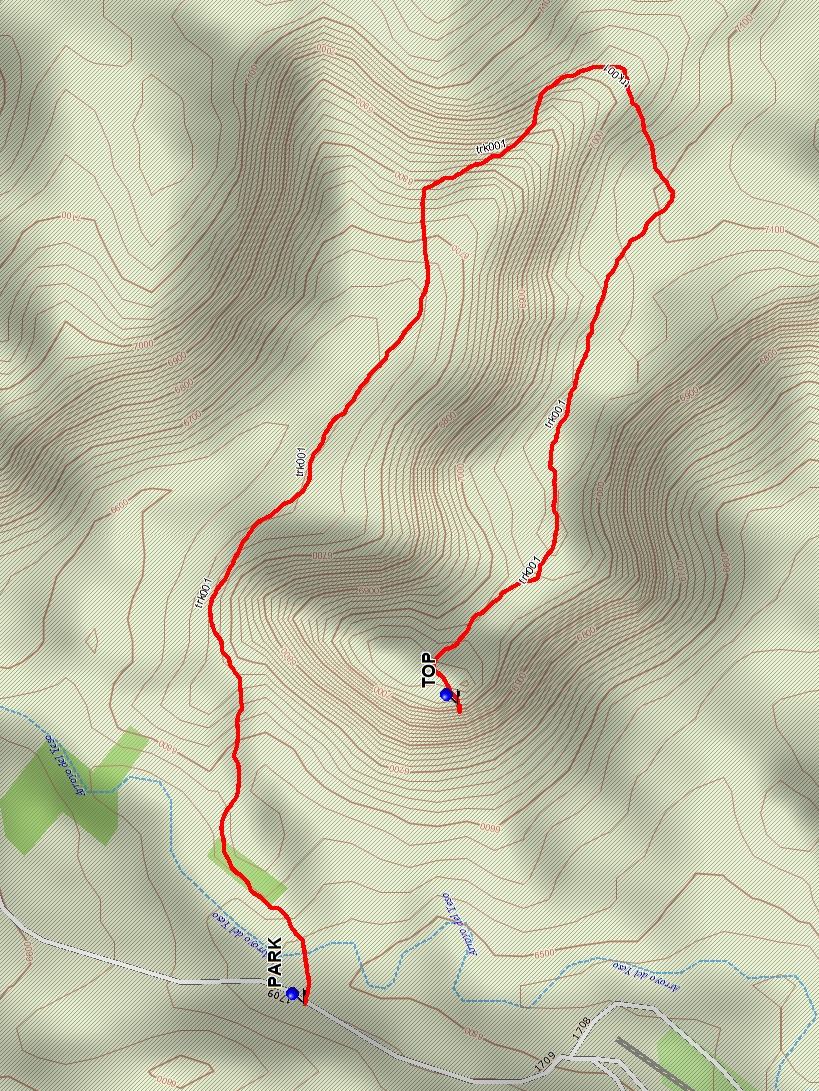
Hike Distance: 3.7 mi
Minimum Elevation: 6549 ft
Elevation Change: 564 ft
Total Uphill: 811 ft
Total Downhill: 811 ft
Avg. Grade: 12 %
Route Type: InOut
On Trail: Yes
Paved or Gravel Roads: Yes
GPS Advised: No
Drive Distance Round Trip: 240 mi
Drive Time One-Way: 2:15
Hiking Seasons: Spring and Fall
New Mexico Game Unit: 51
Hike Status: In Process
Cautions
None.
Trailhead Directions
From Albuquerque, take I-25 to Santa Fe, then US 84/285 to Espanola. Continue north on US 84/285 north, staying on US 84 when US 285 splits off about 5 mi from town. Continue about 35 miles through Abiquiu to the gravel road marked for the Ghost Ranch Presbyterian Center. Turn right and drive 1 mi to a road fork; follow the signs left to the office and ask for permission to hike.
Actual Hike
The marked trail begins just past the chain across the road at Long House guide). The trail goes behind Kitchen Mesa before it ascends to the TOP (1.85 mi). This more difficult hike includes a 15-foot chimney through a cleft in the cliff.
Comments
There is now a $10 user fee to hike on Ghost Ranch. Day visitors are asked to reserve in advance.
For more information about hiking at Ghost Ranch, consult its website.
WaypointsPARK: N36 20.182, W106 28.174
TOP: N36 20.055, W106 27.868
Hike GPS File Name: GhostRanch-KitchenMesaWayTrackAll_DB.gpx
Hike GPS File: Click link to download hike waytrack file
Text Author: Dick Brown
Map Author: Marilyn Warrant
Waypoints Author: Dick Brown
Track Author: Dick Brown
Maintainer: Not Assigned
Editor: Howard Carr