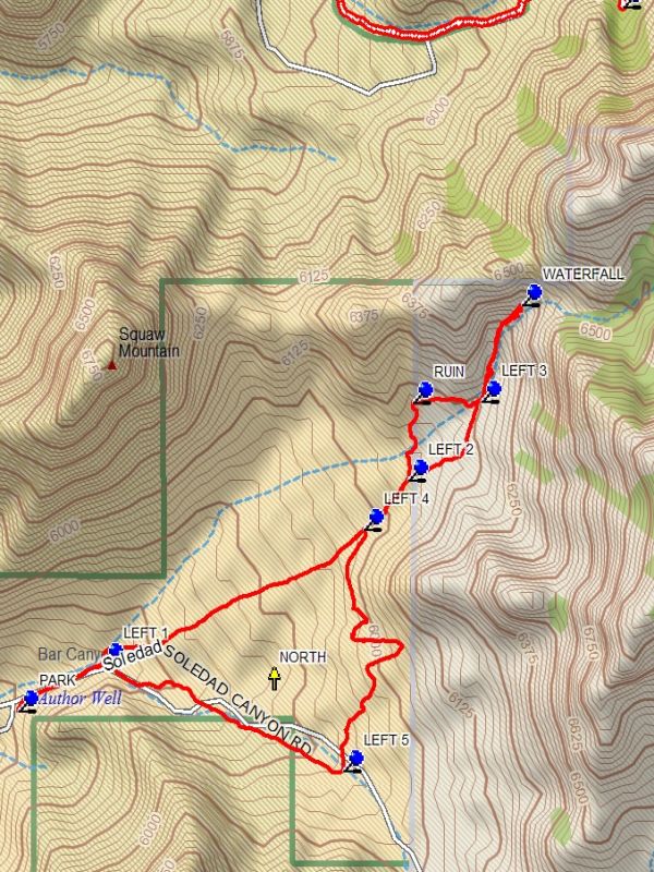
Soledad Canyon Hike
In Southwest New Mexico Region
Map File Source: DeLorme
 Hike Key: H10592
Last Updated: 02/07/2022 12:00am
Last Updated By: Marilyn Fixer
Hike Class: C (Challenging)
Hike Distance: 3.5 mi
Minimum Elevation: 5625 ft
Elevation Change: 675 ft
Total Uphill: 780 ft
Total Downhill: 780 ft
Avg. Grade: 10 %
Route Type: CW Loop
On Trail:
Paved or Gravel Roads:
GPS Advised:
Drive Distance Round Trip: 16 mi
Drive Time One-Way: 0:30
Hiking Seasons: Spring and Fall
New Mexico Game Unit:
Hike Status: Inactive
Highlights
Cactus, ruins and waterfalls with great scenery in the distance.
CautionsWatch out for sticky things and wiggly things.
Trailhead Directions
The Bar Canyon Day Use Area is located on the west side of the Organ Mountains, 10 miles east of Las Cruces. From Exit 1 on Interstate 25, take University Avenue/Dripping Springs Road east for about 4.5 miles, then turn south on the Soledad Canyon Road. That road will turn east in a mile; follow it all the way to the end.
Comments
Can be done as a B hike.
Map Filename: SoledadCanyonImage.jpgHike GPS File Name: SoledadCanyonWayTrack_DBDB.gpx
Hike GPS File: Click link to download hike waytrack file
Text Author: Dick Brown
Map Author:
Waypoints Author:
Track Author:
Maintainer: Marilyn Warrant
Editor: Marilyn Warrant