White Mesa – East Ridge to Seeps Hike
In Ojito Region
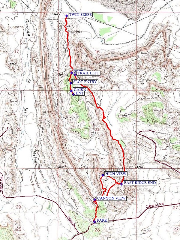
Map File Source: NG Topo
 Hike Key: H10554
Last Updated: 12/06/2023 6:49pm
Last Updated By: Marilyn Fixer
Hike Class: C (Challenging)
Hike Distance: 8.1 mi
Minimum Elevation: 5540 ft
Elevation Change: 500 ft
Total Uphill: 965 ft
Total Downhill: 965 ft
Avg. Grade: 6 %
Route Type: Messy
On Trail: Yes
Paved or Gravel Roads: No
GPS Advised: Yes
Drive Distance Round Trip: 100 mi
Drive Time One-Way: 1:00
Hiking Seasons: Spring and Fall
New Mexico Game Unit: 9
Hike Status: Published
Access Description: Ojito Wilderness Area Access
Highlights
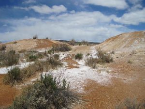
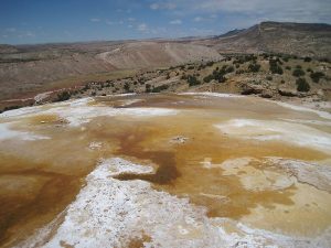
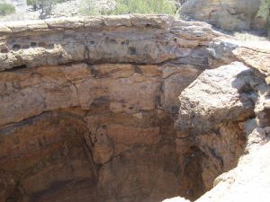
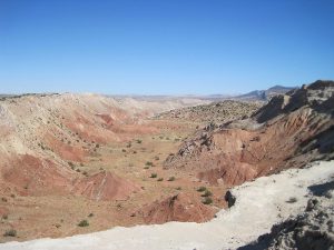
Spectacular canyon views, active seeps, an optional visit to the “Candle Cave.”
CautionsSome steep sections, so hiking poles are helpful.
Trailhead Directions
From Albuquerque go north on I-25, then from Bernalillo go northwest on US-550 for 20.9 miles. Turn left on Cabezon Road, about 2 miles before San Ysidro. Almost immediately there is a Y in the road, go left. At 4.5 miles, on the first downhill in the Ojito Wilderness, there will be a parking area on the right. PARK here.
Actual Hike
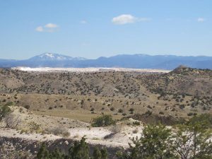
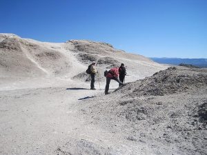
Go north through the pass on the two track. After a short distance, take a track bearing uphill to the left, which joins a road which passes through some old diggings for gypsum. You will find a spectacular canyon view at CANYON VIEW (0.3 mi). Go to the east side of the canyon but do not try to stay near the edge, and find a road which bears north toward a white peak. At the peak one can ascend if desired for a good view of the area at HIGH VIEW (0.8 mi). The Nacimiento uplift, the beginning of the Jemez Mountain area, stretches to the north. To the east is “White Mesa”, an extensive gypsum quarry. To continue, go east to EAST RIDGE END (1.1 mi) and take the trail that goes north along the east edge of the main canyon. At a two track stay left on the trail. Reach a two track and continue north down hill to TRAIL LEFT (2.8 mi) and turn uphill on the narrow trail to a hole which is a collapsed SEEP (2.9 mi). From here, follow a faint trail south to SLOT ENTRY. Continue to a CAIRN (3.1 mi) on your left (the cairn may be missing), then southeast to the entrance ENT (3.2 mi) to Candle Cave. Use a flashlight or head lamp to guide your way to the end, where you will see candles, a visitor book to sign, and several other interesting features. Have lunch in the sheltered area just outside the cave entrance.
After lunch, return north back to the SEEP. Continue going north and downhill to the TWIN SEEPS (4.5 mi) in the distance. Check them out, then return back the way you came. When you reach EAST RIDGE END, take the easier way back southwest to CANYON VIEW, then go south to PARK.
Comments
Much of the first part of this hike description follows the hike White Mesa – East Ridge.
WaypointsPARK: N35 29.907, W106 50.486
CANYON VIEW: N35 30.154, W106 50.482 (0.3 mi)
HIGH VIEW: N35 30.427, W106 50.371 (0.8 mi)
EAST RIDGE END: N35 30.326, W106 50.116 (1.1 mi)
TRAIL LEFT: N35 31.548, W106 50.752 (2.8 mi)
SEEP: N35 31.568, W106 50.798 (2.9 mi)
SLOT ENTRY: N35 31.451, W106 50.806 (3.0 mi)
CAIRN: N35 31.365, W106 50.799 (3.1 mi)
ENT: N35 31.326, W106 50.771 (3.2 mi)
TWIN SEEPS: N35 32.203, W106 50.866 (4.5 mi)
Hike GPS File Name: WhiteMesa-EastRidgeToSeepsWayTrack_MW.gpx
Hike GPS File: Click link to download hike waytrack file
Text Author: Marilyn Warrant
Map Author: Marilyn Warrant
Waypoints Author: Dick Brown
Track Author: Marilyn Warrant
Maintainer: Randy Simons
Editor: Howard Carr