Cienega Petroglyphs – Cieneguilla Petroglyphs Loop Hike
In Santa Fe Region
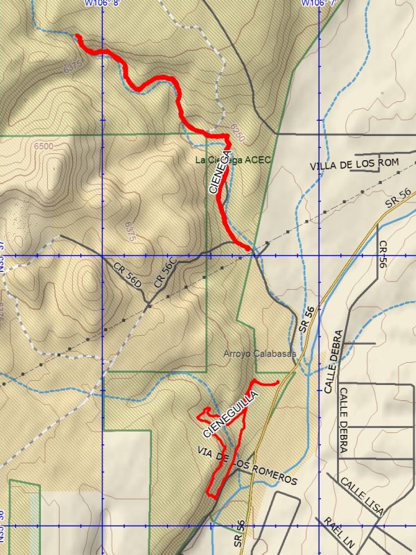
Map File Source: DeLorme
 Hike Key: H10534
Last Updated: 03/12/2021 12:00am
Last Updated By: Marilyn Fixer
Hike Class: B (Moderate)
Hike Distance: 4.7 mi
Minimum Elevation: 6145 ft
Elevation Change: 300 ft
Total Uphill: 430 ft
Total Downhill: 430 ft
Avg. Grade: 5 %
Route Type: Multiple Hikes
On Trail: No
Paved or Gravel Roads: Yes
GPS Advised: No
Drive Distance Round Trip: 102 mi
Drive Time One-Way: 1:00
Hiking Seasons: Spring, Summer, Fall, and Winter
New Mexico Game Unit: 6C
Hike Status: Published
Highlights
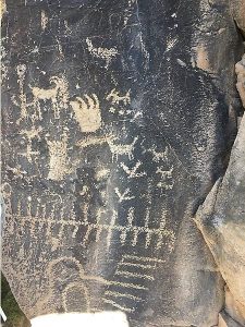
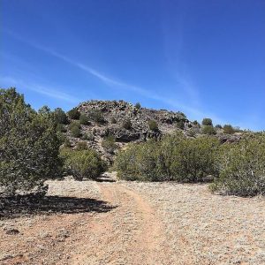
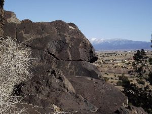
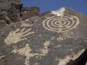
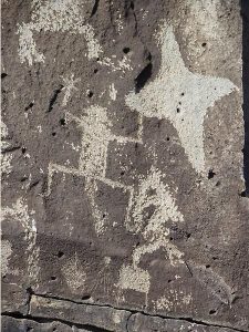
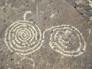
Lots of petroglyphs and some canyon hiking. This hike combines two nearby petroglyph hikes.The Cienega petroglyphs are located in a canyon about 1.5 miles from the trailhead. The Cieneguilla petroglyphs are located about 0.7 miles from the BLM parking area.
CautionsDo not go on this hike if you have balance problems, as the area where the Cieneguilla petroglyphs are located is steep and rocky.
Trailhead Directions
See the individual hike descriptions.
Actual Hike
This is a Multiple Hike in the La Cienega ACEC area. See the individual hike descriptions: Cienega Petroglyphs and Cieneguilla Petroglyphs Loop.
Map Filename: LaCienegaACECImage_DB.jpg
Text Author: Dick Brown
Map Author: Dick Brown
Waypoints Author:
Track Author:
Maintainer: John Cooper
Editor: Dawn McIntyre