San Juan Canyon – Strip Mine Area To FR-10 Hike
In Jemez Mountains Region
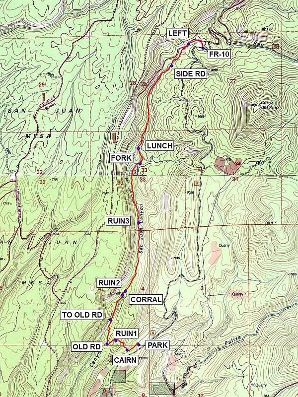
Map File Source: NG Topo
 Hike Key: H10499
Last Updated: 12/15/2020 12:00am
Last Updated By: Marilyn Warrant
Hike Class: C (Challenging)
Hike Distance: 8.5 mi
Minimum Elevation: 6955 ft
Elevation Change: 839 ft
Total Uphill: 1310 ft
Total Downhill: 1310 ft
Avg. Grade: 6 %
Route Type: InOut
On Trail: No
Paved or Gravel Roads: Yes
GPS Advised: Yes
Drive Distance Round Trip: 120 mi
Drive Time One-Way: 1:30
Hiking Seasons: Spring, Summer, and Fall
New Mexico Game Unit: 6A
Hike Status: Published
Highlights
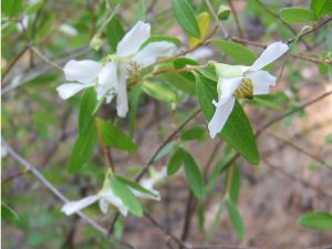
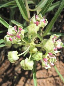
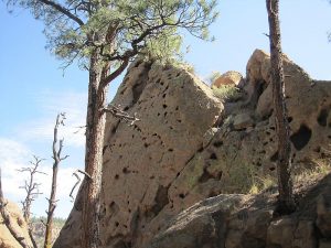
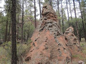
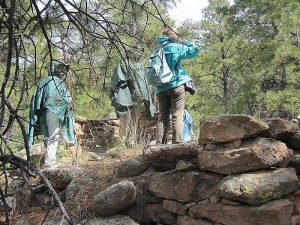
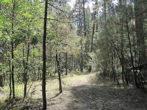
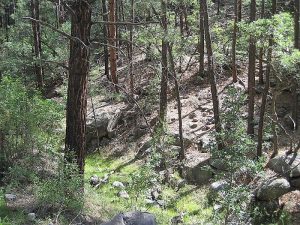
Cool shady hike along a stream. Trees, rocks, and wildflowers. Pueblo ruins.
CautionsHiking poles recommended for steep section at the beginning and end of the hike.
Trailhead Directions
From Albuquerque, I-25 north to Bernalillo Exit 242, US 550 west to San Ysidro, SR 4 north through Jemez Pueblo to sign on right for SR290 TO PONDEROSA. The road becomes dirt at END PAVED and changes number to FR-10. From the Ponderosa turnoff, go 12 mi to an unsigned narrow dirt road on the left a short distance to an object that looks like a small flying saucer and PARK. Be careful not to miss the turn. Your driver won’t appreciate having to turn around on the narrow road.
Actual Hike
From parking, follow a trail southwest for a short distance to a CAIRN (0.2 mi) then go northwest up to a RUIN1 (0.4 mi) on the saddle. No optimal way up/down has been found, so do your best. Continue the same general direction to an OLD RD (0.5 mi). Follow it diagonally to your right and go down to the canyon. Continue up the canyon to a CORRAL (1.0 mi). There are two more ruins RUIN2 (1.1 mi) and RUIN3 (1.8 mi). Go past the FORK (2.5 mi) in the road (don’t go up the drainage to your right). If you’re trying to get back to the van by the Jemez “witching hour” of 2 PM, stop for LUNCH (2.7 mi) shortly after the FORK. Otherwise, continue up the trail and pass a SIDE RD (3.7 mi) to your right. The trail goes north, then curves around to the right to meet up with FR-10 (4.3 mi). Have lunch, then return the way you came. Be sure to take the trail to the LEFT (4.5 mi) (the more apparent trail to the right goes up to San Juan Mesa). After you pass the CORRAL, try to follow the track precisely TO OLD RD on up to the saddle again and down.
Comments
The hike is an easy one except for the 400 ft of steep descent and ascent at the beginning and end of the hike, respectively. Bring hiking poles and wear good boots. There’s some maneuvering around boulders, also.
This hike is primarily in the shade, and follows a small stream. Be sure to look up to the cliffs to the west.
WaypointsTO PONDEROSA: N35 37.520, W106 43.452
END PAVED: N35 41.170, W106 39.221
PARK: N35 43.516, W106 37.522
CAIRN: N35 43.469, W106 37.647 (0.2 mi)
RUIN1: N35 43.552, W106 37.770 (0.4 mi)
OLD RD: N35 43.523, W106 37.865 (0.5 mi)
CORRAL: N35 43.951, W106 37.697 (1.0 mi)
RUIN2: N35 43.988, W106 37.664 (1.1 mi)
RUIN3: N35 44.590, W106 37.521 (1.8 mi)
FORK: N35 45.112, W106 37.507 (2.5 mi)
LUNCH: N35 45.247, W106 37.525 (2.7 mi)
SIDE RD: N35 45.973, W106 37.166 (3.7 mi)
FR-10: N35 46.128, W106 36.828 (4.3 mi)
LEFT: N35 46.167, W106 36.983 (4.5 mi)
Hike GPS File Name: SanJuanCanyon-StripMineAreaToFR10WayTrackRev2_MW.gpx
Hike GPS File: Click link to download hike waytrack file
Text Author: Marilyn Warrant
Map Author: Marilyn Warrant
Waypoints Author: Marilyn Warrant
Track Author: Marilyn Warrant
Maintainer: Marilyn Warrant
Editor: Howard Carr