Big Tesuque To Chamisa TH Hike
In Sangre De Cristos Region
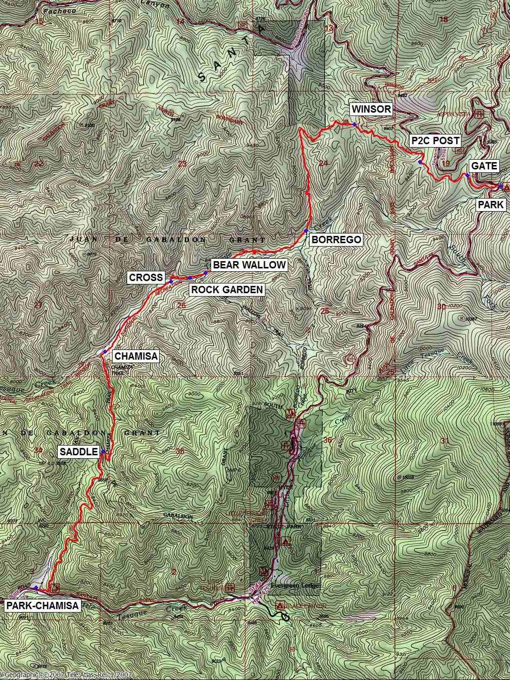
Map File Source: NG Topo
 Hike Key: H10498
Last Updated: 12/15/2020 12:00am
Last Updated By: Marilyn Warrant
Hike Class: C (Challenging)
Hike Distance: 7.1 mi
Minimum Elevation: 7860 ft
Elevation Change: 1888 ft
Total Uphill: 698 ft
Total Downhill: 2586 ft
Avg. Grade: 10 %
Route Type: Oneway
On Trail: Yes
Paved or Gravel Roads: Yes
GPS Advised: No
Drive Distance Round Trip: 162 mi
Drive Time One-Way: 1:30
Hiking Seasons: Spring, Summer, and Fall
New Mexico Game Unit: 44
Hike Status: Published
Highlights
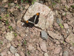
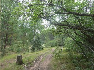
Mostly downhill hike along part of the Winsor Trail. Big Tesuque Creek, wildflowers, woods.
CautionsMost of the uphill is after lunch.
Trailhead Directions
From Albuquerque, take your favorite route to Hyde Parkway, the road to the Santa Fe Ski area. One way is from Albuquerque, take I-25 to the St. Francis exit in Santa Fe. Go just past Paseo de Peralta, and turn right onto Alameda. Continue along the Santa Fe River and turn left on Gonzales. At the intersection with the road to the Ski Area, turn right. It’s 4.2 mi to the Chamisa trailhead from there or 10.4 mi to the Big Tesuque parking area. So, it’s 6.2 mi between the two trailheads.
Actual Hike
Start the hike at the Big Tesuque parking area. The Big Tesuque trailhead is across the highway, a little to the north. Start down steep stone steps and walk along a stream for a short distance. The trail is well-defined throughout — just don’t take any of the side trails, many of which are blocked off. Go through a GATE (0.3 mi) and past the P2C POST (0.8 mi), which might have been an old trail marker. Reach the WINSOR (1.5 mi) trail. About a mile later, the trail takes a turn to the left and goes directly south to a sign for the BORREGO (2.75 mi) trail. Stay on the Winsor trail going now west to the intersection with the BEAR WALLOW (3.7 mi) trail. Keep your eyes peeled to the right, and in a short distance you’ll come across a beautiful ROCK GARDEN (3.8 mi) with dayflowers. CROSS (4.0 mi) Tesuque Creek, and continue to the beginning of the CHAMISA (4.7 mi) trail. Hike steeply uphill for about one mile to the SADDLE (5.7 mi), then once again go downhill to PARK-CHAMISA (7.1 mi). Get in the van, drive the shuttle driver back to his/her car at PARK, then head on home.
Comments
This lovely trail meanders downhill through mature aspen groves and mixed pine forests. There are numerous open areas with wildflower meadows; in fact we spotted 30 different flower species, including blue birdbill dayflower (Commelina dianthifolia). Ponderosa pine and Douglas fir are gigantic and magnificent. The trail follows the stream for much of the second half of the hike, then after a short but steep climb (12% grade) reaches the Chamisa intersection and finishes going downhill again.
The estimated drive time includes the time needed for the shuttle. Be sure to leave 1 space on the van for the shuttle driver. Alternatively, if the driver is willing, the driver could drop off the hikers at the Big Tesuque trailhead, drive back down to the Chamisa trailhead, and hike in reverse order to meet the hikers somewhere on the Winsor Trail. That would shave about 30 min off the total time for the hike.
WaypointsPARK: N35 46.162, W105 48.547
GATE: N35 46.227, W105 48.795 (0.3 mi)
P2C POST: N35 46.309, W105 49.145 (0.8 mi)
WINSOR: N35 46.536, W105 49.631 (1.5 mi)
BORREGO: N35 45.895, W105 49.993 (2.75 mi)
BEAR WALLOW: N35 45.638, W105 50.737 (3.7 mi)
ROCK GARDEN: N35 45.609, W105 50.852 (3.8 mi)
CROSS: N35 45.586, W105 50.991 (4.0 mi)
CHAMISA: N35 45.165, W105 51.482 (4.7 mi)
SADDLE: N35 44.559, W105 51.497 (5.7 mi)
PARK-CHAMISA: N35 43.737, W105 51.991 (7.1 mi)
Hike GPS File Name: BigTesuqueToChamisaTHWayTrack1_MW.gpx
Hike GPS File: Click link to download hike waytrack file
Text Author: Marilyn Warrant
Map Author: Marilyn Warrant
Waypoints Author: Marilyn Warrant
Track Author: Marilyn Warrant
Maintainer: Marilyn Warrant
Editor: Howard Carr