Red Mesa East Loop Hike
In San Ysidro Region
Map File Source: NG Topo
 Hike Key: H10484
Last Updated: 02/25/2025 9:57pm
Last Updated By: Marilyn Fixer
Hike Class: D (Difficult)
Hike Distance: 6.5 mi
Minimum Elevation: 5539 ft
Elevation Change: 1222 ft
Total Uphill: 1481 ft
Total Downhill: 1481 ft
Avg. Grade: 9 %
Route Type: CW Loop
On Trail: No
Paved or Gravel Roads: Yes
GPS Advised: Yes
Drive Distance Round Trip: 80 mi
Drive Time One-Way: 0:45
Hiking Seasons: Spring, Fall, and Winter
New Mexico Game Unit: 6A
Hike Status: Published
Highlights
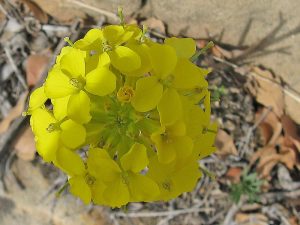
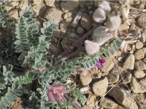
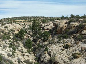
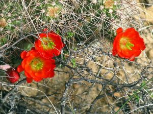
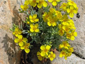
A scenic, rugged hike through a jumble of canyons and sandstone slickrock. Can be an amazing flower hike.
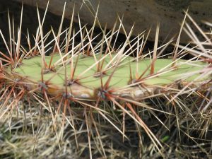
CautionsTotally off-trail, lots of climbing up/down rock ledges and some minor scrambling. Wear sturdy boots and long pants to protect from all the cactus.
Trailhead Directions
From Albuquerque, drive north on I-25 to Bernalillo and Exit 242, then turn west to US-550. Drive northwest on US-550 to mile marker 27 and turn off at mile 27.3 (marked by 2 posts with reflectors) to the small dirt parking area on the north side of the highway at the locked BLM gate. This turn-off is easy to miss, so go slow as you approach.
Actual Hike
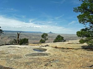
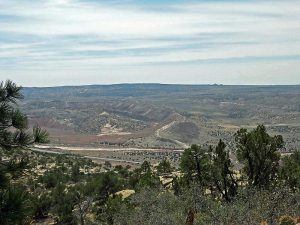
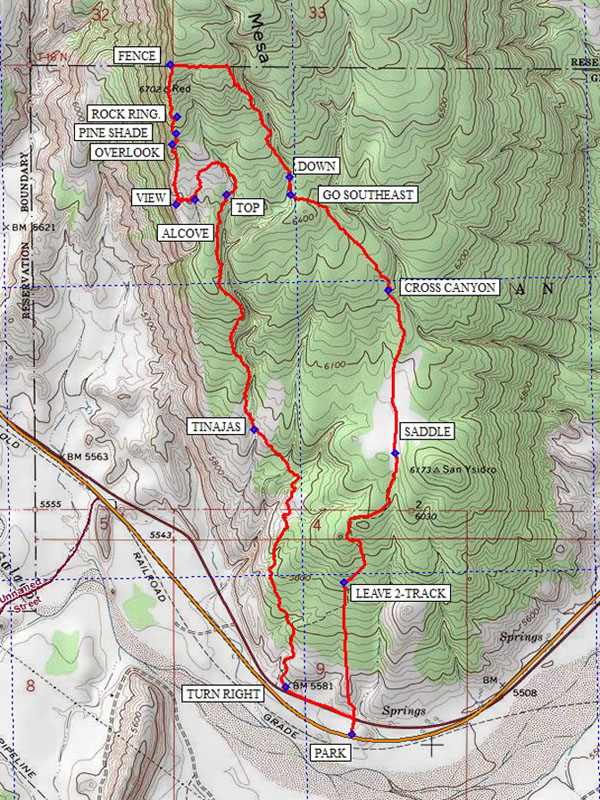
From PARK (0.0 mi) climb through the fence or over the gate heading north a short distance to an old roadway and follow it northwest to TURN RIGHT (0.3 mi). Now head north climbing up as you go, until you reach the edge of a deep canyon. Turn slightly northeast here and follow the eastern rim of this canyon until you can cross at the canyon head and turn northwest. Cross another small canyon and continue northwest over the rocky hill where you will soon reach another canyon with several small water filled pools known as TINAJAS (1.5 mi). Cross this canyon near these pools and go up the west side far enough for easy walking and continue hiking northerly along the western canyon edge. As you hike north and up, this canyon becomes larger and deeper and contains interesting geology and huge blocks of fallen sandstone. In about a mile, the end of this canyon is reached at TOP (2.4 mi) where you will follow the now shallow canyon northerly, turning to the west and then south across the bright yellow and red sandstone domes and crevices. Now find the beginning of a small canyon and follow it south to ALCOVE (2.7 mi). This is an interesting little half cave with signs of habitation- likely recent or perhaps even ancient. Leave the little alcove going west then turn south toward an area of white sandstone and a cliff edge at VIEW (2.8 mi). At the high cliff edge here are terrific views; to the south is the nearby Ojito Wilderness Area, Mount Taylor is 50 miles to the southwest, and Cabezon Peak is 14 miles west.
Now go northerly along the cliff edge to another nice viewpoint at OVERLOOK (3.1 mi). From here go northeast crossing the small canyon and return to the cliff edge going north to PINE SHADE (3.15 mi) which has several shady pines should you want a lunch spot. North of here are several curious circular stone constructions near ROCK RING (3.2 mi); have a look and speculate on their purpose. Continue north to a FENCE (3.4 mi) which is the high point of our hike at 6761 ft. and also marks a Jemez Reservation boundary. Follow this fence-line east until you reach another canyon and turn southeasterly and follow the canyon edge downhill to waypoint DOWN (4.1 mi) and go down into the canyon bottom to waypoint GO SOUTHEAST (4.2 mi). Leave the canyon and cross over the small hill going southeast toward waypoint CROSS CANYON (4.7 mi). Cross over this small canyon and begin to turn south and head for a saddle area just west of the flat top mesa to your south. At the SADDLE (5.25 mi) you will find a relic 2-track road which you will follow down to waypoint LEAVE 2-TRACK (5.9 mi) where you will turn south toward the BLM gate and your ride at PARK (6.44 mi).
Comments
This is a scenic rugged hike thru a jumble of canyons and sandstone slick-rock. The hike is 100% off trail and requires climbing up and down rock ledges and some minor scrambling; there is much cactus to dodge so sturdy boots and long pants are advised.
The difficult terrain and poor footing qualify this as a D class hike.
WaypointsPARK: N35 32.534, W106 50.323
TURN RIGHT: N35 32.674, W106 50.566
TINAJAS: N35 33.440, W106 50.680
TOP: N35 34.137, W106 50.781
ALCOVE: N35 34.124, W106 50.895
VIEW: N35 34.108, W106 50.966
OVERLOOK: N35 34.287, W106 50.978
PINE SHADE: N35 34.319, W106 50.965
ROCK RING: N35 34.368, W106 50.959
FENCE: N35 34.523, W106 50.985
DOWN: N35 34.191, W106 50.552
GO SOUTHEAST: N35 34.137, W106 50.548
CROSS CANYON: N35 33.853, W106 50.193
SADDLE: N35 33.370, W106 50.167
LEAVE 2-TRACK: N35 32.986, W106 50.355
Hike GPS File Name: RedMesaEastLoopHike_ksks.gpx
Hike GPS File: Click link to download hike waytrack file
Text Author: Ken Smith
Map Author: Ken Smith
Waypoints Author: Ken Smith
Track Author: Ken Smith
Maintainer: Not Assigned
Editor: Marilyn Warrant