Cieneguilla Petroglyphs-Cerro Seguro La Cienega Hike
In Santa Fe Region
Map File Source: Other
 Hike Key: H10388
Last Updated: 12/15/2020 12:00am
Last Updated By: Marilyn Warrant
Hike Class: B (Moderate)
Hike Distance: 5 mi
Minimum Elevation: 4700 ft
Elevation Change: 560 ft
Total Uphill: 640 ft
Total Downhill: 640 ft
Avg. Grade: 10 %
Route Type: Lollypop
On Trail:
Paved or Gravel Roads:
GPS Advised:
Drive Distance Round Trip: 100 mi
Drive Time One-Way: 1:00
Hiking Seasons: Spring, Fall, and Winter
New Mexico Game Unit: 6C
Hike Status: Inactive
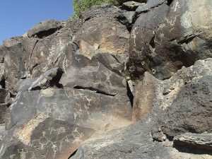
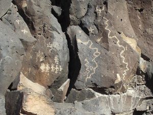
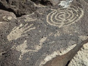
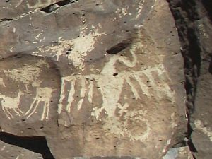
Highlights
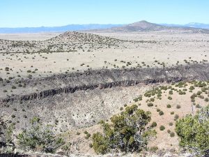
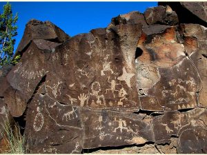
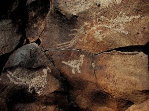
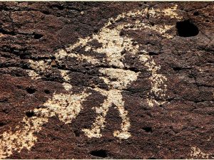
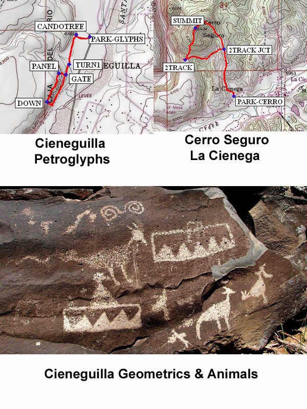
Visit an outstanding collection of petroglyphs then hike to the summit of Cerro Seguro with a view into Santa Fe River Canyon.
CautionsHiking sticks recommended.
Trailhead Directions
I-25 north to La Cienega Exit 271. For the Cieneguilla Petroglyphs, I-25 north to La Cienega Exit 271. Go north 1 mile on Entrada La Cienega (NM 587) past town of La Cienega. Follow Los Pinos Road northeast; it becomes CR 56 (Paseo Real). You will see a small white church off to the left. Continue to where road goes to right (north). Park at PARK-GLYPHS in the fenced BLM parking area on the left. For the Cerro Seguro La Cienega hike, return along Paseo Real and Los Pinos Road to the Entrada La Cienega intersection. Proceed 0.4 miles on Camino Capilla Vieja (CR 54) and park on the shoulder across from a sign for the Rael Ranch at PARK-CERRO.
Actual Hike
Walk 0.1 mile west on a well-defined path, then left along a fence at the junk yard tree (CANDOTREE), following the trail south for 0.4 miles. After crossing an arroyo bear right at TURN1 and pass through a GATE, then head up the escarpment to PANEL. The petroglyph galleries are along the trail just below the rim. For the most impressive images, follow the trail to the left along the petroglyph gallery until you reach a major rock slide. Head down the escarpment at this point and follow along the fence until you rejoin the original trail. For the second part of the hike, from PARK-CERRO, follow a rough road up the northeast side of the hill for 0.4 mi to a 2TRACK JCT. Keep going uphill to a rise with a view of the Santa Fe River Canyon. The trail continues to the left up to the SUMMIT of Cerro Seguro, where there are remnants of pilgrims’ crosses. This is a good lunch spot. Follow the ridgeline down the south side of the hill (no trail) to the flat mesa. Continue south along the mesa edge for nice views of the Santa Fe River canyon, but do not go beyond the fence. It is possible to climb down into the canyon through a gap in the massive rock formations, but we did not do this. Retrace your steps toward the hill and return on a trail that circles the base of Cerro Seguro. It becomes a 2TRACK that meets the entrance road; turn right and follow that back to the start of the hike.
Comments
The Cieneguilla hike entails a rock scramble up to reach the petroglyphs, then careful footing along the galleries and a rock scramble descent. Hiking sticks may be helpful. The Cerro Seguro hike involves a steep climb up a rocky road, off-trail hiking along the ridgeline and down the south side of the hill.
For more information on this area, see this website. A private landowner at Cerro Seguro warned us not to cross fenced land to the west and south of the hill.
Average grades: Cieneguilla Petroglyphs portion — 4%; Cerro Seguro portion — 11%.
Waypoints2TRACK: N 35 34.014, W 106 08.345
2TRACK JCT: N 35 34.086, W 106 08.018
CANDOTREE: N 35 36.544, W 106 07.296
DOWN: N 35 36.127, W 106 07.518
GATE: N 35 36.296, W 106 07.374
PANEL: N 35 36.304, W 106 07.429
PARK-CERRO: N 35 33.766, W 106 07.935
PARK-GLYPHS: N 35 36.535, W 106 07.193
SUMMIT: N 35 34.235, W 106 08.259
TURN1: N 35 36.361, W 106 07.348
Hike GPS File Name: CieneguillaPetroglyphs-CerroSeguroLaCienegaWayTrack_KSKS.gpx
Hike GPS File: Click link to download hike waytrack file
Text Author: Judie Schwartz
Map Author: Bob Schwartz
Waypoints Author: Ken Smith
Track Author: Ken Smith
Maintainer: Not Assigned
Editor: Howard Carr