Ah-shi-sle-pah Badlands Hike
In Northwest New Mexico Region
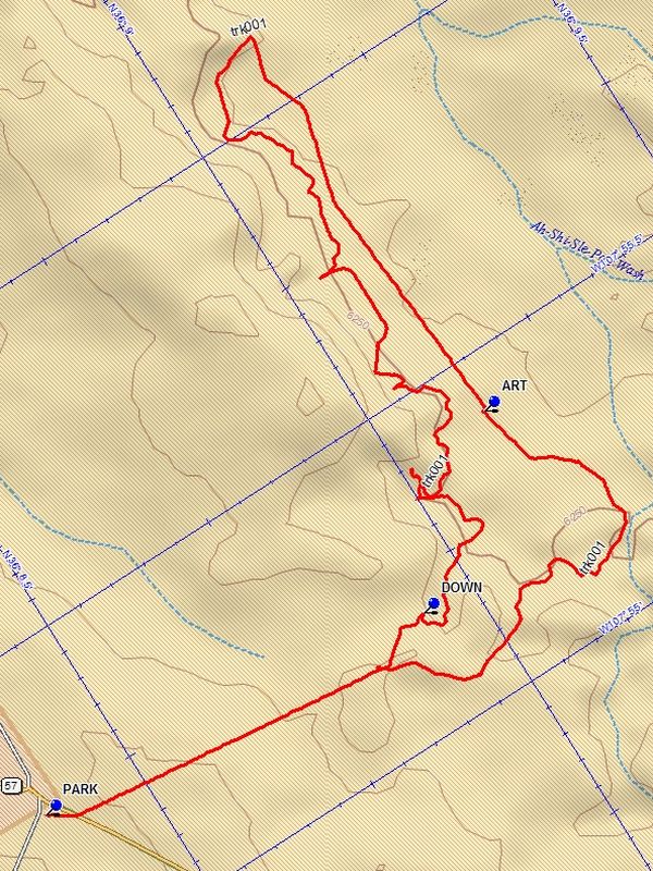
Map File Source: DeLorme
 Hike Key: H10373
Last Updated: 06/29/2021 12:00am
Last Updated By: Marilyn Fixer
Hike Class: B (Moderate)
Hike Distance: 6 mi
Minimum Elevation: 6180 ft
Elevation Change: 125 ft
Total Uphill: 180 ft
Total Downhill: 180 ft
Avg. Grade: 2 %
Route Type: Loop
On Trail: No
Paved or Gravel Roads: No
GPS Advised: Yes
Drive Distance Round Trip: 290 mi
Drive Time One-Way: 2:45
Hiking Seasons: Spring and Fall
New Mexico Game Unit: 7
Hike Status: In Process
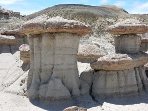
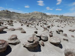
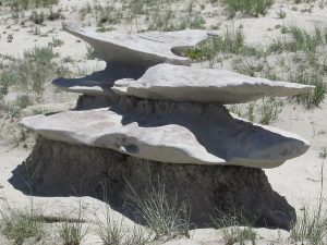
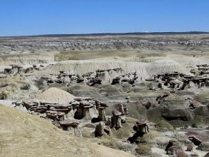
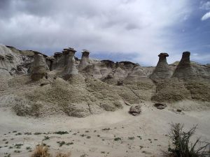
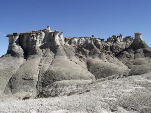
Attractions: Badlands and Rock Formations
Highlights
Hundreds of hoodoos and other formations in this Wilderness Study Area.
CautionsSome difficult terrain and steep pitches. Trekking poles recommended.
Trailhead Directions
From Albuquerque take I-25 north to Bernalillo. Go west on US 550 through San Ysidro, thru Cuba (reset the odometer here). At about 48.5 miles from Cuba go past the “Chaco Culture” sign. After about 3 more miles the Blanca Trading Post will be on your left. Turn left here onto CR7800 and stay on the paved road until it ends. Continue on the dirt until you reach a T intersection SR 47. Go left for about 3.5 mile and watch carefully for a two track on the right. PARK here.
Waypoints
CR7800: N36 15.571, W107 44.440
CR7880-CR7820 Y: N36 11.716, W107 50.391
SR57: N36 10.128, W107 52.829
DOWN: N36 08.926, W107 55.190
PARK: N36 08.366, W107 55.246
ART: N36 09.135, W107 55.411
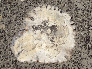
PETRIFIED: N36 09.232, W107 56.360
Hike GPS File Name: Ah-shi-sle-pahBadlandsWayTrack_DBDB.gpx
Hike GPS File: Click link to download hike waytrack file
Text Author: Dick Brown
Map Author: Dick Brown
Waypoints Author: Dick Brown
Track Author: Dick Brown
Maintainer: Dawn McIntyre
Editor: