Pino Trail Short Hike
In Sandia Mountain West Region
Map File Source: NG Topo
 Hike Key: H10371
Last Updated: 03/20/2023 2:37pm
Last Updated By: Marilyn Fixer
Hike Class: C (Challenging)
Hike Distance: 5 mi
Minimum Elevation: 6469 ft
Elevation Change: 1231 ft
Total Uphill: 1250 ft
Total Downhill: 1250 ft
Avg. Grade: 10 %
Route Type: InOut
On Trail: Yes
Paved or Gravel Roads: Yes
GPS Advised: No
Hiker Limit (NF/BLM/NP): 15 (Sandia Wilderness)
Drive Distance Round Trip: 12 mi
Drive Time One-Way: 0:15
Hiking Seasons: Spring, Summer, and Fall
New Mexico Game Unit: 8
Hike Status: Published
Highlights
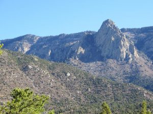
An easier version of the Pino Trail that stops before the steep part begins. Vistas of ABQ below.
CautionsNone.
Trailhead Directions
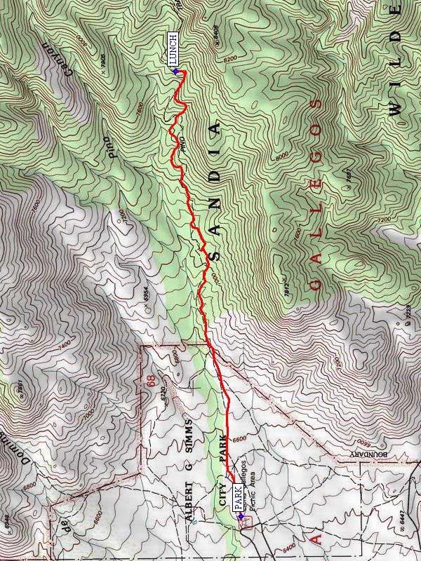
North on Tramway past Academy, look for signs leading right to Elena Gallegos Picnic Grounds. PARK (0.0 mi) near the trail sign for the Pino Trail.
Actual Hike
Pino Canyon Trail 140 starts at the Elena Gallegos Picnic Grounds. It goes almost directly east up the mountain. The first part is easy and then gets steep. It eventually goes to the crest. This hike is designed to be a C version, stopping at 2.5 mi or so up the trail. Of course, hikers can stop sooner and wait for the others to return. Have LUNCH (2.5 mi) and come back the same way. The hike length and total vertical are based on stopping at about 7700′ elevation.
Comments
Views north to top of tram and Kiwanis cabin. Views of the city to the west. Since the hike is on a north facing slope and is under tall pines, it is one of the coolest hikes on the west side of the Sandias so can be done even in late September. You’ll want to schedule for summer, late spring, or early fall to avoid snow.
WaypointsPARK: N 35 09.799, W 106 28.190
LUNCH: N 35 10.072, W 106 25.921
Hike GPS File Name: PinoTrailShortWayTrack_JBJB.gpx
Hike GPS File: Click link to download hike waytrack file
Text Author: Roger Holloway
Map Author: John Boyd
Waypoints Author: John Boyd
Track Author: John Boyd
Maintainer: Not Assigned
Editor: Howard Carr