Sandia Crest House To Tram Hike
In Sandia Mountain East Region
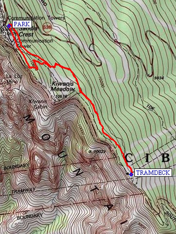
Map File Source: NG Topo
 Hike Key: H10355
Last Updated: 12/15/2020 12:00am
Last Updated By: Marilyn Warrant
Hike Class: B (Moderate)
Hike Distance: 3.2 mi
Minimum Elevation: 10286 ft
Elevation Change: 358 ft
Total Uphill: 424 ft
Total Downhill: 424 ft
Avg. Grade: 8 %
Route Type: InOut
On Trail: Yes
Paved or Gravel Roads: Yes
GPS Advised: No
Drive Distance Round Trip: 70 mi
Drive Time One-Way: 1:15
Hiking Seasons: Spring, Summer, and Fall
New Mexico Game Unit: 8
Hike Status: Published
Highlights
Short hike from the Crest House on the Crest Trail to the Tram area and back.
CautionsNone.
Trailhead Directions
I-40 east to Tijeras exit. North on NM 14, west on Crest Road 536 all the way to the lower Crest parking lot (PARK (0.0 mi)). Parking requires a $3 fee, the Senior Pass, or a Golden Age Passport. There are toilet facilities at the Crest.
Actual Hike
Start at the lower Crest parking lot, and hike along the Crest Trail to the Tram. Eat lunch on the TRAMDECK (1.7 mi).
Waypoints
PARK: N35 12.666, W106 26.965
TRAMDECK: N35 11.769, W106 26.064
Hike GPS File Name: SandiaCrestHouseToTramWayTrack_DBDB.gpx
Hike GPS File: Click link to download hike waytrack file
Text Author: Dick Brown
Map Author: Marilyn Warrant
Waypoints Author: Dick Brown
Track Author: Dick Brown
Maintainer: Not Assigned
Editor: Howard Carr