San Ysidro Trials Long Loop Hike
In San Ysidro Region
Map File Source: DeLorme
 Hike Key: H10315
Last Updated: 12/06/2023 6:38pm
Last Updated By: Marilyn Fixer
Hike Class: B (Moderate)
Hike Distance: 6.7 mi
Minimum Elevation: 5500 ft
Elevation Change: 315 ft
Total Uphill: 570 ft
Total Downhill: 570 ft
Avg. Grade: 4 %
Route Type: Loop
On Trail: No
Paved or Gravel Roads: Yes
GPS Advised: Yes
Drive Distance Round Trip: 70 mi
Drive Time One-Way: 1:15
Hiking Seasons: Spring, Summer, Fall, and Winter
New Mexico Game Unit: 6A
Hike Status: Published
Highlights
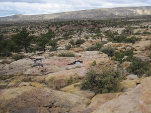
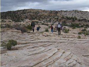
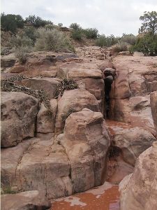
Hike on expanses of rock surface with rock formations, through canyons, and by water pools in a arroyo.
CautionsSome walking on rock surfaces.
Trailhead Directions
From Albuquerque go North on I-25 to Bernalillo. Go west on US 550 from Bernalillo to milepost 25 which is about 1.5 miles beyond San Ysidro. There is a small parking area beyond the west end of paved pull off area on the right in a fenced parking area marked “San Ysidro Trials”. Pull in there and PARK (0.0 mi).
Actual Hike
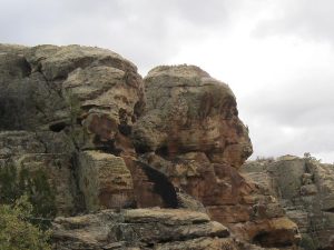
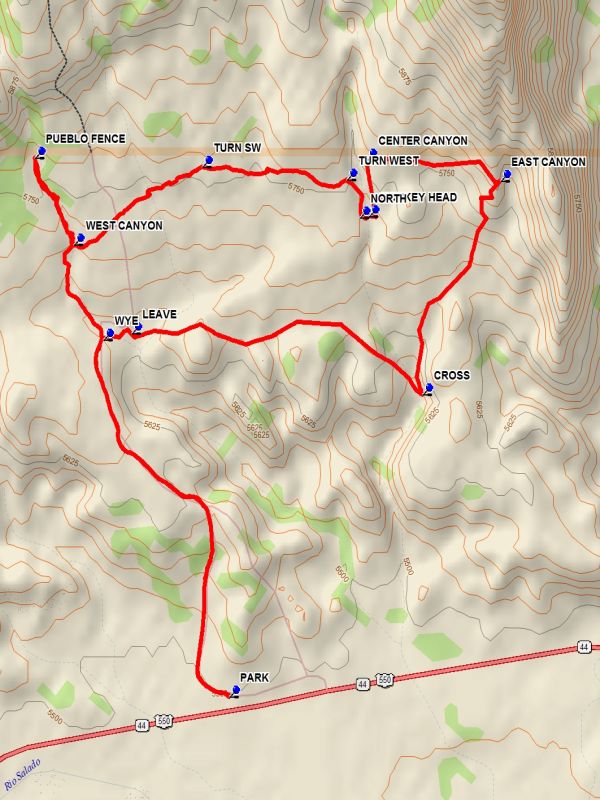
There is a fence pass through at the west end of the parking area. Go through the pass through and hike the road which curves to the north and up the hill. The road drops down into an open motorcycle event gathering area before a arroyo. At this WYE (1.2 mi) bear right and cross the arroyo and follow the path which goes slightly north of east. LEAVE (1.3 mi) the path going right across a small wash and up onto the rim of a large digging. Pass around the south side of the digging and pick up a path. Follow the path, staying on the north side of the low hills. Proceed downward to CROSS (2.2 mi) at the lower end of a small canyon which extends northward. Go north, staying near to the low hill on your right until you see a very rocky up slanting expanse. Travers upward over this area toward EAST CANYON (2.9 mi) where there is a view into a deep gorge. Go northwest to an east/west running fence, which is the boundary line for Jemez Pueblo land. Follow the fence to the CENTER CANYON (3.4 mi) and turn south along the canyon until MONKEY HEAD (3.5 mi) is reached. Cross the canyon and then head NORTH (3.5 mi) along the canyon to the Pueblo boundary fence. Go west, then TURN SW (4.2 mi) moving away from the fence across the rocky section to the WEST CANYON (4.6 mi) and cross the canyon. Go north along the canyon to PUEBLO FENCE (4.9 mi). Turn back and follow the canyon which turns into a wash until you reach the motorcycle event gathering area. Return to parking on the road.
Comments
This is BLM land. A motorcycle club has an agreement with the BLM to use the area for trials. A series of courses have been laid out in the area. The area is seldom used by the cyclists, who have access to the area on the gated road during events.
WaypointsPARK: N 35 33.284, W 106 48.411
WYE: N 35 34.094, W 106 48.811
LEAVE: N 35 34.109, W 106 48.722
CROSS: N 35 33.971, W 106 47.796
EAST CANYON: N 35 34.456, W 106 47.547
CENTER CANYON: N 35 34.504, W 106 47.974
MONKEY HEAD: N 35 34.375, W 106 47.966
NORTH: N 35 34.372, W 106 47.994
TURN WEST: N 35 34.458, W 106 48.036
TURN SW: N 35 34.487, W 106 48.496
WEST CANYON: N 35 34.311, W 106 48.904
PUEBLO FENCE: N 35 34.509, W 106 49.028
Hike GPS File Name: SanYsidroTrialsLongLoopWayTrack_DBDB.gpx
Hike GPS File: Click link to download hike waytrack file
Text Author: Dick Brown
Map Author: Dick Brown
Waypoints Author: Dick Brown
Track Author: Dick Brown
Maintainer: Randy Simons
Editor: Howard Carr