Bear Canyon Arroyo Hike
In Albuquerque Region
Map File Source: DeLorme
 Hike Key: H10299
Last Updated: 03/08/2021 12:00am
Last Updated By: Marilyn Fixer
Hike Class: B (Moderate)
Hike Distance: 7.3 mi
Minimum Elevation: 5459 ft
Elevation Change: 497 ft
Total Uphill: 500 ft
Total Downhill: 500 ft
Avg. Grade: 2 %
Route Type: CW Loop
On Trail: Yes
Paved or Gravel Roads: Yes
GPS Advised: No
Drive Distance Round Trip: 10 mi
Drive Time One-Way: 0:15
Hiking Seasons: Spring, Fall, and Winter
New Mexico Game Unit: 8
Hike Status: Published
Highlights
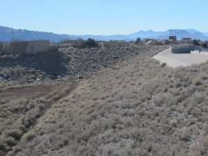
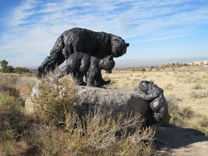
Urban hike along paved bike trail to bear sculpture. View of flood control measures and backyards. Brunch at Flying Star.
CautionsNone.
Trailhead Directions
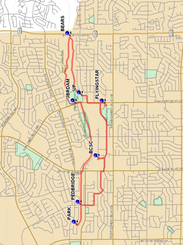
From Wyoming and Spain, go east on Spain a short distance to Camino del Sol NE, turn right and go south to the end of the street, and PARK (0.0 mi) on the side of the street.
Actual Hike
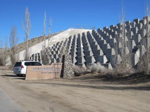
This hike follows the north side of the Bear Canyon arroyo, past a PEDBRIDGE (0.3 mi) that you’ll use on the return trip, along the side of the El Oso Grande park, to the John B. Robert Dam (JBRDAM (2.0 mi)). Walk up the road on the north end of the dam and take a look at the size of the retention area in back. (If you ever see water coming down the flood control structures onto Juan Tabo, there’s a whole lot of water on the other side!) If the weather has been dry, you can continue walking east down into the arroyo. It’s worth going all the way to Tramway to see the BEARS (3.1 mi) monument. On the way back, climb out of the arroyo back to the streets at UP (4.1 mi). Your destination is the FLYINGSTAR (4.55 mi) on Juan Tabo. After a break for something to eat or drink, you could return the way you came, or take a loop through some of the side streets starting with Lagrima de Oro (you’ll pass near the BCSC (5.9 mi) if you need a pit stop). At Moon cross the arroyo on the PEDBRIDGE (7.0 mi), then head west on the same path you came in on to return to the van.
Comments
See the Albuquerque Metropolitan Arroyo Flood Control Authority brochure for more information about Albuquerque flood control.
WaypointsPARK: N35 08.301, W106 32.840
PEDBRIDGE: N35 08.252, W106 32.530
JBRDAM: N35 08.316, W106 30.960
BEARS N35 08.384 W106 29.918
UP N35 08.236 W106 30.838
FLYINGSTAR: N35 07.946, W106 30.963
BCSC: N35 08.025, W106 31.814
Hike GPS File Name: BearCanyonArroyoWayTrack_HC.gpx
Hike GPS File: Click link to download hike waytrack file
Text Author: Marilyn Warrant
Map Author: Marilyn Warrant
Waypoints Author: Marilyn Warrant
Track Author: Howard Carr
Maintainer: Marilyn Warrant
Editor: Howard Carr