4th Of July – Crest – Albuquerque Trail Loop Long Hike
In Manzano Mountains East Region
Map File Source: NG Topo
 Hike Key: H10284
Last Updated: 03/04/2021 12:00am
Last Updated By: Marilyn Fixer
Hike Class: D (Difficult)
Hike Distance: 8.3 mi
Minimum Elevation: 7471 ft
Elevation Change: 1391 ft
Total Uphill: 1684 ft
Total Downhill: 1684 ft
Avg. Grade: 11 %
Route Type: CW Loop
On Trail: Yes
Paved or Gravel Roads: No
GPS Advised: Yes
Drive Distance Round Trip: 100 mi
Drive Time One-Way: 1:30
Hiking Seasons: Spring, Summer, and Fall
New Mexico Game Unit: 14
Hike Status: Published
Highlights
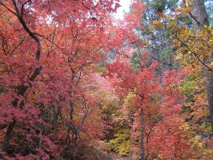
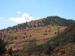
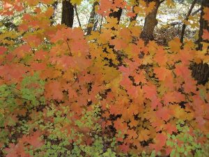
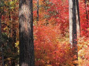
Wonderful hike in the fall with the red and yellow colors of maple leaves.
CautionsHiking poles recommended for the downhill return.
Trailhead Directions
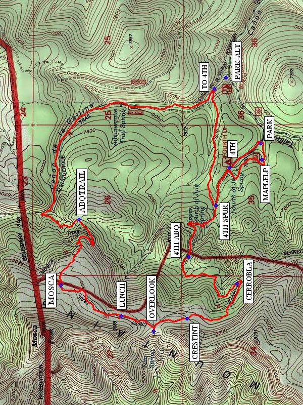
I-40 East to Tijeras exit, south on SR 337 to its end, right (west) on SR 55 to Tajique. Look for sign in Tajique for “4th of July Canyon.” Take FR 55 about 6.5 miles. At the 6.5 mile point the road will bend to the left. Go past the Albuquerque Trail trailhead to the 4th of July Campground. PARK (0.0 mi) near the beginning of the Maple Loop trail.
Actual Hike
Start at the beginning of the MAPLELP (0.2 mi) Trail, then join the 4th of July Trail at 4TH TR. Continue uphill past the junction with the Albuquerque Trail 4TH-ABQ (1.4 mi) and the Cerro Blanco Trail CERROBLA (2.1 mi). You’ll reach the intersection with the Manzano Crest Trail CRESTINT (2.7 mi). Take a few minutes to check out the overlook of the Rio Grande Valley to the west. If the wind isn’t too strong, you could have lunch there. An even better spot for LUNCH (3.3 mi) is in a protected grove of maples north along the Manzano Crest Trail. Continue north on Manzano Crest Trail until it ends at the Mosca Trail (MOSCA (3.9 mi)), which you’ll follow until it connects with the Albuquerque Trail ABQTRAIL (4.7 mi). Take that to the 4TH CUTOFF where you’ll take a right back to 4TH TR to complete the loop. You then can retrace your steps through the Maple Loop Trail or just follow the road back to PARK.
Comments
What you see to the west from the overlook is a subdivision called Meadow Lake and the towns of Valencia and Los Lunas directly beyond. This is a great hike especially during the fall. If you choose to do the hike in the spring or summer, you could eliminate the Maple Loop Trail and start instead at the Albuquerque Trail trailhead at PARK-ALT.
WaypointsPARK-ALT: N34 47.616, W106 22.358
PARK: N34 47.414, W106 22.820
MAPLELP: N34 47.408, W106 22.934
4TH: N34 47.594, W106 22.991
4TH-SPUR: N34 47.675, W106 23.256
4TH-ABQ: N34 47.834, W106 23.619
CERROBLA: N34 47.552, W106 23.808
CRESTINT: N34 47.841, W106 24.052
OVERLOOK: N34 48.035, W106 24.139
LUNCH: N34 48.224, W106 24.032
MOSCA: N34 48.573, W106 23.815
ABQTRAIL: N34 48.468, W106 23.354
TO 4TH: N34 47.684, W106 22.439
Hike GPS File Name: AlbuquerqueTrailLoopLongWayTrack_MWMW.gpx
Hike GPS File: Click link to download hike waytrack file
Text Author: Roger Holloway
Map Author: Marilyn Warrant
Waypoints Author: Marilyn Warrant
Track Author: Marilyn Warrant
Maintainer: Marilyn Warrant
Editor: Howard Carr