Mora Flats Hike
In Pecos Region
Map File Source: NG Topo
 Hike Key: H10238
Last Updated: 12/15/2020 12:00am
Last Updated By: Marilyn Warrant
Hike Class: C (Challenging)
Hike Distance: 7.2 mi
Minimum Elevation: 9228 ft
Elevation Change: 360 ft
Total Uphill: 1140 ft
Total Downhill: 1140 ft
Avg. Grade: 9 %
Route Type: InOut
On Trail: Yes
Paved or Gravel Roads: No
GPS Advised: No
Hiker Limit (NF/BLM/NP): 15 (Pecos Wilderness)
Drive Distance Round Trip: 200 mi
Drive Time One-Way: 2:30
Hiking Seasons: Summer and Fall
New Mexico Game Unit: 45
Hike Status: Published
Highlights
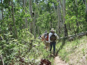
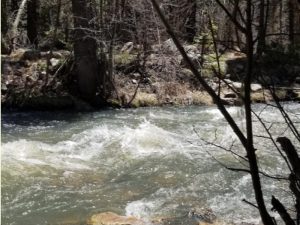
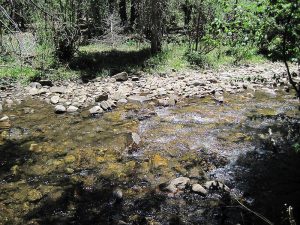
Hike in the woods up and over a hill down to the Mora River.
CautionsNone.
Trailhead Directions
I-25 north past Santa Fe. Take Glorieta exit 299 and follow SR 50 east to town of Pecos. There is a Ranger Station there (restrooms) about one quarter mi. to the right (south) on SR 63 or turn left (north) and follow SR 63 north toward Cowles. About 4 mi. past Terrero watch for a road off to the right (FR 233) that may have a sign about Iron Gate. Follow it about 4 mi. to Iron Gate Campground. The trailhead is at the north end of the campground loop road.
Actual Hike
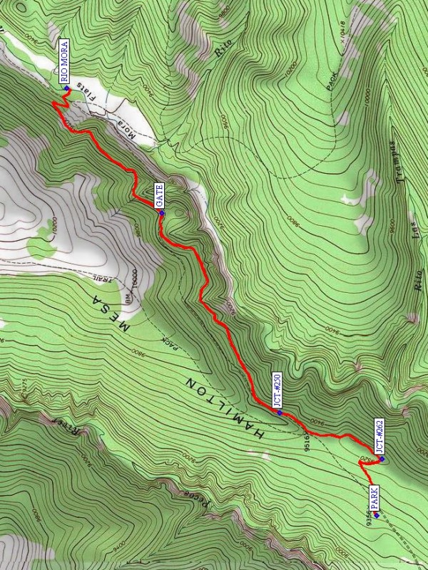
Go northeast on Trail #249 (Hamilton Mesa) from parking. Go left at JCT-#263 (0.5 mi) with the Monte Vista Trail then right at JCT-#250 onto the Rociada Trail. Follow this trail past a GATE (2.5 mi) down to the RIO MORA (3.6 mi) and return.
Comments
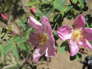
There are porta potties at the campground. We used to call this hike “Iron Gate” but have changed the name to differentiate this hike from another hike (Hamilton Mesa) that leaves from the same trailhead. There are likely to be many wildflowers along the trail and down by the river.
This hike takes more time than most; the drive is long and most will stop at the ranger station on the way up and the Pecos Dairy Queen on the way back. On a recent hike we left the center at 8:15 am and didn’t return until almost 7 pm.
CAUTION: FR 233 is a narrow, rough, rocky road. Don’t drive it in wet weather if you can help it. Go slowly to miss potholes and prevent bottoming out in the ruts.
WaypointsRANGER: N35 34.315, W105 40.544
DQ: N35 34.509, W105 41.763
FR223: N35 47.749, W105 39.438
PARK: N35 50.410, W105 37.281
JCT-#262: N35 50.387, W105 36.968
JCT-#250: N35 50.847, W105 36.712
GATE: N35 51.379, W105 35.607
RIO MORA: N35 51.807, W105 34.919
Hike GPS File Name: MoraFlatsWayTrackRev_MW.gpx
Hike GPS File: Click link to download hike waytrack file
Text Author: Marilyn Warrant
Map Author: Marilyn Warrant
Waypoints Author: Marilyn Warrant
Track Author: Marilyn Warrant
Maintainer: Marilyn Warrant
Editor: Howard Carr