Querencia Loop Hike
In Ojito Region
Map File Source: NG Topo
 Hike Key: H10225
Last Updated: 12/15/2020 12:00am
Last Updated By: Marilyn Warrant
Hike Class: B (Moderate)
Hike Distance: 4.7 mi
Minimum Elevation: 5815 ft
Elevation Change: 265 ft
Total Uphill: 416 ft
Total Downhill: 416 ft
Avg. Grade: 4 %
Route Type: CCW Loop
On Trail: No
Paved or Gravel Roads: No
GPS Advised: Yes
Drive Distance Round Trip: 90 mi
Drive Time One-Way: 1:15
Hiking Seasons: Spring, Fall, and Winter
New Mexico Game Unit: 9
Hike Status: Published
Access Description: Ojito Wilderness Area Access
Highlights
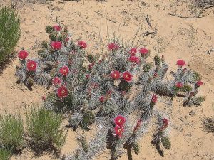
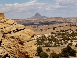
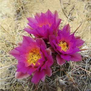
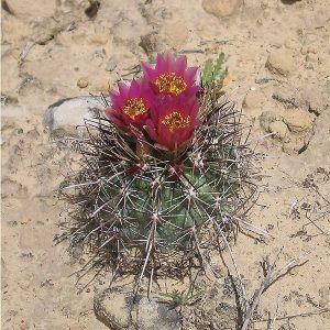
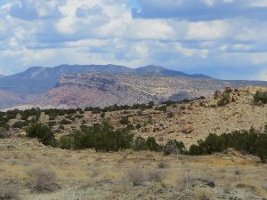
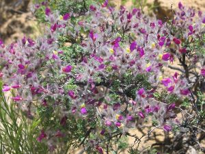
Spring cacti in bloom; views all around to mountains and badlands.
CautionsHiking poles useful on the last steep descent.
Trailhead Directions
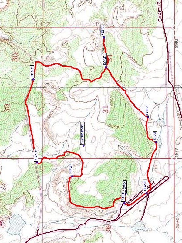
Starting from the intersection of I 25 and US 550 (formerly SR 44) in Bernalillo go northwest on US 550 for 20.9 miles to Cabezon Road. This intersection is about 2 miles before San Ysidro. Turn left onto Cabezon Road. Almost immediately there is a Y in the road, go left. At 8.5 miles from the start of Cabezon Road, after the road starts north in the Querencia Arroyo area, in the first eastward curve there will be a pull off on the right at PARK (0.0 mi).
Actual Hike
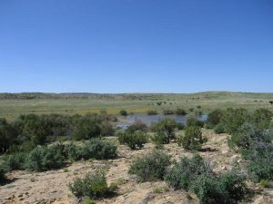
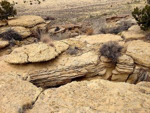
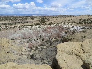
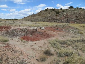
From parking walk back on the road for about 0.3 miles then head north into the narrow arroyo, not the arroyo to the left. At the end of this arroyo ascend the crest of the earth dam on the left side. Then continue north, crossing the small valley to the FORM (0.8 mi). Go up hill in the left notch until the crest and ROAD ONE (1.4 mi) is reached. At the intersection go right to the VIEW ONE (1.6 mi) and return if desired. Or go left and curve around and go north until ROAD TWO (2.6 mi) is encountered. Take the road westward. At ROAD THREE (3.3 mi) just before a small crest go to the left (south). This road affords views to the west into a badlands area. Along this segment there will be a failed WATER EXPT (3.6 mi) in water collection to irrigate the area that you might want to visit. Once south of the badlands curve around to the west, climbing to VIEW TWO (3.9 mi) on top of the mesa. Some years we have seen some pink prickly pear cactus up there. This is a good spot for lunch, with a good view into the northern part of Querencia Arroyo. Then continue along the edge of the mesa where there are many interesting cracks. Don’t fall in. Proceed southward and skirt around the canyon blocking the way to the DOWN (4.6 mi) point, where there is a steep path descending down the notch to the parking point.
Comments
In the spring there are numerous cacti in bloom on some of the slopes.
WaypointsPARK: N35 29.095, W106 53.477
LEAVE: N35 28.950, W106 53.400
DAM: N35 28.885, W106 52.985
FORM: N35 28.938, W106 52.783
ROAD ONE: N35 29.219, W106 52.378
VIEW ONE: N35 29.232, W106 52.135
ROAD TWO: N35 29.700, W106 52.477
ROAD THREE: N35 29.674, W106 53.151
WATER EXPT: N35 29.367, W106 53.014
VIEW TWO: N35 29.443, W106 53.261
DOWN: N35 29.087, W106 53.405
Hike GPS File Name: QuerenciaWayTrackRev1_MW.gpx
Hike GPS File: Click link to download hike waytrack file
Text Author: Dick Brown
Map Author: Marilyn Warrant
Waypoints Author: Dick Brown
Track Author: Dick Brown
Maintainer: Marilyn Warrant
Editor: Howard Carr