Three Gun Spring Hike
In Sandia Mountain South Region
Map File Source: DeLorme
 Hike Key: H10194
Last Updated: 03/20/2023 2:43pm
Last Updated By: Marilyn Fixer
Hike Class: D (Difficult)
Hike Distance: 5.3 mi
Minimum Elevation: 6337 ft
Elevation Change: 1546 ft
Total Uphill: 1699 ft
Total Downhill: 1699 ft
Avg. Grade: 13 %
Route Type: InOut
On Trail: Yes
Paved or Gravel Roads: Yes
GPS Advised: No
Hiker Limit (NF/BLM/NP): 15 (Sandia Wilderness)
Drive Distance Round Trip: 35 mi
Drive Time One-Way: 0:30
Hiking Seasons: Spring, Fall, and Winter
New Mexico Game Unit: 8
Hike Status: Published
Highlights
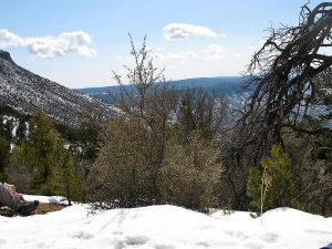
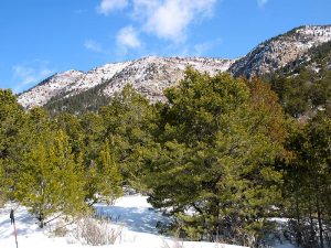
One of the few Sandia mountain hikes that is doable in winter, due to its southern exposure.
CautionsSteep hike, bring trekking poles.
Trailhead Directions
I-40 east to Carnuel exit 170, which is the first exit past Tramway, onto old Rte 66, now SR 333. East 1.5 miles to Monticello Drive on left, Whittier is on right. Follow Monticello Drive thru Monticello subdivision, then left on Allegre St., 522, to the end, then north on Siempre Verde, bearing right on Tres Pistolas, and dead-ending in a cul-de-sac parking area at the mouth of the arroyo and PARK (0.0 mi).
Actual Hike
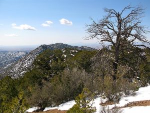
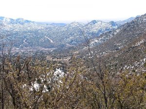
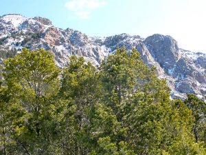
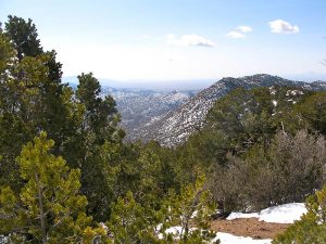
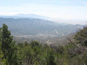
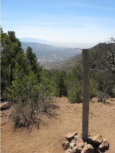
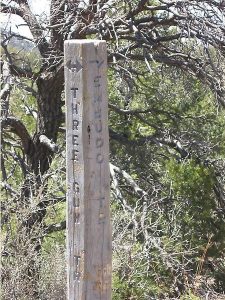
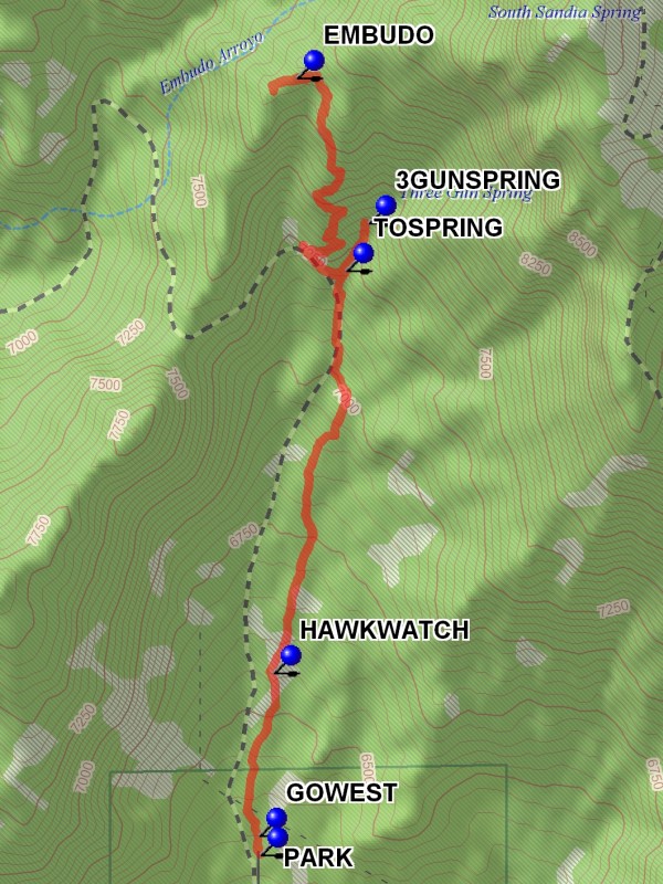
The canyon is at the extreme southern end of the Sandias. You can see your objective (the top) from most of the trail walking up. Shortly after leaving the parking area, take the left option at GOWEST (0.0 mi). You’ll pass the intersection with the HAWKWATCH (0.5 mi) trail and the short spur TOSPRING (1.6 mi) to Three Gun Spring. The trail follows quite steeply in a generally north direction, with a few switch backs, eventually intersecting with the Embudo Canyon Trail 193, EMBUDO (2.5 mi), which represents the top of this hike. Within a few minutes of walking west on the Embudo Canyon trail, find a nice spot for lunch and views of Albuquerque. On the way back, take a look at 3GUNSPRING (3.6 mi). There are reports from a hike in March, 1997, when the canyon was full of large bushes with white flowers, four-petals with yellow center, the unopened ones were pinkish, and cactus was beginning to bloom. On the return, some hikers like to take an eastern version of the southern half of the walk back to the car. When you get to the very sharp switchback to the east, go instead to the west and drop into gully returning to main trail just north of the map board.
Comments
The Three Gun Spring hike is particularly doable in the wintertime since its extreme southern exposure limits snow accumulation.
WaypointsMONTICELLO: N 35 03.933, W 106 26.495
PARK: N 35 04.577, W 106 26.648
GOWEST: N 35 04.617, W 106 26.652
HAWKWATCH: N 35 04.960, W 106 26.614
TOSPRING: N 35 05.805, W 106 26.427
EMBUDO: N 35 06.210, W 106 26.554
3GUNSPRING: N 35 05.905, W 106 26.370
Hike GPS File Name: ThreeGunSpringWayTrack_BGBG.gpx
Hike GPS File: Click link to download hike waytrack file
Text Author: Roger Holloway
Map Author: Marilyn Warrant
Waypoints Author: Bill Gloyd
Track Author: Bill Gloyd
Maintainer: Bill Gloyd
Editor: Marilyn Warrant