Penasco Springs Hike
In San Ysidro Region
Map File Source: NG Topo
 Hike Key: H10173
Last Updated: 12/15/2020 12:00am
Last Updated By: Marilyn Warrant
Hike Class: B (Moderate)
Hike Distance: 5.4 mi
Minimum Elevation: 5733 ft
Elevation Change: 470 ft
Total Uphill: 680 ft
Total Downhill: 680 ft
Avg. Grade: 6 %
Route Type: CW Loop
On Trail: No
Paved or Gravel Roads: Yes
GPS Advised: Yes
Drive Distance Round Trip: 100 mi
Drive Time One-Way: 1:00
Hiking Seasons: Spring, Fall, and Winter
New Mexico Game Unit: 6A
Hike Status: Inactive
Highlights
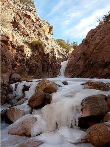
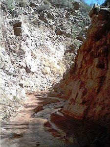
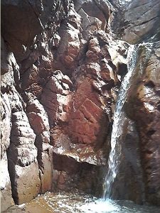
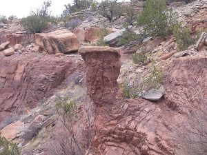
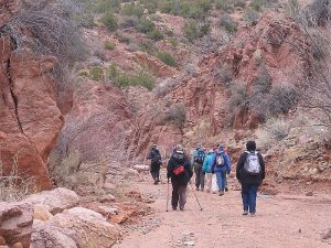
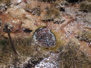
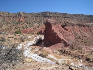
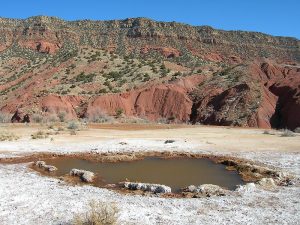
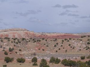
A terrific hike, filled with beautiful and interesting things to see. Views of red cliffs and in the distance White Mesa and Cabezon, white salt deposits, bubbling travertine pools, and a waterfall.
CautionsA few steep sections, so bring your hiking poles.
Trailhead Directions
Get written permission from Zia Tribal Headquarters, either by the Senior Center or hike leader. To find out the current rules, call the pueblo at 867-2196. They will fax or email the information you will need to provide. For each vehicle and hike leader, make a copy of their letter. From Albuquerque, take I-25 north to exit 242, west on US 550 to just before milepost 18 (18 mi. past the Bernalillo exit), Zia Pueblo off to right. Go to Tribal Headquarters there (the building with all the vans in back) and ask for the key to the Northwest area. Show them the letter. Drive about 8 miles beyond San Ysidro (just beyond mile marker 31). The gate is on the right, just over the rise and before the bridge across the arroyo. Drive through, lock the gate, PARK (0.0 mi) beyond the next fence below the hill. If gate doesn’t open, park outside and climb the gate. Each hike leader should take a copy of the letter and leave one copy in each vehicle.
Actual Hike
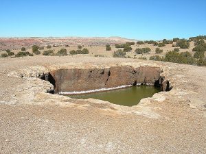
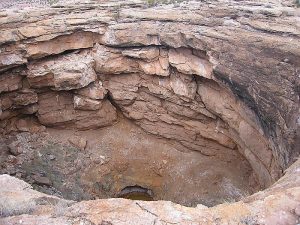
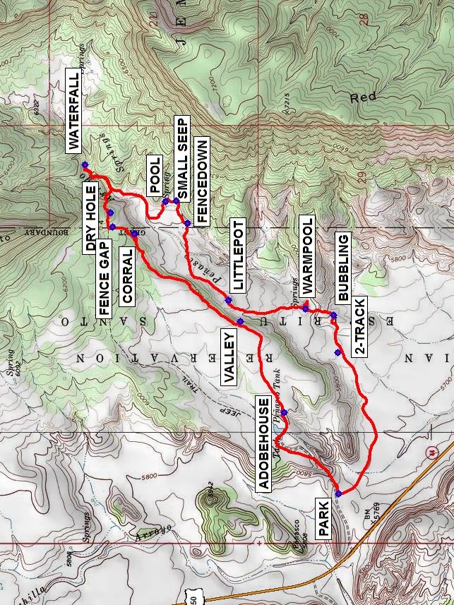
Hike the road up the hill, past a (dry? pond) and an abandoned ADOBEHOUSE (0.6 mi), eventually to the top edge of canyon to the east. At the fork, don’t take the road that goes straight down into a canyon, but turn left and follow the top of the canyon. Admire the VALLEY (1.1 mi) below. A huge rock that has fallen off the cliff (on right) has a stone CORRAL (1.9 mi) at its base. Head for the long hill to the north that slopes down to the east. Go through the FENCE GAP (2.0 mi). (The first big DRY HOLE (2.1 mi) is up on top of a high mound near the eastern foot of that hill. You can see the lunch site (circular pond on other side of canyon to southeast) There is a reddish hill to the north of it. Follow the track carefully down into the canyon and follow the water upstream to a (frozen in winter?) WATERFALL (2.5 mi). Have lunch there or go back downstream to the “swimming POOL (3.1 mi)” spring. There are great views of Cabezon Peak and the nearby red rocks. Proceed south to SMALL SEEP (3.1 mi) then southwest to FENCEDOWN (3.3 mi), go over the down fence, hike west along the fence to avoid the most of the arroyos, and cross the one with the trees. Then follow the canyon bottom south through seeping water areas and two large overflowing domes (LITTLEPOT (3.7 mi) and WARMPOOL (4.2 mi)). A BUBBLING (4.4 mi) area is the beginning of another pool. Follow the 2-TRACK (4.6 mi) back to the van.
Comments
It turns out that much of this hike is on the Jemez reservation. You’ll need to get permission from both the Jemez and Zia pueblos in order to do this hike.
Don’t try this one in summer — not enough shade. Penasco means rocky. In a wet year you might not be able to see the waterfall without wading or climbing over a ridge.
The hike data were determined from a Garmin GPSMap 60CSx active log reduced to 500 trackpoints, with trackpoints from the lunch period deleted.
This hike is set inactive until we get permission from the Jemez Pueblo for the part of this hike that is on their land.
WaypointsZia HQ: N35 29.917, W106 43.776
PARK: N35 35.393, W106 52.852
ADOBEHOUSE: N35 35.617, W106 52.441
VALLEY: N35 35.801, W106 51.976
CORRAL: N35 36.240, W106 51.531
FENCE GAP: N35 36.331, W106 51.495
DRY HOLE: N35 36.339, W106 51.425
WATERFALL: N35 36.446, W106 51.180
POOL: N35 36.111, W106 51.365
SMALL SEEP: N35 36.067, W106 51.362
FENCEDOWN: N35 36.020, W106 51.477
LITTLEPOT: N35 35.849, W106 51.871
WARMPOOL: N35 35.531, W106 51.913
BUBBLING: N35 35.413, W106 51.946
2-TRACK: N35 35.397, W106 52.136
Hike GPS File Name: PenascoSpringsWayTrackRev3_MW.gpx
Hike GPS File: Click link to download hike waytrack file
Text Author: Marilyn Warrant
Map Author: Marilyn Warrant
Waypoints Author: Marilyn Warrant
Track Author: Marilyn Warrant
Maintainer: Marilyn Warrant
Editor: Howard Carr