North Valley Ditch Hike Hike
In Albuquerque Region
Map File Source: DeLorme
 Hike Key: H10112
Last Updated: 12/15/2020 12:00am
Last Updated By: Marilyn Warrant
Hike Class: B (Moderate)
Hike Distance: 7.5 mi
Minimum Elevation: 4970 ft
Elevation Change: 20 ft
Total Uphill: 20 ft
Total Downhill: 20 ft
Avg. Grade: %
Route Type: CW Loop
On Trail: Yes
Paved or Gravel Roads: Yes
GPS Advised: No
Drive Distance Round Trip: 10 mi
Drive Time One-Way: 0:30
Hiking Seasons: Spring, Fall, and Winter
New Mexico Game Unit: 9
Hike Status: Published
Highlights
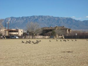
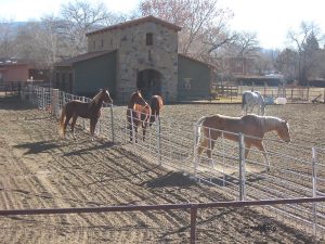
Enjoy horse ranches and farms with exotic animals along the irrigation ditches of Los Ranchos. Foliage in fall, geese and cranes in winter.
CautionsNone.
Trailhead Directions
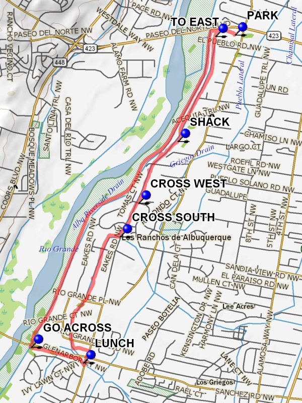
In Albuquerque take Rio Grande Blvd. North to just before the road crosses over Paseo del Norte. There are parking lots on your left at PARK (0.0 mi). This area is sometimes referred to as Shining River.
Actual Hike
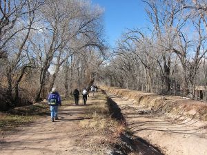
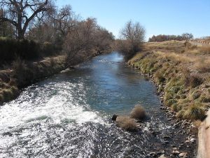
From Parking go west to the Albuquerque Riverside Drain (The ditch with water in it). Go south before crossing the ditch for about 300 feet. A ditch goes to the east at this point. Cross the north-south ditch on the left using the metal grate crossing, then turn south along the east bank of the Albuquerque Main Drain. Do not follow the eastward bearing drain. Enjoy the SHACK (1.2 mi) of the Mayor of Los Ranchos de Albuquerque — impressive. CROSS WEST (1.9 mi) to the west bank on the paved road. Reach a ditch T and CROSS SOUTH (2.3 mi) on the metal grate. This is the Griegos Lateral. Go west. The lateral turns to the south after about 500 feet. At 3.4 miles turn left and go to Rio Grande Blvd and go south, crossing over Montano Rd. On the south side turn west. After a short distance there will be 4 blue benches, a nice place for lunch. Then proceed west to the Albuquerque Riverside Drain and GO ACROSS (4.2 mi) and immediately turn right. This paved pathway goes back north. This segment of the hike allows one to compete with bikers, roller bladers, baby buggies, and assorted other obstacles. Arriving at Paseo Del Norte, go back over the Albuquerque Riverside Drain and back to parking.
Comments
The description is for a clockwise hike.
WaypointsPARK: N35 10.920, W106 38.683
TO EAST: N35 10.909, W106 38.855
SHACK: N35 10.150, W106 39.188
CROSS WEST: N35 09.704, W106 39.536
CROSS SOUTH: N35 09.459, W106 39.701
LUNCH: N35 08.549, W106 40.025
GO ACROSS: N35 08.663, W106 40.488
Hike GPS File Name: NorthValleyDitchHikeWayTrack_DBDB.gpx
Hike GPS File: Click link to download hike waytrack file
Text Author: Dick Brown
Map Author: Marilyn Warrant
Waypoints Author: Dick Brown
Track Author: Dick Brown
Maintainer: Dawn McIntyre
Editor: Marilyn Warrant