Navajo Draw Hike
In Rio Rancho Region
Map File Source: NG Topo
 Hike Key: H10065
Last Updated: 12/15/2020 12:00am
Last Updated By: Marilyn Warrant
Hike Class: B (Moderate)
Hike Distance: 4.9 mi
Minimum Elevation: 6049 ft
Elevation Change: 418 ft
Total Uphill: 450 ft
Total Downhill: 450 ft
Avg. Grade: 4 %
Route Type: Loop
On Trail: No
Paved or Gravel Roads: No
GPS Advised: Yes
Drive Distance Round Trip: 60 mi
Drive Time One-Way: 1:00
Hiking Seasons: Spring, Fall, and Winter
New Mexico Game Unit: 9
Hike Status: Inactive
Highlights
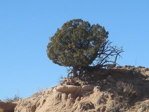
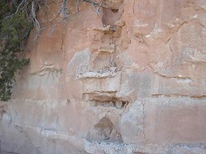
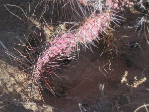
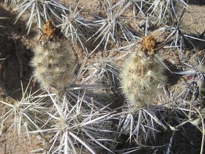
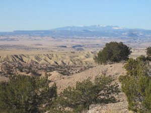
Views west to the King Ranch. Arroyos with rocks and some petrified wood.
CautionsNone.
Trailhead Directions
Take Montano or Paseo del Norte west to Unser, Unser north to Southern, then Southern west to SOUT’RN-ENCINO. Go 6.4 mi NNW on Encino, then turn left onto FROST (the Puerto Station sign is on your right). After about 1.5 mi, TURN right. Go about another 1.5 mi past a big house to a turnout on your left and PARK (0.0 mi) there.
Actual Hike
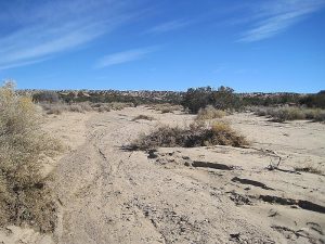
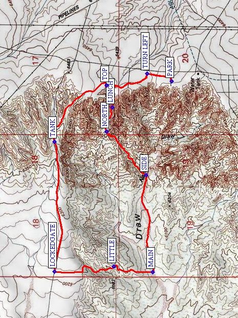
From parking, walk along the dirt road, TURN LEFT (0.2 mi) to stay along the cliff to TOP (0.5 mi). Take a look down, because here is where you’ll come up later. Continue walking north to the TANK (1.2 mi), then go down and west to a LOCKEDGATE (2.1 mi) with great views out over the Rio Puerco to mesas and a multitude of volcanic plugs. Following the fence line, walk on another dirt road south to a LITTLE (2.5 mi) arroyo. Follow the fence line to the MAIN (2.8 mi) arroyo (Navajo Draw). Don’t cross any fences. You can go up Navajo Draw as far as you like. Eventually, backtrack to where the arroyos join at SIDE (3.5 mi), then go up to the NORTH (3.9 mi) arroyo. Have LUNCH (4.1 mi) in the arroyo (there’s some shade). Continue up this arroyo to TOP, then back to the van the way you came.
Comments
Hike is marked inactive until someone checks with the property owner again.
The property owner (Dan Ferru, 892-5518) lives in the big house just to the south of the parking area. Call him to ask permission before leading the hike (if no answer, just leave a message). So far, he tolerates hikers. The hike has been rerouted to avoid bothering him. You can make the hike longer by backtracking as necessary in the main arroyo and cutting over to the north arroyo sooner. The rocks in this arroyo are remarkably varied and are somewhat polished by the tumbling in the arroyo and there is some petrified wood, as well. Rock ledges overhang the water course in some places.
WaypointsSOUT’RN-ENCINO: N35 14.511, W106 46.757
TURN: N35 19.312, W106 51.570
FROST: N35 19.379, W106 50.079
PARK: N35 20.607, W106 51.792
TURN LEFT: N35 20.747, W106 51.737
TOP: N35 20.980, W106 51.821
TANK: N35 21.277 W106 52.214
LOCKEDGATE: N35 21.277, W106 53.123
LITTLE: N35 20.939, W106 53.084
MAIN: N35 20.714, W106 53.126
NORTH: N35 20.978, W106 52.144
SIDE: N35 20.752, W106 52.448
LUNCH: N35 20.948, W106 51.975
Hike GPS File Name: NavajoDrawWayTrackRev_MWMW.gpx
Hike GPS File: Click link to download hike waytrack file
Text Author: Marilyn Warrant
Map Author: Marilyn Warrant
Waypoints Author: Marilyn Warrant
Track Author: Marilyn Warrant
Maintainer: Marilyn Warrant
Editor: Howard Carr