Knife Edge of the Shield Hike
In Sandia Mountain East Region
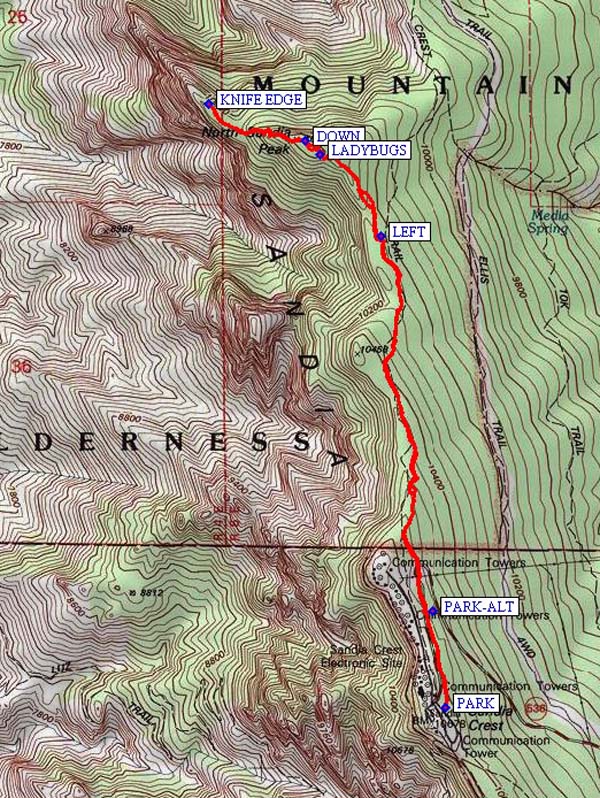
Map File Source: NG Topo
 Hike Key: H10022
Last Updated: 03/20/2023 2:30pm
Last Updated By: Marilyn Fixer
Hike Class: C (Challenging)
Hike Distance: 4.9 mi
Minimum Elevation: 9900 ft
Elevation Change: 750 ft
Total Uphill: 1060 ft
Total Downhill: 1060 ft
Avg. Grade: 10 %
Route Type: InOut
On Trail: No
Paved or Gravel Roads: Yes
GPS Advised: Yes
Hiker Limit (NF/BLM/NP): 15 (Sandia Wilderness)
Drive Distance Round Trip: 64 mi
Drive Time One-Way: 0:45
Hiking Seasons: Summer and Fall
New Mexico Game Unit: 8
Hike Status: Published
Highlights
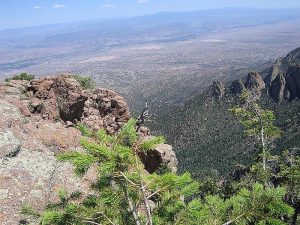
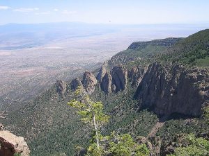
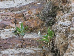
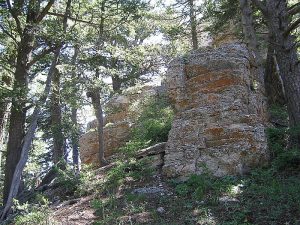
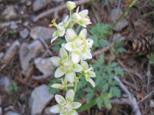
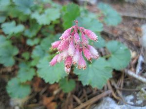
Views from the Sandias to the west and north. Wildflowers in season; limestone cliffs.
CautionsA very steep descent/ascent from North Peak. Climbing on rocks with good handholds & footholds. Optional walk along the Knife Edge.
Trailhead Directions
I-40 east to Tijeras exit, north on NM 14, go west on Crest Rd. 536, and PARK (0.0 mi) at the Crest Parking Lot. As an alternative, you can cut out 1/2 – 1 mi of the hike by parking at PARKALT (0.3 mi). Go west on Crest Rd. 536 almost all the way to the crest. It may be easier to find if you DO go all the way to the crest, turn around and go back down about 0.3 or 0.4 mi. looking for a small pull off to the right just after passing a small trail going up on the left.
Actual Hike
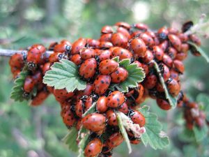
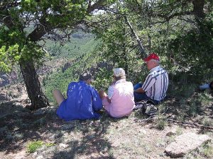
Hike north on the Crest Trail. The trail has various side trails, most of which end up at the same place. When you approach the North Peak, there’s a side trail to the LEFT (1.5 mi) that isn’t marked. Leave the main trail, and head northwest to the summit of North Peak. You may come across some amazing concentrations of LADYBUGS (1.9 mi). The hike is fairly easy up until this point. Some of the hikers may want to stay up here for lunch. There are many branching trails from North Peak. Go DOWN (2.0 mi) along the most westerly ones to get the great view. There are four steep descents/climbs to get down to the KNIFEEDGE from the North Peak.
Comments
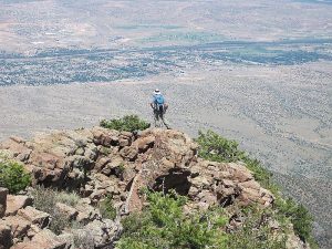
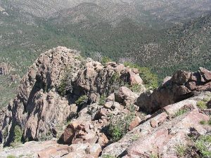
If you go too far out onto the knife edge, it can get scary. Go as far as you feel comfortable. Or stay on the main body of the shield and don’t go out on the edge at all. On July ’03, three of our group stayed on top of North Peak until the others returned. The “shield” is prominently seen from the west of the Sandias as a broad expanse of vertical rock face. From where we will be, it will be a very thin ridge, narrower than a car in places. Great views of the city and the prominent “Needle” from the precipitous edge of the north crest. Pick out Cabezon Peak, Bernalillo, and Jemez Dam to the west. View Del Agua Overlook across the Canyon to the east. There are some patches of coral bells, columbine, monks’ hood, and other flowers on the way down from the North Peak. If you go in early August, you may witness the “Ladybug Love-In”.
WaypointsPARK: N 35 12.659, W 106 26.964
PARKALT: N 35 12.906, W 106 27.005
LEFT: N 35 13.861, W 106 27.164
LADYBUGS: N 35 14.069, W 106 27.353
DOWN: N 35 14.106, W 106 27.401
KNIFE EDGE: N 35 14.200, W 106 27.702
Hike GPS File Name: KnifeEdgeoftheShieldWayTrack_KSKS.gpx
Hike GPS File: Click link to download hike waytrack file
Text Author: Roger Holloway
Map Author: Marilyn Warrant
Waypoints Author: Ken Smith
Track Author: Ken Smith
Maintainer: Marilyn Warrant
Editor: Dawn McIntyre