Mesita De Ricardo – Rock Features Hike
In Cabezon Region
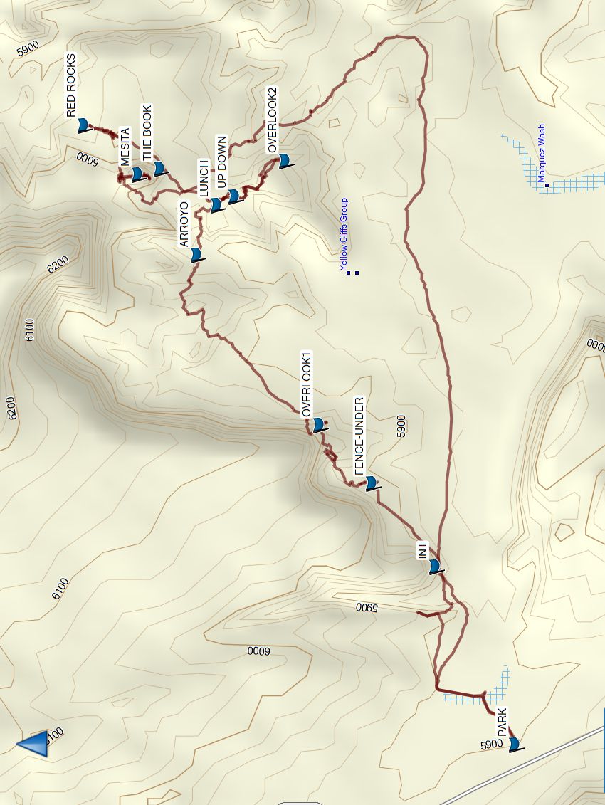
Map File Source: Garmin BaseCamp
 Hike Key: H10740
Last Updated: 01/22/2025 8:24pm
Last Updated By: Marilyn Warrant
Hike Class: C (Challenging)
Hike Distance: 6.2 mi
Minimum Elevation: 5850 ft
Elevation Change: 260 ft
Total Uphill: 840 ft
Total Downhill: 840 ft
Avg. Grade: %
Route Type: CW Loop
On Trail: No
Paved or Gravel Roads: No
GPS Advised: Yes
Drive Distance Round Trip: 100 mi
Drive Time One-Way: 1:30
Hiking Seasons: Spring, Fall, and Winter
New Mexico Game Unit:
Hike Status: In Process
Access Description: Ojito Wilderness Area Access
Attractions: Arroyos, Badlands, Rock Formations, and Views
Trailhead Directions
From Albuquerque take I-25 north to Bernalillo. From the intersection of I-25 and US 550 (formerly SR 44) in Bernalillo go northwest on US 550 for 20.9 miles to Cabezon Road (about 2 mi. before San Ysidro). Turn left onto Cabezon Road then go left almost immediately at the Y in the road. At 12.5 miles, turn right onto Pipeline road, and go 3.8 miles [shorter distance] to a small pullout on the right and PARK (0.0 mi) there.
Waypoints
PARK: N35 30.886, W106 57.768
INT: N35 31.032, W106 57.359
FENCE-UNDER: N35 31.149, W106 57.168
OVERLOOK1: N35 31.247, W106 57.033
ARROYO: N35 31.473, W106 56.641
LUNCH: N35 31.436, W106 56.527
UP DOWN: N35 31.404, W106 56.507
OVERLOOK2: N35 31.310, W106 56.425
MESITA: N35 31.582, W106 56.455
RED ROCKS: N35 31.683, W106 56.343
THE BOOK: N35 31.542, W106 56.442
Hike GPS File Name: MesitaDeRicardo-RockFeatures.gpx
Hike GPS File: Click link to download hike waytrack file
Text Author: Marilyn Warrant
Map Author: Marilyn Warrant
Waypoints Author: Marilyn Warrant
Track Author: Carl Gervais
Maintainer: Not Assigned
Editor: