Tunnel Springs To Crest Trail Hike
In Placitas Region
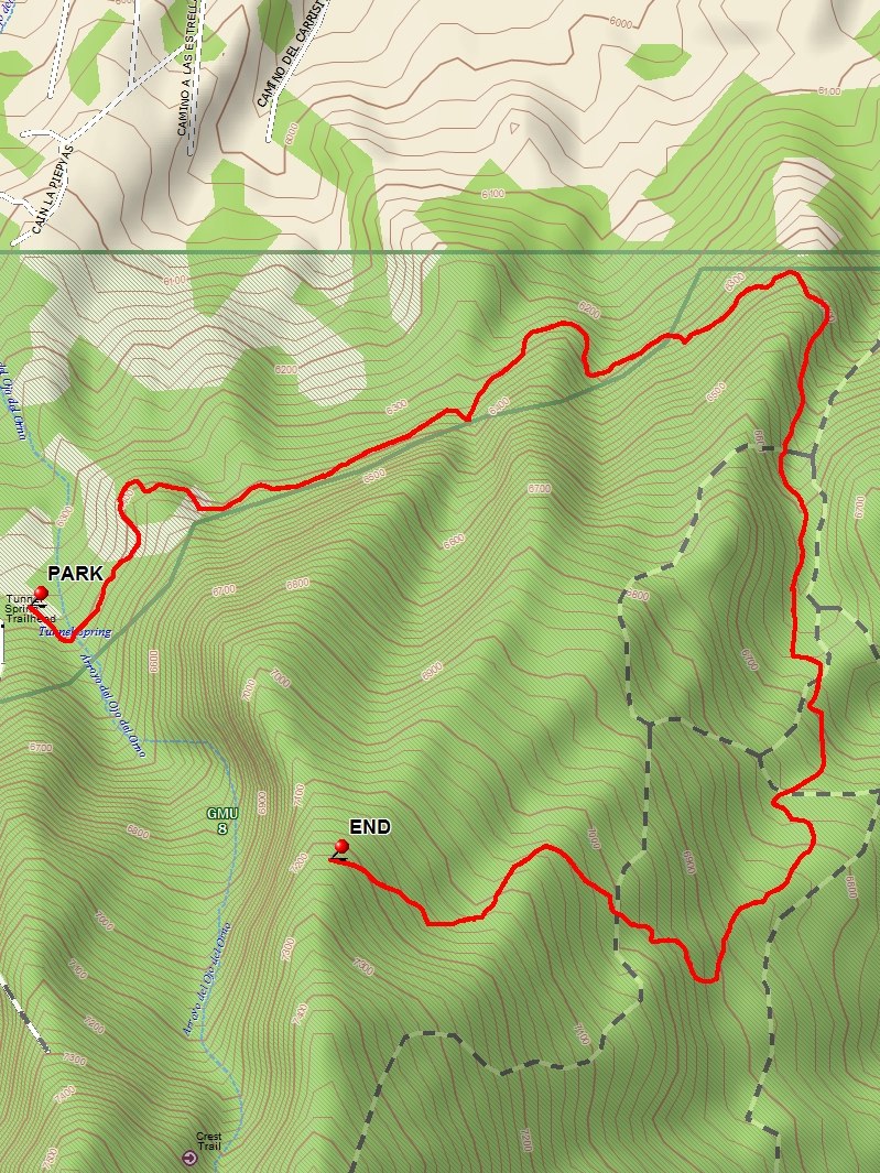
Map File Source: DeLorme
 Hike Key: H10578
Last Updated: 12/15/2020 12:00am
Last Updated By: Marilyn Warrant
Hike Class: C (Challenging)
Hike Distance: 5.8 mi
Minimum Elevation: 6270 ft
Elevation Change: 960 ft
Total Uphill: 1240 ft
Total Downhill: 1240 ft
Avg. Grade: 10 %
Route Type: InOut
On Trail: Yes
Paved or Gravel Roads: No
GPS Advised: No
Drive Distance Round Trip: 50 mi
Drive Time One-Way: 0:45
Hiking Seasons: Spring and Fall
New Mexico Game Unit: 8
Hike Status: Published
Highlights
Views to the north and east as far as Cabezon.
CautionsBring hiking poles and wear sturdy boots.
Trailhead Directions
Take I-25 north to Placitas exit (exit 242). Go east on SR 165 for 5 miles. Tunnel Springs Road (Forest Road 231) is on the right, just before mile marker 5 at LEAVE SR 165. Follow it (rough dirt road) and signs for about 1.5 miles to the Tunnel Springs trailhead. Use a Golden Age Passport to avoid the fee, continue on to the parking area, and PARK (0.0 mi). Note the springs pouring water out a pipe at south side of road just before entering parking area.
Actual Hike
Follow the trail in an easterly direction without any climbing, then under towering stone cliffs. The trail eventually turns south onto North Crest Trail, climbing up a deep rocky canyon. Looking east beyond you will see the Las Huertas (The Orchards) Canyon which has many homes. After reaching the top of the canyon you can see the North Peak. Stop hiking near END (2.9 mi), and have lunch. Return the way you came.
Waypoints
Access
LEAVE SR 165: N35 18.395, W106 27.086
Hike
PARK: N35 17.489, W106 26.369
END: N35 17.236, W106 26.003
Hike GPS File Name: TunnelSpringsToCrestTrailWayTrack_DBDB.gpx
Hike GPS File: Click link to download hike waytrack file
Text Author: Dick Brown
Map Author: Dick Brown
Waypoints Author: Dick Brown
Track Author: Dick Brown
Maintainer: Not Assigned
Editor: Howard Carr