Gascon Point Hike
In Pecos North Region
Map File Source: NG Topo
 Hike Key: H10563
Last Updated: 12/15/2020 12:00am
Last Updated By: Marilyn Warrant
Hike Class: C (Challenging)
Hike Distance: 5 mi
Minimum Elevation: 8282 ft
Elevation Change: 1044 ft
Total Uphill: 1055 ft
Total Downhill: 1055 ft
Avg. Grade: 8 %
Route Type: InOut
On Trail: Yes
Paved or Gravel Roads: Yes
GPS Advised: Yes
Drive Distance Round Trip: 155 mi
Drive Time One-Way: 3:00
Hiking Seasons: Summer and Fall
New Mexico Game Unit: 45
Hike Status: Published
Highlights
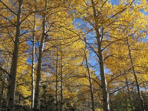
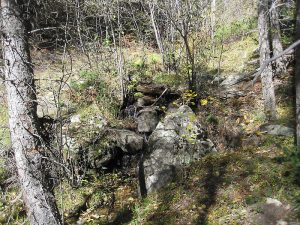
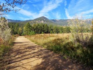
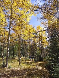
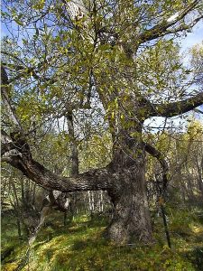
Aspen glades, views, small stream.
CautionsHiking poles will come in handy when crossing the mucky area.
Trailhead Directions
From Albuquerque, travel north on I-25 to the I-25 EXIT at Las Vegas onto E University. (The distance to PARK from this point is about 31 mi.) Turn right on North Grand Ave. then left onto Mills Ave. (HWY329). Take another right onto HWY518, and continue to Sapello. At HWY94/HWY518 veer left onto Hwy 94. At HWY94/HWY105, take a left onto Hwy 105. Continue on NM105 that veers to the right past Pendaries (VILLAGE LN) (don’t go onto Hwy 276). After about 5 miles the paved road stops and there is a gravel road up a hill. DO NOT go up. Rather, park at the junction off to the right and begin your hike up the gravel road that turns into dirt.
Actual Hike
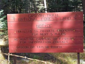
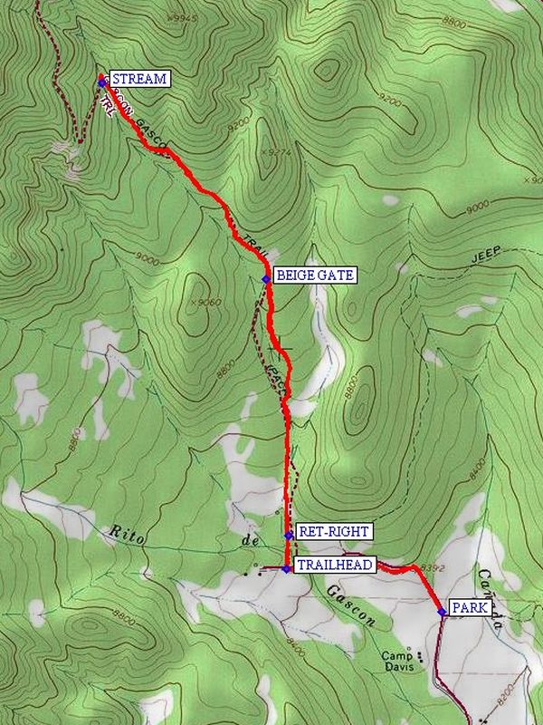
Follow the gravel road until you come to a gate and a sign to your right for the TRAILHEAD (0.6 mi) for the Gascon Trail. (The property past the gate belongs to Gene Hackman, we’re told.) The trail starts out going into a mucky area and crosses a small stream. It continues through an easement with private property on both sides. Where there are forks, keep along the fence to your right. There’s a BEIGE GATE (1.6 mi) to go through. The trail goes steadily uphill through aspen and conifers. A good turn-around point is the small STREAM (2.5 mi) with a teeny waterfall, wildflowers, ferns, and mosses. On the way back, watch out for a narrow trail to the right (RET-RIGHT (4.3 mi)) back to the trailhead.
Comments
Thanks to Don Bennett for providing detailed descriptions of the hike and how get to the parking location.
WaypointsAccess
I-25 EXIT: N35 35.750, W105 12.523
HWY329: N35 36.432, W105 12.650
HWY518: N35 36.324, W105 13.376
HWY94/HWY518: N35 46.381, W105 15.215
VILLAGE LN: N35 50.655, W105 23.766
Hike
PARK: N35 54.280, W105 26.992
TRAILHEAD: N35 54.398, W105 27.513
BEIGE GATE: N35 55.189, W105 27.580
STREAM: N35 55.728, W105 28.131
RET-RIGHT: N35 54.488, W105 27.507
Hike GPS File Name: GasconEd2WayTrack_MW.gpx
Hike GPS File: Click link to download hike waytrack file
Text Author: Marilyn Warrant
Map Author: Marilyn Warrant
Waypoints Author: Marilyn Warrant
Track Author: Marilyn Warrant
Maintainer: Not Assigned
Editor: Howard Carr