Ghost Ranch – Chimney Rock Hike
In Ghost Ranch Region
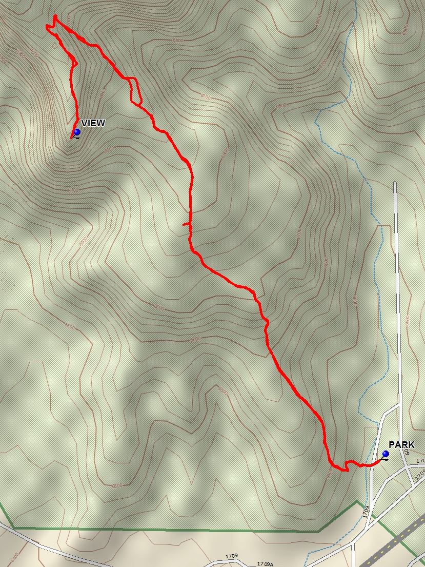
Map File Source: DeLorme
 Hike Key: H10542
Last Updated: 06/29/2021 12:00am
Last Updated By: Marilyn Fixer
Hike Class: C (Challenging)
Hike Distance: 2.7 mi
Minimum Elevation: 6455 ft
Elevation Change: 565 ft
Total Uphill: 740 ft
Total Downhill: 740 ft
Avg. Grade: 11 %
Route Type: InOut
On Trail: Yes
Paved or Gravel Roads: Yes
GPS Advised: No
Drive Distance Round Trip: 240 mi
Drive Time One-Way: 2:15
Hiking Seasons: Spring and Fall
New Mexico Game Unit: 51
Hike Status: Published
Highlights
Climb to a height where there are great views of the surrounding area and Ghost Ranch features.
CautionsNone.
Trailhead Directions
From Albuquerque, take I-25 to Santa Fe, then US 84/285 to Espanola. Continue north on US 84/285 north, staying on US 84 when US 285 splits off about 5 mi from town. Continue about 35 miles through Abiquiu to the gravel road marked for the Ghost Ranch Presbyterian Center. Turn right and drive 1 mi to a road fork; follow the signs left to the office and ask for permission to hike. The trailhead sign for the Chimney Rock hike is located at the arroyo behind the Museums and past the Corral Block complex.
Actual Hike
Cross the arroyo and follow the trail up the ridge. This hike has wonderful views as the trail climbs from 6,500 to 7,100 feet. From the top there is an excellent VIEW (1.35 mi) of the Piedra Lumbre basin.
Comments
There is now a $10 user fee to hike on Ghost Ranch. Day visitors are asked to reserve in advance.
WaypointsPARK: N36 19.837, W106 28.479
VIEW: N36 20.295, W106 29.025
Hike GPS File Name: GhostRanch-ChimneyRockWayTrack_DB.gpx
Hike GPS File: Click link to download hike waytrack file
Text Author: Dick Brown
Map Author: Marilyn Warrant
Waypoints Author: Dick Brown
Track Author: Dick Brown
Maintainer: Not Assigned
Editor: Howard Carr