Golden Open Space – Mesa Loop Trail Hike
In Golden Region
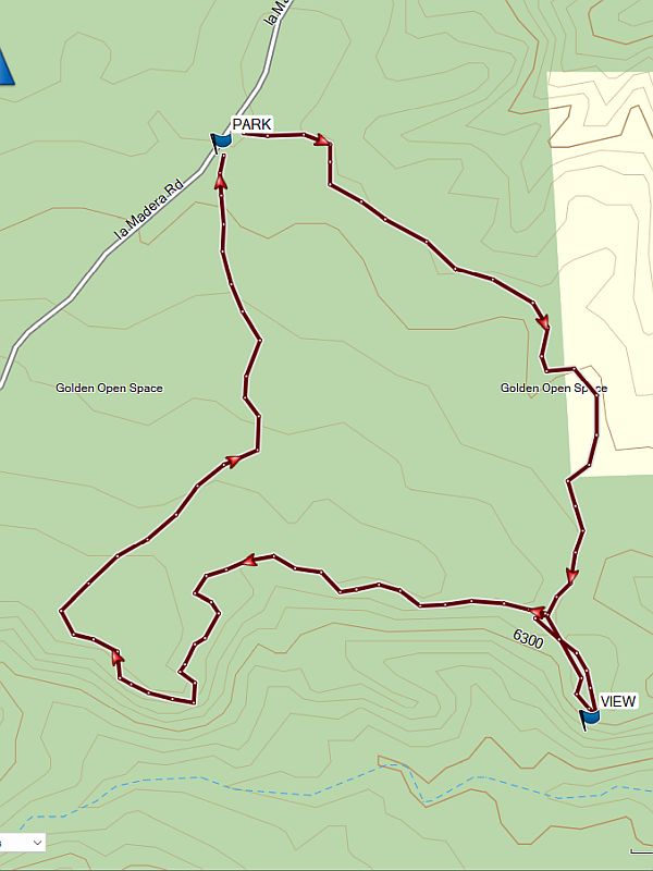
Map File Source: NG Topo
 Hike Key: H10450
Last Updated: 04/21/2024 8:32pm
Last Updated By: Dawn McIntyre
Hike Class: A (Easy)
Hike Distance: 2.2 mi
Minimum Elevation: 6250 ft
Elevation Change: 144 ft
Total Uphill: 165 ft
Total Downhill: 165 ft
Avg. Grade: 3 %
Route Type: CCW Loop
On Trail: No
Paved or Gravel Roads: No
GPS Advised: No
Drive Distance Round Trip: 70 mi
Drive Time One-Way: 1:15
Hiking Seasons: Spring, Summer, Fall, and Winter
New Mexico Game Unit: 8
Hike Status: Published
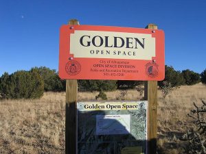
Access Description: Golden Open Space Access
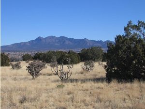
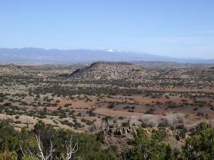
Attractions: Arroyos and Views
Highlights
Views from mesa to the east of the Sandias and down into the arroyos below.
CautionsNone.
Trailhead Directions
From Albuquerque, take I-40 to North 14. In Cedar Crest just after the school on the left, turn left onto LA MADERA Road (the road to East Mountain High School). Stay on the windy but paved road until it turns to dirt at a cattleguard in 7.5 miles. It is about 2 miles from this point to [PARK] (0.0 mi).
Actual Hike
Do a loop following the bike trail. You can start in either direction. Be sure to stop at VIEW for a glimpse of the colorful arroyos down below.
Comments
This hike is part of the City of Albuquerque’s Open Space Program, the Golden Open Space. This is a good hike to do in hot weather when the forests are closed.
This hike used to be called the Golden Open Space Bike Trail or the Mesa Loop Trail.
WaypointsLA MADERA: N35 10.421, W106 20.225
PARK: N35 16.285, W106 19.663
VIEW: N35 15.796, W106.19.273
Hike GPS File Name: LosDuendesLpWayTrack_MW.gpx
Hike GPS File: Click link to download hike waytrack file
Text Author: Marilyn Warrant
Map Author: Marilyn Warrant
Waypoints Author: Marilyn Warrant
Track Author: Marilyn Warrant
Maintainer: Marilyn Warrant
Editor: Dawn McIntyre