Pecos NHP – Glorieta Battlefield Hike
In Pecos Region
Map File Source: Other
 Hike Key: H10449
Last Updated: 03/13/2021 12:00am
Last Updated By: Marilyn Fixer
Hike Class: A (Easy)
Hike Distance: 2.5 mi
Minimum Elevation: 7260 ft
Elevation Change: 100 ft
Total Uphill: 180 ft
Total Downhill: 180 ft
Avg. Grade: 4 %
Route Type: Loop
On Trail: Yes
Paved or Gravel Roads: Yes
GPS Advised: No
Drive Distance Round Trip: 180 mi
Drive Time One-Way: 1:45
Hiking Seasons:
New Mexico Game Unit: 45
Hike Status: Published
Highlights
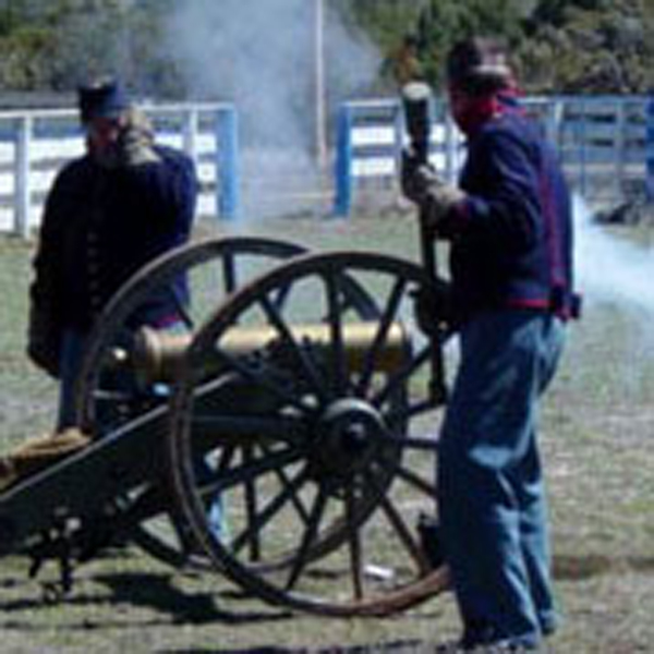
Explore a Civil War battlefield. Extras may include a talk about medical practices during the Civil War or reenactments.
CautionsNone.
Trailhead Directions
I-25 north from Albuquerque. Take exit 299 on to Hwy 50 to the Pecos village then south two miles on State Road 63 to the Pecos National Historical Park VISITOR CENTER. If you’ve made prior arrangements and prefer a self-guided tour of the Glorieta Battlefield, you can get directions and borrow keys to the entrance GATE from the front desk at the Pecos NHP. PARK a short distance from the GATE.
Actual Hike
The western most battle of the Civil War was fought within the Pecos NHP on March 26-28, 1862 (the Battle of Glorieta Pass was referred to as the Gettysburg of the West)! This is a 2.5-mile interpretive walk with 180 ft total vertical. If interested, ask the park if you can add a 1-hr talk by Bob Mallin, a park volunteer and real Civil War historian whose interest is the medicine and surgery of that time.
Comments
Admission is $3.00 per person or bring a Golden Age Passport or other National Park Pass. Reservations are required for groups who want to take guided tours. Most tours are only offered from Memorial Day through Labor Day. For tour options and reservations, see the NHP website. For more information, see Battle of Glorieta Pass.
The hike is often combined with Pecos NHP – Pecos Ruins, another short hike.
WaypointsVISITOR CENTER: N35 33.009, W105 41.170
GATE: N35 33.985, W105 45.245
PARK: N35 34.012, W105 45.279
Hike GPS File Name: PecosNHP-GlorietaBattlefieldWaypoints_MW.gpx
Hike GPS File: Click link to download hike waytrack file
Text Author: Cindy McConnell
Map Author: Marilyn Warrant
Waypoints Author: Dick Brown
Track Author: Marilyn Warrant
Maintainer: Bill Gloyd
Editor: Marilyn Warrant