Monte Largo Canyon Hike
In Manzano Mountains West Region
Map File Source: NG Topo
 Hike Key: H10398
Last Updated: 12/15/2020 12:00am
Last Updated By: Marilyn Warrant
Hike Class: B (Moderate)
Hike Distance: 3.7 mi
Minimum Elevation: 6250 ft
Elevation Change: 570 ft
Total Uphill: 670 ft
Total Downhill: 670 ft
Avg. Grade: 8 %
Route Type: InOut
On Trail: No
Paved or Gravel Roads: No
GPS Advised: Yes
Drive Distance Round Trip: 120 mi
Drive Time One-Way: 1:30
Hiking Seasons: Spring, Fall, and Winter
New Mexico Game Unit: 14
Hike Status: Published
Highlights
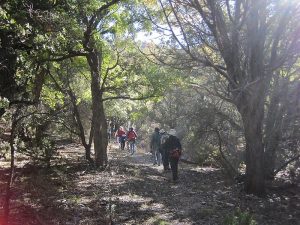
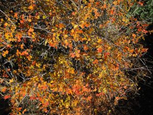
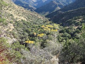
Cool hike with rocks, a stream, and colorful leaves in the fall.
CautionsNone.
Trailhead Directions
I-25 south to Exit 191 to Belen. Go east 1 mi. on Camino del Llano (NM 548). At the first light, turn left onto Main Street (NM 314). Drive north 0.6 mi., then turn right onto Reinken Ave. (NM 309). Go 2.4 mi. east, crossing the railroad tracks and the river. Take a right onto Rio Communities Blvd (NM 47). (See the GPX file labeled “Route.”) Go southeast 7.4 miles and turn left on LAS BORREGAS Rd into the Tierra Grande development. Continue on gravel road for 5.6 miles. Turn LEFT2 and drive 0.6 mile to cattleguard at Canyon Del Rio (sign). Turn RIGHT1 immediately after crossing cattleguard. Road narrows and is rough in spots but is still graveled. Continue east on road for 4.0 miles and then turn RIGHT2 on rough rocky road for 1.2 miles to the parking area at the trailhead.
Actual Hike
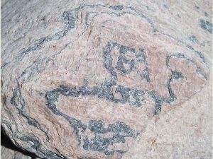
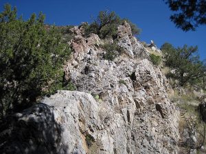
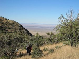
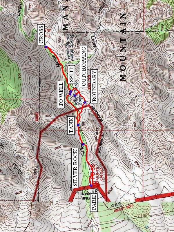
Walk up the trail past the SILVER ROCK (0.4 mi) to the TANK (0.7 mi). For much of this part of the trail, you’ll follow a black water pipe. Just east of this point, the trail splits. Take the right-hand branch, go past the Manzano Wilderness BOUNDARY (0.9 mi), and go up to the OUTCROPPING (1.1 mi) to your left. This is a good place for a break. Continue east. At SPLIT (1.3 mi), the trail merges with the left-hand branch. Continue going up the canyon, CROSS (1.9 mi) the streambed, and have lunch. On the way back, return to SPLIT and take the now right-hand (north-side) trail. Shortly after this, take a short detour TO WELL (2.6 mi) where a spring emerges. Continue to the TANK, and return the way you came.
Comments
This hike is based on the Monte Largo Canyon hike, #49, in 60 Hikes within 60 Miles: Albuquerque by Stephen Ausherman, p. 286.
WaypointsAccess
NM47: N34 39.169, W106 44.169
LAS BORREGAS: N34 34.081, W106 39.377
LEFT2: N34 34.003, W106 33.895
RIGHT1: N34 34.512, W106 34.277
RIGHT2: N34 35.894, W106 31.156
Hike
PARK: N34 36.048, W106 29.890
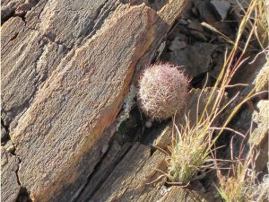
SILVER ROCK: N34 36.129, W106 29.436
TANK: N34 36.173, W106 29.238
BOUNDARY: N34 36.115, W106 29.005
OUTCROPPING: N34 36.198, W106 28.934
SPLIT: N34 36.233, W106 28.887
CROSS: N34 36.449, W106 28.428
TO WELL: N34 36.240, W106 28.915
Hike GPS File Name: MonteLargoCanyonWayTrack_MWMW.gpx
Hike GPS File: Click link to download hike waytrack file
Text Author: Vivian Heyward
Map Author: Marilyn Warrant
Waypoints Author: Marilyn Warrant
Track Author: Marilyn Warrant
Maintainer: Vivian Heyward
Editor: Dawn McIntyre